Panel on Climate Variability and Change
60 likes | 166 Vues
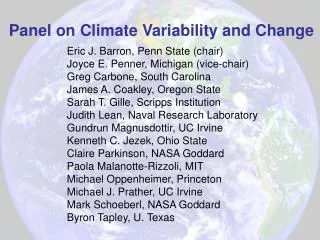
Panel on Climate Variability and Change. Eric J. Barron, Penn State (chair) Joyce E. Penner, Michigan (vice-chair) Greg Carbone, South Carolina James A. Coakley, Oregon State Sarah T. Gille, Scripps Institution Judith Lean, Naval Research Laboratory Gundrun Magnusdottir, UC Irvine

Panel on Climate Variability and Change
E N D
Presentation Transcript
Panel on Climate Variability and Change Eric J. Barron, Penn State (chair) Joyce E. Penner, Michigan (vice-chair) Greg Carbone, South Carolina James A. Coakley, Oregon State Sarah T. Gille, Scripps Institution Judith Lean, Naval Research Laboratory Gundrun Magnusdottir, UC Irvine Kenneth C. Jezek, Ohio State Claire Parkinson, NASA Goddard Paola Malanotte-Rizzoli, MIT Michael Oppenheimer, Princeton Michael J. Prather, UC Irvine Mark Schoeberl, NASA Goddard Byron Tapley, U. Texas
VISION for Climate Research and Applications • If projections are correct… • Impacts of climate change on society will become noticeable…to many. • The public will demand more information on climate and climate change as well as improved predictions. • Research will focus on the prediction of seasonal anomalies and decadal trends on regional scales to: • protect life and property, • promote economic vitality, • enable environmental stewardship, and • support a broad range of policy decisions.
What Observing Strategy Follows from the Vision? • Sustained multi-decadal measurements of quantities key to understanding variability and change. • Better understanding of processes that govern the climate system. • More comprehensive use of observations in model development and evaluation. • Greater emphasis on regional and seasonal variability and change. • Greater focus on enabling a “family” of climate forecasting products that connect to societal needs (energy, agriculture, water, human health, etc). • An integrated approach to “multiple stresses” (climate, land use, pollutants).
Development of “Climate Missions” • Considered fundamental factors governing climate variability and change (forcing, response, feedbacks, internal variability, etc.) • Adopted Global Climate Observing System (GCOS) list of “climate variables” to assess current and planned space-borne (as well as surface and in situ) capabilities (e.g., EOS, NPOESS, GLORY, GPM, OCO, ARM, ARGO, BSRN, AERONET, etc.) • Used responses to RFI to synthesize missions to extend capabilities and fill gaps in critical areas.
Technologically Ready Missions Mission W (OceanCirc): Ocean circulation, heat storage, and forcing Wide-swath RADAR ALTIMETER Vector wind SCATTEROMETER Mission X (IMPACT):Clouds, aerosols, ice sheet topography, carbon storage Scanning LIDAR capable of sea-ice topography Multi-angle, wide-swath multiwavelength polarization detecting IMAGER Hyperspectral, high resolution IMAGER CLOUD RADAR Mission Y (InSARSat):Ice sheet flow, biomass volume Interferometric Synthetic Aperture Radar InSAR Missions in Need of Development Mission Alpha (SURFF): Coordinate/combine sensor capabilities to create a dedicated “surface fluxes” evaporation, evapotranspiration, sensible heat… SCATTEROMETER + Surface Observations Mission Beta (ConTSat): Convective transport of trace species, heat, and momentum IR Limb scanning,FTIRor filter radiometer (HIRDLS) LIDAR Cloud and Precip RADARS Field Campaigns and Surface Observations Mission Gamma (Calibration Observatory): Highly calibrated, broadband and spectrally resolved sensors covering UV to far IR and time standard for GPS. Coarse spatial resolution BROADBAND RADIOMETERS Coarse spatial resolution SPECTRAL RADIOMETERS GPS Receiver with ultra-stable oscillator.: “Climate Missions” (Not Prioritized) • Special Mission • Continue Earth Radiation Budget Observations:fly CERES soon…
Implications for Agencies, Research Infrastructure, Education, and Society • Climate Data Stewardship:NASA has,given sufficient budget, demonstrated ability to maintain and improve climate data sets developed from space observations. NOAA has neither budget, nor demonstrated ability, nor demonstrated a will to do the job. • NPOESS needs to be reconfigured. Science and scientists should have a prominent role in the development and evolution of the program. In almost every way, NPOESS sensors are a step backward from the EOS sensor systems. • Agency Partnerships: Agencies (including, DOD, DOE, EPA, FAA, NSF…) need to address the surface and in situ observations required by climate science. • International Partnerships. NASA and NOAA should work to facilitate international participation in missions and science, and take advantage of opportunities to fly U.S. instruments on foreign platforms and to fly foreign instruments on U.S. platforms…although data sharing remains a problem. • Model development needs to better utilize space-borne observations. Budgets and infrastructure should be designed to facilitate the wide variety of potential uses of space-borne observations in model development and assessment. • Develop climate science capabilities at a regional scale. Regional scale assessments of climate change will have the greatest societal impact. • Improve support for education in the Earth sciences. The steady and declining budgets for Earth Science research for the past 15 years threatens to create a gap in trained workers. The volume of observations that are to be analyzed and the applications that are envisioned will require many more workers than are currently being educated. • Data Management: Develop infrastructure and financial support sufficient for a “virtual planet.” Make data from satellite, surface, and in situ networks readily available and easy to use by scientists, students, policy makers, and resource managers.