Absolute Location: Latitude and Longitude Explained
790 likes | 1.14k Vues
Learn about absolute location using latitude and longitude to pinpoint places on the globe. Discover how latitude and longitude lines work together to provide precise global addresses. Explore the Equator, Prime Meridian, and their significance in determining locations worldwide.

Absolute Location: Latitude and Longitude Explained
E N D
Presentation Transcript
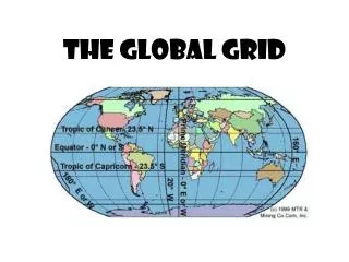
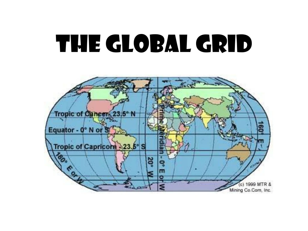
The global grid makes it possible to state the “absolute location” of a place – exactly where it is. http://www.psdgraphics.com/backgrounds/world-globe-background/ http://matagalatlante.org/nobre/featpost/doc/featexamples.html
Absolute location – longitude & latitude – is like a global address. http://amyrondinel.com/2010/09/home-is-where-the-heart-is/
Los Angeles, California: 34°N 118W° http://www.hightunnels.org/ForEducators/Planning/FullMoonFarmCaseStudy/planningorientationlatitude.htm
The absolute location of any place is the latitude + the longitude. http://www.ukdivers.net/chartwork/chartintro.htm
LATITUDE lines are the FLAT lines. http://www.ukdivers.net/chartwork/chartintro.htm
The most famous line of latitude is the Equator. http://www.geolounge.com/wp-content/uploads/2014/08/latitude.png
The Equator is the longest line of latitude, because it’s at the “fattest” part of the earth. http://www.cliparthut.com/clip-arts/908/globe-with-latitude-lines-908531.jpg
But up by the North Pole – and down by the South Pole – the lines are shorter.
Latitude lines run flat east and west, but they don’t measure how far east or west something is. That’s not my job. That’s longitude’s job! (We’ll get to that later.)
Latitude lines measure how farnorthor south you are fromtheEquator.
North Pole Think of LATITUDE like the rungs of a ladder. (ladder sounds like latitude). It’s how you climb up and down the globe. 90°N 60°N 30°N EQUATOR 0° 30°S 60°S 90°S South Pole
Anywhere you are on the 30°N line, you are 30°northof the Equator.
And anywhere you are on the 30°S line, you are 30°southof the Equator.
And now, we take a moment to focus on the Equator. . . http://www.geolounge.com/wp-content/uploads/2014/08/latitude.png
on the Equator in Ecuador http://www.elmundodeanders.com/Mitad%20del%20Mundo.htm http://www.southernhorizons.com/images/galapaos/Mapsinf/SAmap.jpg
and in Brazil http://www.advrider.com/forums/showthread.php?t=314904 http://www.questconnect.org/sa_j_brazil_crossing.htm
Macapá, Brazil http://www.flickr.com/photos/teamtrev/35447999/
http://ahunsberger.blogspot.com/2008/01/geog-411-political-maps.htmlhttp://ahunsberger.blogspot.com/2008/01/geog-411-political-maps.html in Gabon http://www.flickr.com/photos/27767476@N04/2987565877/ http://www.flickr.com/photos/33357097@N00/2334967076/
http://www.travelpod.com/travel-photo/bonthorn/1/1210984380/crossing-the-equatorx.jpg/tpod.htmlhttp://www.travelpod.com/travel-photo/bonthorn/1/1210984380/crossing-the-equatorx.jpg/tpod.html in Uganda http://www.travelpod.com/travel-blog-entries/jmo/jmo_world_tour/1088505180/tpod.html
and inKenya http://www.fimafrica.org/7.html
http://www.wainscoat.com/kenya/samburu.html http://www.travelblog.org/Bloggers/Twiga-Kali/
in Indonesia http://www.horizonsunlimited.com/newsletter/2008-10.shtml http://afe.easia.columbia.edu/main_pop/kpct/ct_seast.htm
http://indahnesia.com/picture/SUM/004/equator_monument.php http://www.tripadvisor.com/LocationPhotos-g317101-Pontianak_Borneo.html#27121388
Bethany’s latitude is 35°N,because we are 35° north of the Equator.
up or down the globe (northor south). Latitude is all about how far you are from the Equator –
So remember to think of latitude like the rungs of a ladder. http://www.nauticus.org/currptpless01.html http://www.shoponline2011.com/m~c-laptop-computers~b-462~f-1-646838_679798-679809.aspx
LONGITUDE http://www.ukdivers.net/chartwork/chartintro.htm
EVERY longitude line goes from the South Pole all the way to the North Pole.
North Pole Lines of longitude are f a r t h e s ta p a r tat the Equator. They get closer togethertowards the poles. South Pole
Longitude lines tell us how far we are from the PrimeMeridian. http://www.ukdivers.net/chartwork/chartintro.htm
Anywhere you are on the 30°E line, you are 30°eastof the Prime Meridian. http://www.hammondmap.com/catalog/classroom_activities/latlong1.html
Anywhere you are on the 30°W line, you are 30°westof the Prime Meridian. http://www.hammondmap.com/catalog/classroom_activities/latlong1.html
The Equator is a real location. But who decided where to put the Prime Meridian?
In the 1500s, when the Portuguese controlled the Atlantic, they drew the first Prime Meridian passing through the Madeira Islands. Graphicmaps.com
http://www.fotosearch.com/clip-art/spanish.html Portugal owned the Madeira Islands, so they thought it was a good idea to use THEIR land for the Prime Meridian location. We control the Atlantic. So, of course, it makes perfect sense that we would put the Prime Meridian through OUR land. WE are the center of the world! Graphicmaps.com
http://www.math.nus.edu.sg/aslaksen/gem-projects/hm/0203-1-10-instruments/glossary.htmhttp://www.math.nus.edu.sg/aslaksen/gem-projects/hm/0203-1-10-instruments/glossary.htm This Prime Meridian was used by most mapmakers for the next 300 years.
When the British got control of the Atlantic, they set a new Prime Meridian, right through England! Graphicmaps.com