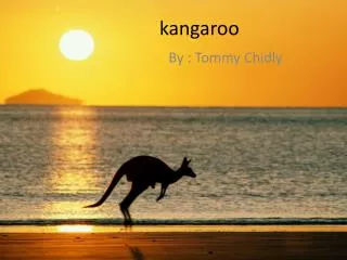
GIS Kangaroo Project
140 likes | 296 Vues
By Flinders Park Primary School yr 6 students Robbie. L, Ciaran. B, Nick. G, Ethan. W, Davin. T and Bryce. J. GIS Kangaroo Project.

GIS Kangaroo Project
E N D
Presentation Transcript
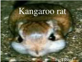
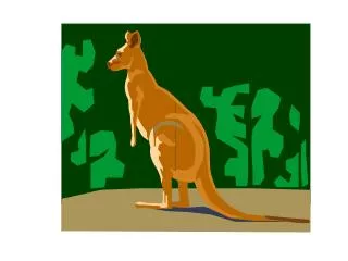
By Flinders Park Primary School yr 6 students Robbie. L, Ciaran. B, Nick. G, Ethan. W, Davin. T and Bryce. J GIS Kangaroo Project We are a mob of Western Grey Kangaroos grazing on the Flinders Park school oval. It is early evening and as the sun sets we move off in search of a quieter place to live… Can we make it to the Fitzgerald River National Park (a biodiversity hotspot), Ravensthorpe?
Ms Mc gave us this challenge because during International Year of the Forest our class has been learning about forests, trees and sustainable practices to do with the environment. One of the topics we covered has been Green (or Wildlife) Corridors, which are areas of habitat connecting wildlife populations separated by human activities (such as roads, development, or logging). Green corridors link up bushland that has remained as National Parks or that has been missed when farms have been started. A Green corridor has heaps of plants native to the area and are a safe place for animals, fungi, plants, insects, spiders, frogs and birds to multiply. Green corridors help keep animals and plant species healthy and safe. This is important for the future because the climate is changing and everyone needs to be aware of that change and protect the resources we still have.
US Robbie . L Team Captain Bryce. J Recorder Ciaran. B Tech assistant Davin. T Writer Nick. G Tech expert Ethan. W Captain’s Lieutenant
John Bloor Preparing On the first day of using the program , we were introduced to John Bloor, who would be our mentor for using arc map 10. Over a 7 week period, we learnt for an hour and a half every Wednesday how to use arc map 10. We constructed a maximum of 2 kangaroo tracks each , one coastal track and one inland track, and chose the best one of each. Around week five of preparing for the project, a lady named Sylvia Leighton (who works at the Department of Environment and Conservation) came in and talked with our group about what kind of obstacles we might encounter along our kangaroo tracks. We were ready to start working on the project.
Why and How • We have decided to work on this project so we can teach the new Yr6-7s that are chosen for the project next year and enter the competition with new enthusiasm. • Ms McNamara (our teacher) uploaded arc map for us to use in wk1. All of us worked in literacy and S+E to complete our tracks and to work together on our project.
Kangaroo Project Rules • The kangaroo can only travel roughly 10 km per day. • They like to bed down in woodland areas greater than 50 hectares. • They should NOT travel through woodland closer than 100 metres to major road or 20 metres to a minor road. • They can cross open land from one wooded area to another. • The tracks can only cross rivers that are a line on the program.
The Coastal Track (T1) The coastal track runs mainly along the coast. By Nick
Explanation of T1 The coastal track crosses a total of 16 roads, the kangaroos jumped across 19 small rivers, stopped 26 times overnight in bushland at least 50 metres away from a road or town . Our kangaroos went 8 days without water. The main problem with the coastal track was we had to figure out a way to pass the Lower King bridge. We had to take a really long way round but we made it in the end.
The Inland track (T2) The inland track runs mainly inland By Robbie
Explanation of T2 The inland track has crossed 14 minor roads, 4 major roads, 4 roads and one national highway ( Southcoast highway ). Our kangaroos slept 19 nights in a safe place but suffered 12 days ( not all in a row ) without water. The kangaroos also crossed 14 small bodies of water and 56 bush tracks.
ROADS Rivers Obstacles On this long journey we have encountered many obstacles. For example: Major rivers and roads. More realistic problems would be farms, getting enough water especially grazing in grasslands. Sylvia told us that kangaroos only cross bridges if there is a bush fire.
Range of our track Finish Point Start Point
What we Learnt We learnt over the course of terms 3 & 4 about how to use the marvellous ArcGIS and how to co-operate as a team. We found that there are many successful ways for our kangaroos to get to Fitzgerald National Park.
Please Wait • SpecialThanksTo: Thanks to John Bloor for being our mentor and teacher. To Sylvia Leighton for coming in and giving us some good ideas and advice. To Ms McNamara and Ms Walter for downloading the program and also giving us some ideas and boundaries. Thanks For Watching!