Download
1 / 15
150 likes | 338 Vues
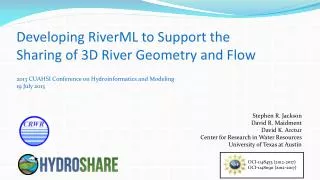
Developing RiverML to Support the Sharing of 3D River Geometry and Flow. 2013 CUAHSI Conference on Hydroinformatics and Modeling 19 July 2013. Stephen R. Jackson David R. Maidment David K. Arctur Center for Research in Water Resources University of Texas at Austin.

E N D
Developing RiverML to Support the Sharing of 3D River Geometry and Flow 2013 CUAHSI Conference on Hydroinformatics and Modeling 19 July 2013 Stephen R. Jackson David R. Maidment David K. Arctur Center for Research in Water Resources University of Texas at Austin OCI-1148453 (2012-2017) OCI-1148090 (2012-2017)
HydroShare: Channel Data From the NSF project proposal: “As an exemplar for advancing data access, we will establish a national repository within HydroSharefor river channel cross section data: a new data type not presently supported by CUAHSI HIS. Since 2003, the United States has spent more than $2 billion on digital flood map modernization. A great deal of river channel cross-section, morphology and hydraulic modeling data has been developed to support this mapping and some of that could be repurposed to advance water science. This repository will include a mechanism for voluntary submission of information and it will provide access to this data in a standard way such that it is easy to run hydraulic models that use this data on either local or HPC environments.”
HydroShare.org: Web-based collaborative environment for sharing data & models
Sample Hydraulic Model: HEC-RAS Calculated Water Surface Elevation • At present, river data formats are software-specific, and thus options for data sharing are limited. Georeferenced Cross Sections
HydroShare: Resource Discovery • With a standardized exchange language, generalized tools can be developed to discover, view, and share river information independent of the software package which generated the data.
HydroShare: Channel Data From the NSF project proposal: “As an exemplar for advancing data access, we will establish a national repository within HydroSharefor river channel cross section data: a new data type not presently supported by CUAHSI HIS. Since 2003, the United States has spent more than $2 billion on digital flood map modernization. A great deal of river channel cross-section, morphology and hydraulic modeling data has been developed to support this mapping and some of that could be repurposed to advance water science. This repository will include a mechanism for voluntary submission of information and it will provide access to this data in a standard way such that it is easy to run hydraulic models that use this data on either local or HPC environments.”
OGC HY_Features: General Semantic Structure Hydraulic Hydrologic Based on International Glossary of Hydrology
RiverML: Interoperability in River Modeling RiverML (Geometry, Catchment, River Network) Hydrologic Calculation Software (HEC-HMS, PondPack, etc.) Terrain Processing Software (ArcGIS, AutoCAD, etc.) RiverML (Water Surface Elevation Observations) RiverML (Flow Rate Observations) RiverML (Geometry, River Network) Hydraulic Calculation Software (HEC-RAS, MIKE Flood HD, etc)
Geometry: Cross Sections and Flow Lines Cross Sections Center Flow Line Overbank Flow Lines Topological Flow Lines
Flow Time Observations: Flow Rate and Water Surface Elevation Single Value (Steady State) Time Series (Hydrograph)
RiverML: Modular Design • Geometry • Flow Line • Cross Section • Section Property • Structure • Reference Point • A consistent set of RiverML files shares the same set of Reference Points. This allows models to be created modularly and joined unambiguously. • River Network • Channel • Reach • Junction • Reference Point • Catchments • Basin • Outfall • Reference Point • Observations • Observation • Reference Point
RiverML: Roadmap for Development • Gather Data • Software Inventory • Canonical Use Cases • Harmonization Paper • Identify community goals for RiverML • Identify common input/output parameters • Describe approach for a harmonized core conceptual model (UML) • RiverML0.1 UML/XML • Focus on 1D Inundation Mapping Use Case • Demonstrate plausible information structure • Hydroshare User Interface (RiverML0.1) • Demonstrate a plausible implementation • OGC Interoperability Experiment (RiverML0.1) • Organize a larger scale test of RiverML with multiple agency/industry participants • OGC Standards Working Group (RiverML1.0) • Modify based on results of Interoperability Experiment • Expand to additional Use Cases • Create rigorous design ready for OGC adoption July 2013 to June 2014 2014 - 2015 2015 - 2016
Summary: What is RiverML? • A proposed UML/XML schema for river modeling data transfer • An implementation of the OGC HY_Features semantic structure, which is based on the WMO International Glossary of Hydrology • Intended for eventual adoption as an OGC International Standard • Under development in conjunction with CUAHSI HydroShare, a web-based collaborative environment for sharing data & models
Acknowledgements RiverML is a collaborative effort that has already benefited greatly from the input of many people, including: • David Maidment (UT Austin, USA) • David Arctur (UT Austin, USA) • David Tarboton (Utah State University, USA) • Ulrich Looser (Federal Institute of Hydrology, Germany) • Irina Dornblut (Federal Institute of Hydrology, Germany) • David Valentine (UC San Diego, USA) • Alva Couch (Tufts University, USA) • Peter Taylor (CSIRO, Australia) • Rob Atkinson (CSIRO, Australia) • Simon Cox (CSIRO, Australia) • Dean Djokic (ESRI, USA) • VenkateshMerwade (Purdue University, USA) • OGC Hydro DWG Working Group • HydroShare Development Team • Funding for this research has been provided by the National Science Foundation [OCI-1148453 (2012-2017) OCI-1148090 (2012-2017)]
Questions? Stephen Jackson Graduate Research Assistant Center for Research in Water Resources The University of Texas at Austin srj9@utexas.edu