Download
1 / 24
240 likes | 364 Vues
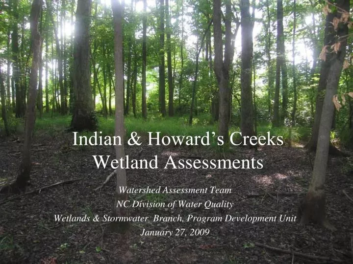
Indian & Howard’s Creeks Wetland Assessments. Watershed Assessment Team NC Division of Water Quality Wetlands & Stormwater Branch, Program Development Unit January 27, 2009. Study Objectives.

E N D
Indian & Howard’s Creeks Wetland Assessments Watershed Assessment Team NC Division of Water Quality Wetlands & Stormwater Branch, Program Development Unit January 27, 2009
Study Objectives • Assess the current functioning of about 30 jurisdictional wetlands in the Indian & Howard’s Creeks Local Watershed Plan (LWP) area using NC Wetland Assessment Method (NC WAM) • Calculate restoration equivalents based on potential for enhancement at each site • Characterize the level of functioning of wetlands as a whole throughout the LWP area
Study Design • Remote identification (GIS) of possible jurisdictional wetlands (JWLs) • Stratified random selection of these for site visits • Visit sites, look for areas meeting US Army Corps of Engineers criteria for JWLs (wetland hydrology, hydric vegetation, and hydric soils)
Field Wetland Assessment Methods • Delineate (USACE method) and record boundary • Photos • Determine NC wetland type • Conduct NC WAM assessment for each JWL: • Under current conditions (at all sites), • AND a second time using expected conditions if enhancement done at the site (if applicable)
NC Wetlands Assessment Method (NC WAM) • Developed over last several years by team of scientists from multiple state and federal agencies • Compare to reference conditions expected for each NC wetland type • Rapid, observational method • Answers from field form entered into an Excel workbook for calculation of ratings
NC WAM Calculator Output • Results in rating of High, Medium, or Low for: • Overall wetland function • Major functions (Hydrology, Habitat, Water Quality) • Up to 21 sub-function/metric combinations (actual number depends on NC WL type)
NC WAM rating • NC WAM calculator- Excel & VBA based • Two ratings for each site if enhancement opportunities exist • Change in rating used to calculate restoration equivalents
Restoration Equivalents - Proposed • Regulators have proposed policy that would allow enhancements that result in wetland functional uplift to be used towards mitigation requirements • Ratios and conversion of NC Wetland Types to Mitigation Types were included in USACE public notice June 2008 • www.saw.usace.army.mil/WETLANDS/Notices/2008/ • PNforMitigationChanges6-3-2008.pdf
Field Sites • 80 initial sites • 67 sites visited in August 2008
Sites assessed • 22 sites had JWLs • 29 JWLs delineated and assessed
JWL Characteristics • Total of 43 wetland acres assessed • Size range: 0.2 – 13.9 acres • Median size: 0.5 acres • Six different wetland types but bottomland hardwood forest and riverine swamp forest most common by far • Highest concentration in middle and lower Indian Cr.
NC WAM- Overall Function NC WAM Overall Function ratings as a percentage of total assessments
Overall Function By NC Wetland Type Distributions of NC WAM Overall Function ratings by wetland type [Bottomland Hardwood Forest (BLH), Floodplain Pool (FP), Headwater Forest (HWF), Non-Tidal Freshwater Marsh (NTFM), Riverine Swamp Forest (RSF), and Seep]
Common Stressors • Sites rating Low or Medium overall were often due to: • Relic ditches • Old stream relocations • Livestock • Recent logging (two sites only) • Incised streams
Common Stressor- Recent Logging Wetland 125a
Common Stressor- Livestock Wetland 063
Common Stressor- Stream Incision Site 132 (no JWL at this site)
Thanks! • John Dorney (DWQ) • Rick Savage, Amanda Mueller, and Mike Turner (DWQ PDU) • Steve Kroeger (WAT) • Rob Carson (Lincoln Co.) • Felipe Jolles (UNC-CH) • Mike Herrmann and Michele Drostin (EEP)
http://h2o.enr.state.nc.us/ncwetlands/pdu.htm Susan Gale, Watershed Assessment Team (WAT) Wetlands Program Development Unit 919-715-3477 susan.gale@ncmail.net