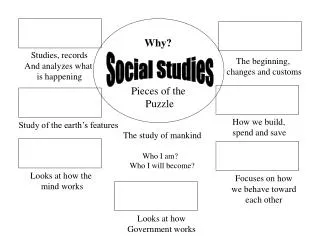
Social Studies
Social Studies. Atlantic Canada. Physical Setting. We are going to start with Physical Setting . What does physical setting mean?. Lines of Latitude. Lines of longitude. Notice the Prime Meridian. Maps. Using the maps provided let’s locate each of the Atlantic provinces.

Social Studies
E N D
Presentation Transcript
Social Studies Atlantic Canada
Physical Setting • We are going to start with Physical Setting. • What does physical setting mean?
Lines of longitude • Notice the Prime Meridian
Maps • Using the maps provided let’s locate each of the Atlantic provinces. • Notice how they compare in size. Which province is smallest, largest?
Notice the location and size of each of the four Atlantic provinces.
Topographic Maps • Besides regular maps we can also find out a lot about an area with the use of a topographic map. • Topographic maps show many details that regular maps exclude. Details such as elevation, lakes, marshes, hills and valleys are just a few.
Map activity 1 • Read pages 10 and 11 in the text book and answer questions 1 and 2 on page 11. • Read pages 12 and 13 and answer questions 1-5.
Assignment 1 - Create your own map 10 marks • Using any resource you want create a map of your neighborhood. • Include: street names, houses, playgrounds, shortcuts, trails, commercial buildings(businesses), churches, schools, places that hold a special meaning, bus stops…
Relative Location and Absolute Location Absolute Location is the exact location of a point on the earth’s surface identified by coordinates. The Lines of Latitude and Longitude are used to find the absolute location. Relative Location is the general location of a place described in terms of distance or direction from another place. • Relative location is something you would use when you gives directions to someone.
Relative Location Activity • Pretend that your parent(s) are coming for a meeting at school and they need to know what seat you sit it during homeroom. • In your notebook, write down directions (relative location) for your parent(s) to help them find your seat in the classroom.
Relative Location activity • What is the Relative Location of Canada? • What is the Relative Location of Atlantic Canada? • What is the Relative Location of New Brunswick? • What is the Relative Location of Oromocto? • What is the Relative Location of your house?
Provincial Capitals • Let’s locate the capital of each Atlantic Province. • New Brunswick – • Nova Scotia – • P.E.I. – • Newfoundland and Labrador -
New Brunswick • New Brunswick is one of the 4 Atlantic provinces. • New Brunswick borders Quebec, Maine, Nova Scotia and is connected to PEI via the Confederation Bridge. • The capital of NB is Fredericton. • There are 8 major communities in NB: Edmundston, Campbellton, Bathurst, Miramichi, Moncton, Dieppe, Saint John and Fredericton.
It is 85% covered by forest, which is the terrain of most of the interior of this province. New Brunswick is the largest of Canada's three Maritime Provinces and mainly surrounded by coastline.
Bodies of Water in NB • NB is a province whose history and culture are deeply connected to the water. • The biggest lake is Grand Lake. • There are 7 major river systems that run throughout NB: Restigouche, Nepisiguit, Miramichi, Petitcodiac, Kennebecasis, Saint John and Tobique Rivers. • The Atlantic Ocean borders the southern, eastern and north eastern parts of the province. • The Bay of Fundy is located in the south. • The Northumberland Strait flows between NB and PEI. • The Gulf of Saint Lawrence flows around north eastern NB and the coast of PEI, NS and NFLD.
Atlantic Canada As A Region • Canada is such a large country that people who live in one area may have little contact with people from another. As a result, people often identify the most with people from the same region. • The region that we live in is Atlantic Canada. This area is called this because the Atlantic Ocean forms borders for all 4 provinces.
Geographers define a region by an area that shares common features such as language, ways of making a living, cultural expressions, physical environment, climate and location. • N.B., N.S., P.E.I. and NFLD and Labrador are the four provinces that constitute Atlantic Canada. These provinces are distinct and have their own defined culture.
Distance and Time • For many years communities set their clocks by the sun. In the mid 1800’s, time differences began to pose a problem as communication improved. Time distance or the time it takes to get between given points was shrinking. • A Canadian surveyor, Sir Sandford Fleming, suggested that the globe be divided into 24 time zones. This idea was adopted in 1884.
Saskatchewan • Saskatchewan is an oddity for time zones. Saskatchewan is mostly in the Central Time Zone, along with Manitoba and north western Ontario. However, Saskatchewan does not observe a time change (back or forward by one hour in the fall and spring) except in the city of Lloydminster which observes Daylight Saving Time but is also in the Mountain Time Zone.
Read page 22 in the text book to familiarize yourself with the time zones in Canada. Look at the map on page 23 to assist you in answering the following questions: • Question 2 and 3 from page 23. • What time zone do you live in? • When you travel to southern destinations(ex. Dominican Republic) why don’t you have to change your watch? • What changes happened in the 1800’s that lead to the need for the creation of time zones?
Landforms In Atlantic Canada • Much of Atlantic Canada is known for its rugged terrain dotted with thousands of lakes and ponds, and its coastline broken with bays and inlets. Along with these features we also have other physical features such as: • Mountains– a mass of land that is significantly higher than the surrounding area. Mountains are generally 600m and higher.
Fjord – is a long, narrow inlet with steep sides or cliffs, created in a valley carved by glacial activity. • Although fjords are typically salt water Newfoundland’s GrosMorne National Park houses a fresh water fjord sometimes called a fjord lake. • Mostly found in NFLD.
Testing your knowledge • Review pages 24 and 25 and answer questions 1, 2 and using the map below, what can you say about the general location of most fjords?
Using your text book read pages 26-29 and complete a Venn Diagram for each pair of water forms below: • Pond; lake • Bay; gulf • Fen; bog
Rivers • River – a long narrow body of water that flows from high to low land and empties into a body of water (like a lake or an ocean).