Download
1 / 14
140 likes | 333 Vues
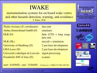
IWAKE instrumentation systems for on-board wake vortex and other hazards detection, warning , and avoidance S. Rahm, DLR. Thales Avionics (F, coordinator) data unit Airbus Deutschland GmbH (D) simulator DLR (D) lidar (CTI) + long range data unit NLR (NL) aircraft + simulation

E N D
IWAKEinstrumentation systems for on-board wake vortex and other hazards detection, warning, and avoidanceS. Rahm, DLR Thales Avionics (F, coordinator) data unit Airbus Deutschland GmbH (D) simulator DLR (D) lidar (CTI) + long range data unit NLR (NL) aircraft + simulation University of Hamburg (D) 2 mm laser development LISA Laser (D) 2 mm laser development Université catholique de Louvain signal processing Fraunhofer IOF of Jena (D) scanner start : 01/05/02; end : 31/04/05; Contract no.: G4RD-CT-2002-007788 Working Group on Space-Based Lidar Winds; Sedona Feb. 2005
IWAKE: NLR Cessna with “Bubble” and scan geometry Working Group on Space-Based Lidar Winds; Sedona Feb. 2005
Scan Pattern Scanning range: 3° vertical x 12° horizontal; 75 horizontal lines Center of scan : 9° to the right und 9° to the ground with respect to aircraft axis Duration of one scan: 5 s / pattern + 1 s flyback => 66 ms / line with approx. 33 shots @ 500 Hz PRF Working Group on Space-Based Lidar Winds; Sedona Feb. 2005
IWAKE instrument (DLR part with IOF scanner) lidar + cooling data rack Working Group on Space-Based Lidar Winds; Sedona Feb. 2005
Installation in NLR Cessna Working Group on Space-Based Lidar Winds; Sedona Feb. 2005
Inside Cessna Citation Working Group on Space-Based Lidar Winds; Sedona Feb. 2005
“Scanner Bubble” Working Group on Space-Based Lidar Winds; Sedona Feb. 2005
Flights in the area of Toulouse: • June,22: LTA wake vortex flight • June, 23: long range wind • June, 25: LTA wake vortex flight Working Group on Space-Based Lidar Winds; Sedona Feb. 2005
LTA wake vortex measurements 25/06/2004 The wake vortex is moving from the right to the left side blue at the LOS plot and green/yellow at the spectral width Working Group on Space-Based Lidar Winds; Sedona Feb. 2005
LTA wake vortex measurements 25/06/2004 preliminary results from UCL TELE (Belgium) 2120 2000 1880 1760 1640 1520 1400 1280 1160 1040 920 800 Range [m] LOS detection field Working Group on Space-Based Lidar Winds; Sedona Feb. 2005
Long range measurements 23/06/2004 LOS wind speed (top)+ difference between range gates (bottom) Working Group on Space-Based Lidar Winds; Sedona Feb. 2005
Long range measurements 23/06/2004 (zoom) Working Group on Space-Based Lidar Winds; Sedona Feb. 2005
Long range measurements 23/06/2004 correlation at different range gates Working Group on Space-Based Lidar Winds; Sedona Feb. 2005
Conclusion • IWAKE demonstrated axial detectability of wake vortices • Clear air turbulence: Correlation between turbulence and acceleration needs exact LOS along flight track • Groundbased + airborne A380 wake vortex measurements planned at DLR for this year (other project). Working Group on Space-Based Lidar Winds; Sedona Feb. 2005