Comprehensive Data Management and Analysis Software for GIS: JANITOR System
JANITOR is a versatile freeware system designed for data creation, management, and analysis in GIS laboratories. It includes interconnected applications like JanMap, JanDat, SQLTools, DataBuilder, and FieldGIS, making data management simple and efficient. Key features include primary data collection, spatial data analysis (e.g., Buffer, Intersect), GPS integration, and easy output printing (maps, tables, and PDFs). JANITOR accesses various data sources, facilitating effective data handling and publication while ensuring reliability and user-friendliness.

Comprehensive Data Management and Analysis Software for GIS: JANITOR System
E N D
Presentation Transcript
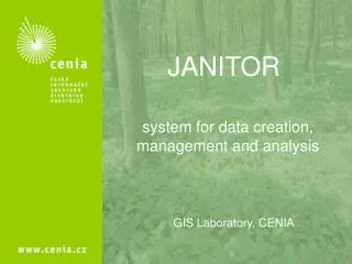
JANITOR system for data creation, management and analysis GIS Laboratory, CENIA
JANITOR • consists of severalinterconnected applications, enabling simple and quick datamanagement- JanMap, JanDat, SQLTools, DataBuilder, FieldGIS • provides tools for primary data collection and additional data processing - storage, organization, surveying, analysis • freeware • ease of use, utility, reliability
JANITOR • reading datafrom GPS, DB, WMS, IMS, files(standard formats in common use are supported) • spatial data and attributesediting • spatial data analysis: Buffer, Union, Clip, Intersect • printing output: maps, tables, pdf documents => I get only what I really need, no redundant functions
JANITOR JANITOR JanMap Maps JanDat Output SQLTools Forms DataBuilder FieldGIS Data
JANITOR reads data from anywhere • data from distant sources • own data setting • data management and publication • data sendingto target stores
JANITOR workswith GISdata • JanMap: • GIS – application • reading datafrom GPS, DB, WMS, IMS etc. • GIS data editing • topology check • analyses (Buffer, Clip, Union etc.) • symbology settings, labels • printing output
JANITOR works with tables • JanDat • Table data management • application • table management • editing • data query andsellection • export
JANITOR is able toquery SQLTools application for database administration • database connection • viewing and editing structure and data • export + import • query maker SQLTools DBMS
JANITOR creates formsets • DataBuilder • Application for building sets • of interconnected forms • It enables: • to insert data into databases • to read data from databases • to choose and to analyze data from databases • to link attributes to spatial data
JANITOR can be mobile • FieldGIS • GIS application for PDA: • enables tocheck datain place • enables to gain data in place • enables tousecode-lists • links attributes to spatial data • supports GPS
JANITOR -example of usage Apteryx australis Janitor client Data storage SQL Data input Output Drosera sp. Publication, presentation Data processing Data input
Thank for your attention. GIS Laboratory, CENIA http://janitor.cenia.cz janitor@cenia.cz