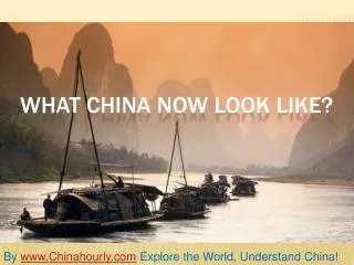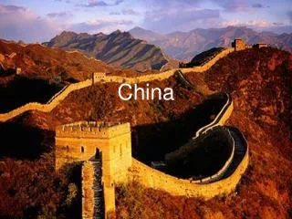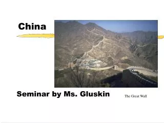
China
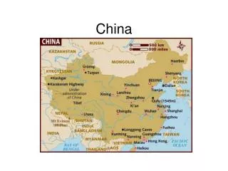
The Peoples Republic of. China. Physical Map . Physical Features . Mountains cover one third of China. Himalayas –tallest mountain range in the world Kunlun Shan Tian Shan . Plateau. The largest plateau in the world is located in China.

China
E N D
Presentation Transcript
The Peoples Republic of China
Physical Features • Mountains cover one third of China. • Himalayas –tallest mountain range in the world • Kunlun Shan • Tian Shan
Plateau • The largest plateau in the world is located in China. • It is called the Plateau of Tibet (Roof of the World). • It is 14,800 ft above sea level. http://kekexili.typepad.com/life_on_the_tibetan_plate/images/tibetan_plateau_railway.png
Unique land Features • Stone Forest http://lh3.ggpht.com/_X5OT4pgXzBQ/SFdC-Egj_TI/AAAAAAAABq8/yacIGk5xsSk/P1090128.JPG
Desert • The Gobi Desert is Twice the size of Texas. • It’s the largest desert region in Asia. • It’s covered with rocks and stones rather than sand. http://images.encarta.msn.com/xrefmedia/aencmed/targets/maps/map/T028749A.gif http://www.historyforkids.org/learn/china/environment/pictures/desert2.jpg
Rivers • China’s 2 major rivers: • The Yangtze River • The Yellow River These are important transportation routes and also a source of soil. http://www.cis.umassd.edu/~gleung/landfo/xline1.jpg
Rivers Continued • These rivers flood their banks in the spring. • Deposit rich soil that form flat river basins that can be farmed. • The most productive farmlands are found in valleys formed by these major rivers. • These rivers are where China’s ancient civilizations started.
Natural Disasters • Floods and earthquakes are a major problem in China. • Ex. The Yellow River is also know as “China’s Sorrow.” • In 1998, The Yellow River flooded and killed 3,000 people and caused 20 billion dollars worth of damage.
Earthquakes • Ring of Fire: Pacific coastal areas with volcanoes. • Eastern China lies along a fault (crack in the earth’s crust). • Earthquakes are common and deadly.
Population • The majority of the population lives in the Eastern third of the country. • All of wealthy live in the cities. • However, the majority of Chinese aren’t wealthy. http://www.geocities.com/stevejford/CHINA2.jpg
Major Cities of China • Beijing • Shanghai • Hong Kong http://www.infohostels.com/immagini/Beijing.jpg www.mfginchina.net http://www.destination360.com/asia/china/images/s/china-hong-kong.jpg
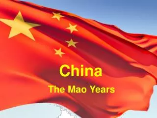
Government • China became a Communist State in 1949 under Mao Tse-tung • Communist State: Strong control over the economy and society. The decides what crops are grown, what products are made and what price the items are to be sold at. • Under this system, China’s economy struggled. http://www.jaunted.com/files/3873/ChinaCommunismMao.jpg
In 1978, China began allowing certain features of a Free Enterprise. • China’s economy has since boomed!
Economy • Eastern China is rich in minerals, petroleum and natural gas. • China is a world leader in mining coal and iron ore. • Thelargest manufacturing areas are found in large cities. http://www.oneinchpunch.net/wordpress/wp-content/uploads/2007/10/china-toy-manufacturing2.jpg