2011 NGS and National Height Modernization Program Update: CSRC Meeting Insights
80 likes | 217 Vues
The Fall 2011 CSRC Coordinating Council Meeting focused on advancing science and tools to achieve the Ten-Year Plan and National Height Modernization Program (NHMP) goals. Key activities included enhancing vertical components of the National Spatial Reference System (NSRS) through supported projects, such as the GRAV-D fieldwork for geoid updates and pilot projects for FEMA mapping. Future plans involve developing comprehensive guidelines, updating infrastructure analyses, and modernizing geodetic control data. For inquiries, contact Renee Shields at NOAA.

2011 NGS and National Height Modernization Program Update: CSRC Meeting Insights
E N D
Presentation Transcript
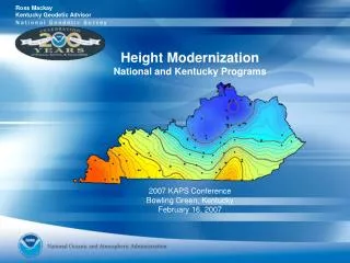
NGS and National Height Modernization Program Update CSRC Coordinating Council Meeting Fall, 2011 La Jolla, CA via webinar
STRATEGY • Advance science, models, tools, and education in order to: • Achieve Ten-year Plan Objectives • Achieve National Height Modernization Program (NHMP) goals • Transition to new geometric and geopotential datums (c. 2022)
NGS/NHMP Activities Science: NHMP supported projects to enhance vertical component of NSRS. MYCS – release of Multi-Year CORS Solution NA 2011 – adjust passive control for consistency with MYCS GEOID12
NHMP ACCOMPLISHMENTS Science: NHMP supported projects to enhance vertical component of NSRS. GRAV-D fieldwork and data processing to support a 1 cm geoid and the new geopotential datum Pilot Project in North Carolina to produce a new set of instructions for FEMA floodplain mapping based on access to the new datums Texas Geoid Slope Validation Survey engaging a variety of testing methods to address achievable accuracy of a gravimetric geoid model International Great Lakes Datum (IGLD) fieldwork and data processing completed to update the IGLD, benefitting US-Canada boundary region
NHMP ACCOMPLISHMENTS Models and tools: NHMP supported many recent NGS products including. HTDP development in partnership with Scripps and University of Alaska, Fairbanks – also working on vertical (e.h.) component- VTDP VTDP development including repeat surveys in Southern Louisiana and subsidence monitoring in Harris-Galveston Subsidence District Transformation tool between epochs after National Adjustment of 2011 – studying the need for it
NHMP ACCOMPLISHMENTS Education: NHMP continue to support education and outreach. Monthly teleconferences, now with guest speakers LiDAR workshop and Partner Meeting in August 2011 ACSM / Survey Summit / ESRI User Conference in July 2012 Updating NGS HMP web site
NHMP FUTURE PLANS • Developing National Height Modernization Plan (NHMP) • Updating Height Modernization Guidelines, NGS 58 / NGS 59 • Infrastructure gap (e.g. CORS) analysis • Modernize NGS geodetic control datasheets
Questions Renee Shields Height Modernization Manager 301-713-3231, x116 Renee.Shields@noaa.gov