Download
1 / 17
170 likes | 437 Vues
Polar Communications & Weather (PCW) Mission. Mike Manore, Louis Garand, David Bradley - Environment Canada Guennadi Kroupnik – Canadian Space Agency. Motivation for an Arctic Mission. A rapidly changing environment rapidly diminishing ice cover, amplified climate change

E N D
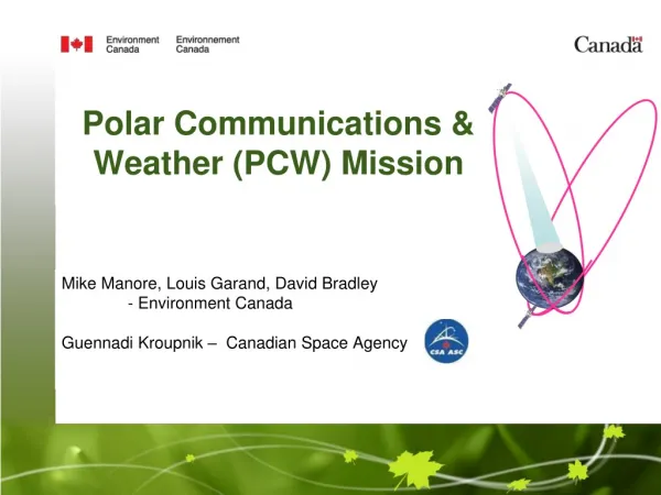
Polar Communications & Weather (PCW) Mission Mike Manore, Louis Garand, David Bradley - Environment Canada Guennadi Kroupnik– Canadian Space Agency
Motivation for an Arctic Mission • A rapidly changing environment • rapidly diminishing icecover, amplified climate change • region of high meteorological and climate significance • Growing need for operational information infrastructure • increased marine and air traffic – civilian and military • economic development, services, sovereignty • for support to operations, safety, regulation, science • A gap in global communications and observation systems • lack of braodband satcom >75° • sparse in-situ observing networks • geostationary observing systems not suitable >55° • Other • support for Canada’s Northern Strategy • economic development • environmental protection • sovereignty • active region of space weather
Polar Communications and Weather Mission - Objectives • Reliable communications and navigation servicesin the high latitudes (North of 70º) to ensure: • - seamless 24/7 broadband, two-way connectivity • - uninterrupted data (IP) transfer • - interoperability with existing communications services • High temporal/spatial resolution meteorologicaldata above 50º N in support of: • Numerical Weather Prediction (short to medium range) • Environmental monitoring, emergency response • Climate monitoring • Space Weather Monitoring • Canadian-led mission with international partnerships • Canadian Space Agency leadership
Payloads and Mission Primary Payloads (Core mission): Ka-band (4 beams) and X–band (1 beam) 2-way High Data Rate communication Imaging Spectroradiometer (16-20 channels, 0.5-1 km VIS, 2 km IR) Space weather suite of instruments Secondary Payloads (Enhanced mission) Additional mass and power capacity may permit secondary payloads(under evaluation); e.g.; GNSS augmentation, Air Traffic Management Science instruments: Broadband radiometer, Aurora Imager, Atmospheric composition instrument (UV-NIR), Fourier Transform spectrometer (IR, similar to IASI) Technology demonstration: Software defined radio, V-band communications
Areas of Interest Meteorological Coverage Requirement (50ºN) Meteorological Coverage Goal (45ºN) Canadian Communications Coverage Requirement (may be expanded in enhanced mission)
Mission Overview • Primary (Core) Mission • 2 satellites in HEO orbit • Molniya or other – tbd • 2-way, 24/7 high data rate communication services • up to 12 Mb/sec • Ka-band + X-band • GEO-like imagery 50-90 N • 15-30 min refresh • 16-20 ABI-like channels • 0.5-1 km VIS, 2 km IR • Space-weather sensors • tbd based on final orbit • Secondary (Enhanced) Mission (tbd) • GNSS augmentation • Air Traffic Mgt • Science instruments (at proposal stage) • e.g., auroral imager, broadband radiometer, UV-NIR, FTS, …
Preliminary Spacecraft Concept Mass: up to 2000 kg Power: up to 4000 W Pointing Knowledge: 7.6 arcsec Pointing Control: 55.1 arcsec Ka + X-band telecom antennas Meteo instrument aperture
Spacecraft Concept Mass: up to 2039 kg Power: up to 2219 W 8
Preliminary Services Concept Ka-band downlink to gateway station 2-way telecom beams (4) (for Canadian area of interest) Imaging area for meteo instrument
Space Segment Meteo and SW Processing Comms Figure 1: OverviewPCW GroundSegment Architecture(MDA) Gateway Station TT+C L0 Comms L1 L1 L1 L2+ L1 L2+ 10
Comms Payload X-band, commercial Ka-band, and government Ka-band planned. Ka-band is also to support downlink for met data. Forward Link: 4 commercial channels + 4 government channels. Return Link: 1 commercial channels + 1 government channel + 1 mesh channel. Coverage Areas Ka-band: to be served by 4 user beams and one gateway beam. X-band: to consist of one user beam with re-use of Ka-band gateway beam. Frequency Band Earth to Space Space to Earth Military X Band* 7.9 – 8.4 GHz 7.25 – 7.75 GHz 29.5 – 30.0 GHz 19.7 – 20.2 GHz Commercial Ka Band 30.0 – 31.0 GHz 20.2 – 21.2 GHz Military Ka Band 11
Ground Segment • Backup PCW • Operations Center – • Location (TBC) • SCC • MC 12
PCW Imager Definition: 20 Channels
Cooperation with NOAA Participation in meteo International User and Science Team since initiation science and operational inputs to User Requirements Document (URD) NOAA PCW Workshop – December 2010 strong support for PCW mission concept and services at operational and senior management level multiple areas for potential cooperation identified validation of user requirements (meteo, comms, space weather) science and applications development instrument technology and cal/val data processing and product dissemination space weather instrumentation and products NOAA-Canada Coordination Group validate applicability of PCW capabilities to NOAA requirements define and scope potential areas of cooperation engage other interested US agencies (e.g., USAF, USN, NASA, …) report to senior management – NOAA, CSA, EC – June 2011
Major Milestones Phase 0 completed: September 2008 User and Science Teams formed Phase A Approved: November 2008 Phase A contract awarded: July 2009 Phase A Major Milestones: Phase A kicked-off: July 2009 Technology Readiness Assessment Review: October 2009 Mission Requirements Review: February 2010 Preliminary System Requirements Review: June 2010 Phase A Final Review – March 2011 Procurement Strategy defined: 2011 Phase B/C/D contract award: 2012* Satellite launch: 2016* Beginning of operations: 2017* * Subject to finalmission approval


