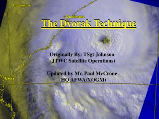
Can Dvorak Intensity Estimates be Calibrated?
150 likes | 316 Vues
Can Dvorak Intensity Estimates be Calibrated?. John A. Knaff NOAA/NESDIS Fort Collins, CO. Dvorak Technique: Overview. The Dvorak Technique estimates tropical cyclone intensity by analyzing satellite image patterns and IR cloud top temperatures .

Can Dvorak Intensity Estimates be Calibrated?
E N D
Presentation Transcript
Can Dvorak Intensity Estimates be Calibrated? John A. Knaff NOAA/NESDIS Fort Collins, CO
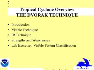
Dvorak Technique: Overview • The Dvorak Technique estimates tropical cyclone intensity by analyzing satellite image patterns and IR cloud top temperatures. • Intensity is assigned with intensity units (called T-numbers ranging from 1 to 8, in 0.5 increments), where one T-number represents one day’s intensity change at an average rate. • The T-number can be given as a maximum surface wind speed or a minimum sea-level pressure.
Dvorak Technique: Procedure • Simplified Approach: • 1. Locate Center • 2. Assign Pattern • 3. Make measurements (Visible or EIR) • 4. Assign T-Number • 5. Assign CI (Current Intensity)
Why Calibrate? • Through a concerted WMO effort the Dvorak Technique (circa 1984) was taught to and adopted at all WMO RMSCs and Tropical Cyclone Warning Centers by the late 1980’s • The method has been found to be relatively stable with respect to satellite sensor resolution (Zehr, Beven, DeMaria) • Historical records exist for these estimates, thus these represent a quality climate record of global tropical cyclone intensity. • A systematic validation vs. Aircraft estimated winds (i.e., best track) has not been done and is needed. HOW ACCURATE/PERSISE ?
Questions I Want to Answer • Does the Dvorak Technique have systematic biases wrt intensity, intensity trend, size, translational speed, and latitude? • What are the error characteristics of such estimates as a function of …. ? • Can CI estimates be improved for? • Operationally (for advisories) • Post-season (i.e., best tracking) • Reanalysis of historical TCs
Approach • TC fix, advisories and best track data, 1989-2007 • For each fix • Interpolate intensity from the best track (truth) • Get Radius of Outer Closed Isobar from advisories and best tracks, interpolate to fix time • Compare intensity (fix vs. truth) • Homogeneous fix record from 1) Satellite Analysis Branch (SAB, Washington) and 2) Tropical Analysis and Forecast Branch (TAFB, Miami) • Stratify by factors (composite) • Intensity • Intensity & Intensity trend (12-h) • Intensity & Latitude • Intensity & Size (ROCI) • Intensity & Speed of translation • Regression using the composite datasets that span the range of factors.
Multiple Regression – Based Bias Correction Valid for Vmax 20-140kt
A Universal Relationship • Assume a function for biases as a fixed function of intensity • Recalculate the regression coefficients. Valid for Vmax 20-140kt
Conclusions • Shown • A bias correction for the Dvorak intensity estimates has been developed • Biases are a function of • Intensity • Intensity change • Latitude • Size (ROCI) • Storm speed • Can be applied in real-time, and for reanalyses • Not shown • RMSE appear to be solely a function of intensity