Download
1 / 20
200 likes | 420 Vues
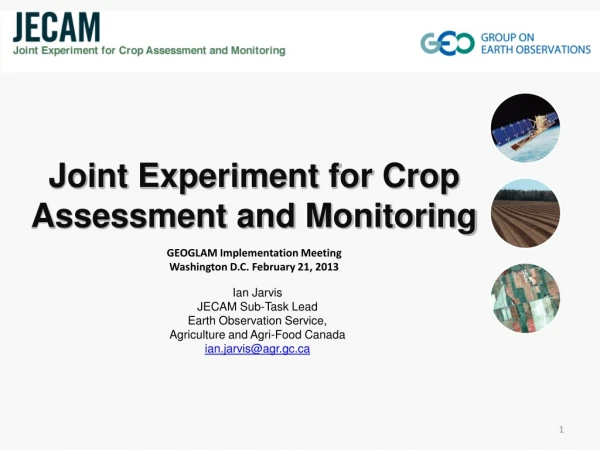
Ian Jarvis JECAM Sub-Task Lead Earth Observation Service, Agriculture and Agri-Food Canada ian.jarvis@agr.gc.ca. Joint Experiment for Crop Assessment and Monitoring. GEOGLAM Implementation Meeting Washington D.C. February 21, 2013. Overview of GEO-JECAM

E N D
Ian Jarvis JECAM Sub-Task Lead Earth Observation Service, Agriculture and Agri-Food Canada ian.jarvis@agr.gc.ca Joint Experiment for Crop Assessment and Monitoring GEOGLAM Implementation Meeting Washington D.C. February 21, 2013
Overview of GEO-JECAM The GEO Agricultural Community of Practice EstablishedJECAM to: Enhance international collaboration around agricultural monitoring towards the development of a “systems of systems” to address issues associated with food security and a sustainable and a profitable agricultural sector worldwide JECAM is achieving this objective by: Network distributed regional experiments on cropland pilot sites around the world representing a range of agricultural systems Share time series datasets from a variety of earth observing satellites and in-situ data and assess them for agricultural assessment and monitoring Facilitating the inter-comparison of monitoring and modeling methods, product accuracy assessments, data fusion and product integration, for agricultural monitoring
Overview… 2 Synthesis of the results from JECAM will enable: • Development of standards for monitoring and reporting protocols • A convergence of the monitoring science approaches to define best practices for different agricultural systems • Inform user requirements for Earth Observation Data needs • Support monitoring enhancements in the development of the GEOGLAM system of systems The Approach: • Collect and share time-series datasets from a variety of Earth observing satellites and in-situ crop and meteorological measurements for each site. • The Committee on Earth Observing Satellites (CEOS) and member agencies are supporting this activity with the acquisition and timely provision of data for JECAM.
JECAM.ORG JECAM Website
JECAM activities are being undertaken at a series of study sites which represent many of the world’s main cropping systems • 15 sites currently exist, at least 5 new in development, 3 dormant Sites in development
One of the early lessons was that JECAM needed a way to track the uptake of EO data and in turn CEOS needed a way to track to progress, productivity and imact of the research they are supporting • In response: JECAM annual reports are in progress (Complete for CEOS mtg in March) • 8 Sites have submitted reports, 2 pending, 3 sites dormant, 2 sites not yet ready to report • From the 8 sites reporting there have been 10 peer reviewed papers and 19 presentations related to JECAM research identified Current Status – JECAM Annual Reports 6
Current Status – Satellite Data Access • The interaction with the space agencies and commercial providers has been very positive • On-going communication is required to ensure sites are aware of the opportunity and taking full advantage • There has been significant support from SAR providers • From sites reporting at least 60 acquisitions from Radarsat 2 and 32 TerraSAR-X • Significant Support from optical data providers • MODIS - RapidEye • MERIS - HJ1 and HJ1 IRS (China sites) • DMC - AWifs • SPOT 7
Current Status – Research Activities Crop Mapping and Area Estimation • All sites reporting include crop mapping as an objective 2012 Crop Map, Canada-Red River Site
Current Status – Research Activities Crop Condition – Crop Growth Parameters • 6/8 Sites reporting include crop condition objectives 2012 PASG Map, South Africa Site 2012 Ukraine Site
Current Status – Research Activities Crop Yield Forecasting • 6/8 Sites reporting include yield research 2012 Crop Biomass, China Shandong Site July 2012 Crop Status, China Heilongjiang
Current Status – Research Activities Soil Moisture Monitoring • 4/8 Sites reporting include soil moisture monitoring research Radarsat 2, Soil Moisture, Canada South Nation Site December 2012 Rainfall Map, South Africa Site
Current Status – Research Activities Residue and Tillage Mapping • 4/8 Sites reporting include residue and tillage monitoring research Tillage Mapping, China, Heilongjiang Site Crop Residue, Canada Red River Site
Current Status – JECAM Collaboration • There is already significant bi-lateral collaboration between site planned and underway. • Use of the site network to support research external to JECAM is now taking place: • ESA Sentinel 2 Simulation over JECAM sites • IMAGINES project • NASA-Canada SMAP Validation Experiment (SMAPVEX) • UMD-Validation of LAI and FAPAR derived from coarse spatial resolution data 13
SMAP will provide global soil moisture data using active radar and passive microwave sensors • AAFC was asked by NASA and U.S. Department of Agriculture to lead an international SMAP validation experiment using the Red River JECAM site • SMAPVEX will help NASA validate their models for soil moisture retrieval and will be used to adapt AAFC models to use SMAP data • Involved 75 scientists • Canada: AAFC, EC, Manitoba provincial agriculture ministry (MAFRI) and 3 universities • U.S.: NASA, Jet Propulsion Lab, USDA and 10 universities • Campaign lasted 6 weeks and resulted in 45,000 soil moisture measurements; NASA flew 2 aircraft 17 times Current Status – JECAM Collaboration NASA/Canada SMAP Validation Experiment (SMAPVEX) 14
Current Status – JECAM Collaboration ESA Sentinel 2 Simulation over JECAM sites • 6 JECAM sites were asked to participate • 5 are able to support the mission with ground data • ESA will acquire Spot4 and RapidEye over the sites from February through May • SPOT 4 orbit was lowered 3km to mimic the Sentinel 2 Constellation 5 day repeat cycle • Simulated multi-temporal datasets will be made available in June 15
Current Status – New Site Proposals • Several sites have come forward recently, the following have documented sites already: • Tunisia (CISBO): cereals / forage / broad beans in winter, vegetables in summer • The following documented tropical sites link in with CIRAD mission, and include: • Madagascar (Antsirabé) : Mid-altitude mixed rice cropping system; irrigated on terraces or basins, and rainfed on the hills. - Partnership FOFIFA • Tanzania( Rungwe ) : Highland agro-forestry system based on coffee, banana and corn - Partnership State university of Sao Paulo (UNESP) • Brazil (Sao Paulo) : Mainly eucalyptus tree plantations (typical field size of 50 ha), and sugar cane, pastures, citrus orchards - partnership ICRAF 16
Summary • The data acquisition planning with CEOS, Space Agencies and Commercial providers is proceeding well and most JECAM sites are receiving data • Lessons learned with CEOS-JECAM data acquisition process: • We have instituted an annual report process to obtain information on JECAM research progress, EO data usage and collaboration activities. The final report will be delivered to CEOS at the SIT meeting in March and made available on the JECAM website. • New website launched last year. Content from the annual reports will be used to keep the site “fresh” (JECAM.ORG). Site will be updated with • We are positioning JECAM in order to further leverage national investments in research to support GEOGLAM outcomes • Annual JECAM Meeting in planning (June to July timeframe, Canada). We will work towards developing a response to the GEOGLAM phased approach
Discussion Current-Future Priorities • JECAM focus has shifted to enhanced collaboration between sites • Be responsive to GEOGLAM “R&D towards monitoring enhancements” needs • Use the JECAM network to test/contrast/compare national monitoring approaches • Development of regional studies to define best practices for harmonized national to regional monitoring in response to GEOGLAM phase approach • Development of comparative studies to develop standards and practices that inform GEOGLAM “system of systems” for agricultural monitoring • Use JECAM sites to validate new sensors 18
Data Requests of JECAM Sites: Canadian RED River and South Nation Watersheds