Download
1 / 19
190 likes | 284 Vues
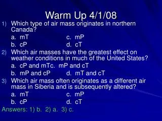
Warm Up 4/1/08. Which type of air mass originates in northern Canada? a. mT c. mP b. cP d. cT Which air masses have the greatest effect on weather conditions in much of the United States? a. cP and mT c. mP and cT b. mP and cP d. mT and cT

E N D
Warm Up 4/1/08 • Which type of air mass originates in northern Canada? a. mT c. mP b. cP d. cT • Which air masses have the greatest effect on weather conditions in much of the United States? a. cP and mT c. mP and cT b. mP and cP d. mT and cT • Which air mass often originates as a different air mass in Siberia and is subsequently altered? a. mT c. mP b. cP d. cT Answers: 1) b. 2) a. 3) c.
Fronts Chapter 20, Section 2
Formation of Fronts • When two air masses meet, they form a front, which is a boundary that separates two air masses • Fronts can form between any two contrasting air masses • In contrast to the vast sizes of air masses, fronts are narrow (~15-200 km wide) • In the ideal case, the front would move in the same direction with warmer air overlying cooler air • However, the distribution of pressure across a front causes one air mass to move faster than the other, causing it to advance into the slow air mass
Warm Fronts • A warm front forms when warm air moves into an area formerly covered by cooler air • The surface position of a warm front is shown by a red line with semi-circles that point toward the cooler air • The first sign of the approaching warm front is the appearance of cirrus clouds • Because of their slow rate of movement and very low slope, warm fronts usually produce light-to-moderate precipitation over a large area for an extended period • A gradual increase in temperature occurs with the passage of a warm front, as does a wind shift from the east to the southeast
Concept Check • What causes a warm front to form? • When warm air moves into an area formerly covered by cooler air, a warm frot forms.
Cold Fronts • A cold front forms when cold, dense air moves into a region occupied by warmer air • On a weather map, the surface position of a cold front is shown by a blue line edged with blue triangles that point toward the warmer air mass • As a cold front moves in, it becomes steeper and advance more rapidly than warm fronts • The forceful lifting of air along a cold front can lead to heavy downpours and gusty winds • As a cold front approaches, towering clouds can often be seen in the distance • The weather behind a cold front is dominated by a cold air mass, so weather clears shortly after the front has passed
Concept Check • How are cold fronts different from warm fronts? • Cold fronts are much steeper than warm fronts and advance more rapidly than warm fronts do, causing more violent weather to form.
Stationary Fronts • Occasionally, the flow of air on either side of a front is neither toward the cold air mass nor toward the warm air mass, but almost parallel to the line of the front • The surface position of the front does not move, and a stationary front forms • On a weather map, stationary fronts are shown by blue triangles on one side of the front and red semicircles on the other • Sometimes, gentle to moderate precipitation occurs along a stationary front
Occluded Fronts • When an active cold front overtakes a warm front, an occluded front forms • The weather associated with an occluded front is complex: most precipitation is associated with the warm air’s being forced upward • Remember, fronts, like all aspects of nature, do not always behave as we expect them to
Middle-Latitude Cyclones • The main weather producers in the U.S. are middle-latitude cyclones, denoted by the letter L • Middle-Latitude Cyclones – large centers of low pressure that generally travel from west to east and cause stormy weather • The air in these weather systems moves in a counterclockwise direction and in toward the center of the low • Most middle-latitude cyclones have a cold front, and frequently a warm front, extending from the central area • Forceful lifting causes the formation of clouds that drop abundant precipitation
Concept Check • How do middle-latitude cyclones form and develop? • The first stage is the development of a front. Over time, the front takes on a wave shape. Changes in air flow and pressure result in a counterclockwise flow of air. The cold front eventually closes in on the warm front to produce an occluded front. As the cold front lifts, an occluded forms. Eventually, the cyclone weakens.
The Role of Airflow Aloft • Airflow aloft plays an important role in maintaining cyclonic and anticyclonic circulation • The rotating wind systems are actually generated by upper-level flow • Surface convergence must be offset by outflow somewhere higher in the atmosphere • As long as the spreading out of air high up is equal to or greater than the surface inflow, the low-pressure system can be sustained • More often than not, air high up in the atmosphere fuels a middle-latitude cyclone • In an anticyclone, air spreading out at the surface is balanced by air coming together from high up
Assignment • Read Chapter 20, Section 2 (pg. 564-570) • Do Chapter 20 Assessment #1-37 (pg. 583-584) • Print Out “Investigation 20A – Analyzing Severe Weather Data”