CARTOGRAFIA - A. NETO
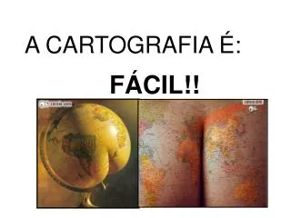
CARTOGRAFIA - A. NETO. “Cartografia é a ciência e a arte de de expressar graficamente, por meio de mapas e cartas, o conhecimento humano da superfície da Terra.
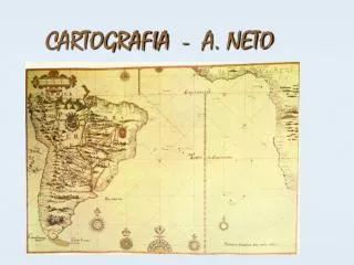

CARTOGRAFIA - A. NETO
E N D
Presentation Transcript
“Cartografia é a ciência e a arte de de expressar graficamente, por meio de mapas e cartas, o conhecimento humano da superfície da Terra. Uma ciência, porque essa expressão gráfica, para alcançar exatidão satisfatória, procura apoio científico na coordenação de determinações astronômicas e matemáticas e nas noções topográficas e geodésicas. É considerada arte, quando se subordina às leis estéticas da simplicidade, clareza e harmonia, procurando atingir o ideal de beleza.” P.R. Múcio Bakker
MAPAS (IBGE 2004) Os mapas correspondem à representação, aproximada, em um plano dos aspectos - geográficos, naturais, culturais e antrópicos -em proporção reduzida de toda superfície terrestre ou de parte dela. Para confecção de um mapa é necessária a aplicação de um conjunto de procedimentos que visa relacionar os pontos da superfície terrestre a pontos correspondentes no plano de projeção (mapa). Estes procedimentos consistem em
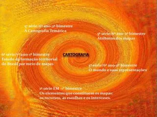
CARTOGRAFIA • TÉCNICA OU ARTE DE PRODUZIR MAPAS • HISTÓRICO • PRÉ-HISTÓRIA • ANTIGUIDADE • IDADE MÉDIA • GRANDES NAVEGAÇÕES • ATUALIDADE
ELEMENTOS DO MAPA • ESCALA • TÍTULO • COORDENADAS GEOGRÁFICAS • ORIENTAÇÃO • LEGENDA • CONVENÇÕES CARTOGRÁFICAS
ESCALAS • NUMÉRICAS: 1: 2000000 • GRÁFICAS: • TAMANHOS • GRANDES: até 1: 250 000 • MÉDIAS: de 1: 250 000 até 1: 1 000 000 • PEQUENAS: acima de 1: 1 000 000
ESCALAS • PLANTAS: • GRANDE (1:5000 a 1:20000) • CARTAS TOPOGRÁFICAS • MÉDIAS (1:100000 e 1:200000) • GRANDES (1:10000 e 1:50000) • COROGRÁFICAS (até 1:1000000) • GEOGRÁFICAS (acima 1:1000000)
COMO CALCULAR? • D= distância real • d= distância no mapa • E= escala • D= d.E • d= D/E • E=D/d
PROJEÇÕES CARTOGRÁFICAS • ASPECTOS • DISTÂNCIA, FORMA e ÂNGULO • EQUIDISTANTES • EQUIVALENTES • CONFORMES • AFILÁTICAS
CARACTERÍSTICAS • EQUADOR PRESERVA A ESCALA • QUANTO MAIOR A LATITUDE, MAIOR A DEFORMAÇÃO • PARALELOS EM INTERVALOS DESIGUAIS • MERIDIANOS IGUAIS E PERPENDICULARES AO EQUADOR • ACIMA DE 80° N (inviável)
CARACTERÍSTICAS • PARALELO CIRCULARES • MERIDIANOS RADIAIS • INDICAÇÃO DE USO • LATITUDES INTERMEDIÁRIAS • EUROPA • ÁSIA • AMÉRICA DO NORTE
CARACTERÍSTICAS • PLANA • POLAR • MERIDIANOS e PARALELOS • ESTEREOGRÁFICAS • ORTOGRÁFICAS • AZIMUTAIS • ADAPTADAS
CARACTERÍSTICAS • EUROCÊNTRICO • PROJEÇÃO CONFORME • NÃO DEFORMA ÂNGULOS • VALORIZA A FORMA • DEFORMA AS ÁREAS • HEMISFÉRIO NORTE
CARACTERÍSTICAS • TERCEIRO-MUNDISTA • EQUIVALENTE • VALORIZA A ÁREA • DEFORMA OS CONTORNOS DOS CONTINENTES • ÁFRICA EM DESTAQUE
REPRESENTAÇÕES DO RELEVO • CORES ALTIMÉTRICAS • HIPSOMÉTRICAS • VERDE:PLANÍCIES • AMARELO: PLANALTOS • VERMELHO, MARROM, PRETO, BRANCO • TERRAS ALTAS
REPRESENTAÇÕES DO RELEVO • CORES ALTIMÉTRICAS • BALTIMÉTRICAS • PROFUNDIDADE DAS ÁGUAS • TONS DE AZUL (escuro para claro) • CURVAS DE NÍVEL • LIGAM PONTOS DE IGUAL ALTITUDE • INCLINAÇÃO DO RELEVO (plano ou não)
NÃO FIQUE CONFUSO, VAMOS AOS FUSOS... HORÁRIOS FUSOS HORÁRIOS