Download
1 / 8
80 likes | 220 Vues
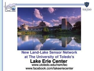
New Land-Lake Sensor Network at The University of Toledo ’ s. Lake Erie Center. www.utoledo.edu/nsm/lec. www.facebook.com/lakeeriecenter. Setting: Lake Erie Ecosystem Today. Lake Erie is the shallowest & most productive of the GL with the largest watershed

E N D
New Land-Lake Sensor Network at The University of Toledo’s Lake Erie Center www.utoledo.edu/nsm/lec www.facebook.com/lakeeriecenter
Setting: Lake Erie Ecosystem Today • Lake Erie is the shallowest & • most productive of the GL with the largest watershed • Heavily impacted by agriculture & industry • Houses the world’s largest freshwater fisherieswalleye, yellow perch & smallmouth bass • Harmful algal blooms, declining habitats, E. coli, sedimentation & invasive species are growing concerns • Our Lake Erie Center programs are dedicated to developing & implementing solutions
LEC Environmental Research Developing Hands-on Solutions to key environmental problems at the land-lake ecosystem interface Multidisciplinary cutting-edge scientific and engineering tools: • DNA & acoustic tracking of fish stocks (NOAA, USEPA) • HAB monitoring (NOAA) • Lake sensor network (NSF, USFS, USDA) • eDNA to track invasive species (NOAA) • Bioremediation (USDA) • Artificial wetlands (USEPA GLRI) Education & Outreach Programs: • NSF Gk-12“Graduate Fellows in High School STEM: An environmental Science Learning Community at the Land-Lake Ecosystem Interface”-2012-13 focus on the sensor network data • Monthly Public Lecture Series • NSF URM Undergraduate • Research & Mentoring • Sensor Network Faculty Team: • Dr. Jiquan Chen (Carbon flux data) • Dr. Kevin Czajkowski (GIS) • Dr. Tom Bridgeman (HABs, water quality) • Dr. Ricky Becker (remote sensing) • Dr. Carol Stepien (integration, education)
New LEC Land-Lake Sensor Network Lake Sensor equipment funded by NSF FSML Builds off Dr. Jiquan Chen’s land sensor network
Route of the LEC Vessel-Mounted Flux Tower • Through the Microcystis algal bloom at the estuarine of the Maumee River • Through the sedimentary flow south of the Detroit River • Measurements taken near permanent stations in the Western basin (PermS1, PermS2)
Preliminary Data from Marshland (coastal wetland) versus Cropland (agricultural field) Sites • Marshland releases evident methane during the day • Cropland releases methane during the day and uptakes small amounts during the night • The orders of methane fluxes are much smaller in the cropland than in the marshland • (Data from LEES Lab, Dr. Jiquan Chen)