Download
1 / 8
90 likes | 239 Vues
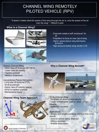
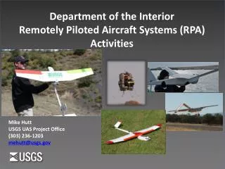
Department of the Interior Remotely Piloted Aircraft Systems (RPA) Activities. Mike Hutt USGS UAS Project Office (303) 236-1203 mehutt@usgs.gov. Why Remotely Piloted Aircraft Systems? . Department of the Interior (DOI) manages more than one-fifth of U.S. land .

E N D
Department of the Interior Remotely Piloted Aircraft Systems (RPA) Activities Mike Hutt USGS UAS Project Office (303) 236-1203 mehutt@usgs.gov
Why Remotely Piloted Aircraft Systems? Department of the Interior (DOI) manages more than one-fifth of U.S. land • RPA can help address information gaps in remote areas • Manned aircraft can pose safety risks, be more expensive , are weather dependent • and restricted to daytime operations • Satellite observations are hindered by weather, low resolution, and long data acquisition intervals • Field surveys can be costly, challenging and geographically limited 2
Factors For Increased RPA Usage • RPA technology is developing at extraordinary rates • U.S. Universities involved with RPA related programs- 165 • Countries involved with RPA manufacturing- 65 • US RPA related manufactures- 200 • Global RPA related manufactures- 715 • Global RPA platforms- 2400 • Federal Aviation Administration Reauthorization Act • Establishes a 2015 deadline for integration of RPAs into the National Airspace System (NAS) • Public use small RPAs be allowed to operate in the NAS by May 2014 • Requires the FAA to establish six RPA test sites • Supports RPA operations in the Arctic- first commercial operations • Association for Unmanned Vehicle Systems International predicts that three years after being integrated into the NAS, RPAs will- • Provide more than 70,000 U.S. jobs • Add more than $13 billion to U.S. economy
Who Can Fly in the NAS? • FAA regulations • Can a civilian company operate an UAS as part of a business?Currently, civilian companies may not operate a UAS as part of a business without obtaining a Special Airworthiness Certificate - Experimental Category (SAC-EC). However, this SAC-EC is very limited in scope of operational use. FAA Order 8130.34. • Who can receive a Certificate of Authorization (COA) to fly a UAS in the NAS?Only public agencies operating an unmanned aircraft. • What is a “Public Agency?Any agency that operates a public aircraft (14 CFR Part 1.1). If you receive funding from the federal government at some level, you are probably a “Public Agency.” A public agency can never operate under the guidelines of Advisory Circular 91-57 (Model Aircraft) 4
Outstanding Issues…. • Issues that are being addressed: • Standards (ASTM F-38 and RTCA SC203) • Definitions • Secure command and control links • Aircraft certification/registration • Operator training/certification/registration/licensing • Air traffic requirements/procedures • Spectrum allocation • Sense and Avoid • Secure GPS • Lost link procedures • Safety analysis/risk acceptance • Insurance • Liability • Public perception • Privacy…………… 5
Wildlife Management Migratory Birds- Sandhill Cranes, Whooping Cranes, Trumpeter Swans, Geese, Ducks Pygmy Rabbit, Fish Habitat Large Animals Grizzly Bear, Elk, Big Horn Sheep, Wild Horses, Mule Deer, Goats, Wild Hogs Sage Grouse Inventory Sea Turtles Eagle & Swan Nest Sample DOI UAS Applications • Public Safety • Abandoned Mine Lands (AML) • Coal Seam Fire Detection • Wildfire Incident Support • Monitor Volcanic Activity • Monitor Landslides • Flood Mapping • Search and Rescue • Dam- Levy Inspections • Hunting Regulation Enforcement • Law Enforcement Support Inspections- Mapping • Fence, Pipeline, Powerlines • Mine Reclamation • Riparian Zone Surveys • Vegetation – Invasive Surveys • Archeological Site Surveys • Environmental Survey- Palmyra Atoll • Damage Assessments • Easement Verification • Volumetric Calculations • Geologic Mapping • Earth Science Research • Assess Impacts of Dam Removal • Hydrographic Surveys • Fire Science Research • Monitor Forest & Rangeland Health • Erosion Studies • Rupture Zone Identification • Geologic Resource Mapping • Climate Change • Sensor Research • Image Processing Research
Wildfire Optical data of prescribed burn Recent Developments In Development thermal data of prescribed burn
Summary • Compared to traditional data acquisition methods, RPA data acquisition can be more- • Economical, • Safer and • Efficient • Allows us to do things we couldn’t do before • Enhanced Observations, • New Science, • More Informed Decisions • Assessment of Technology- • Developing at an extraordinary rate, • Viewed as a multipurpose tool, • Plug and Play Sensors, • Analysis Tools Lagging • Will not replace other observation techniques • Will emerge as the primary platform for • DOI remote sensing applications 8