Download
1 / 25
250 likes | 399 Vues
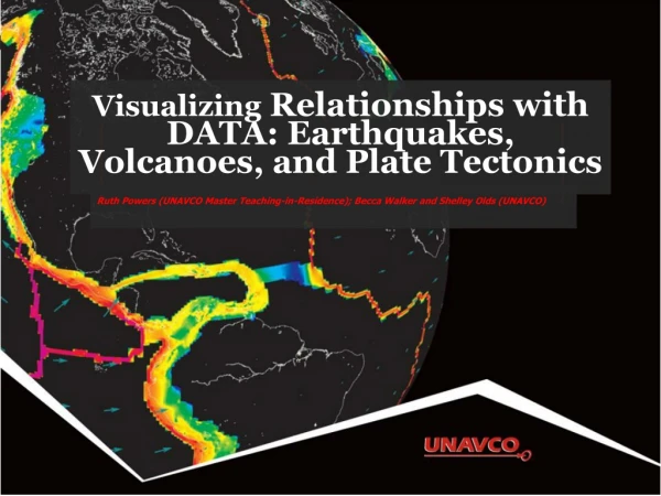
Visualizing Relationships Between Earthquakes, Volcanoes, and Plate Tectonics. Ruth Powers (UNAVCO Master Teaching-in-Residence); Becca Walker and Shelley Olds (UNAVCO). Activity Outcomes. Learners should be able to…

E N D
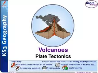
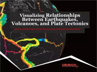
Visualizing Relationships Between Earthquakes, Volcanoes, and Plate Tectonics Ruth Powers (UNAVCO Master Teaching-in-Residence); Becca Walker and Shelley Olds (UNAVCO)
Activity Outcomes Learners should be able to… • Describe how the locations of earthquakes, volcanoes, and velocity vectors from GPS stations in the Western United States inform us about plate boundary zones • Describe and draw a velocity vector • Analyze regional plate motion and crustal deformation based on velocity vector maps • Describe the difference between a plate boundary and plate boundary zone
Part 1: Prepare Your Map for Study Go to: http://www.unavco.org/ Click on Map Tools, then EarthScope Voyager Jr.
Zoom Into the Western U.S. Click on map to zoom in Zoom into the United States Zoom into the Western United States
Add Political Lat/Long under Add Features Add political boundaries and latitude/longitude lines
Part 2: Compare Earthquake and Volcano Locations • Work with a partner • Follow the instructions: • Add your feature(hold ctrl- or command-key to keep the Political, Lat/Long) • Studyyour map • Answerthe questions • Draw the locations of your feature • Share your findingd • Stop at Part 3
Earthquakes and Volcanoes Discussion: • What geographic features (mountains, plains, valleys, etc) are frequently where there are only: • Earthquakes? • Volcanoes? • In which regions do you find earthquakes and volcanoes near each other? What’s there? • Summarize the relationships you discovered. • What explanation can you provide for the observed relationships?
Part 3: Examine GPS Vector Data GPS station positions change as plates move. B A How will GPS Station B’s position change relative to GPS Station A? GPS stations are not to scale
Part 3: Examine GPS Vector Data GPS station positions change as plates move. B A GPS Station B is moving toward A. GPS stations are not to scale
About Velocity Vectors Length of the vector arrow = how fast the plate is moving (magnitude). Direction of the vector arrow = the direction that the plate is moving at that GPS station Tail of vector = location of GPS station
Part 3 continued: Sketch and Study the Vectors Sketch some of the observed velocity vectors on your map of the Western United States Answerquestions on page 8 Discusswith your teammate
Neighboring Frames of Reference: North America Reference frame North America (SNARF) which means: • The rest of the world’s plates move, while the North America plate stays fixed. • Near Alaska, the vector arrows are pointing to the North West (NW) because the Pacific plate is moving to the NW… and the edge of Alaska is also moving NW
Neighboring Frames of Reference: Pacific Plate Pacific plate as reference frame: • Pacific plate doesn’t move • Near Alaska, the vector arrows point South East • Alaska is moving to the South East…
Part 4: Sketch and Study the Modeled Vectors • Sketch vectors where they are very different from each other • Draw where you believe the plate boundaries are located • Compare with plate boundaries in EarthScope Voyager Jr. • Answerquestions • Discusswith your teammate
Wrap Up What we did: • Explored locations of earthquakes and volcanoes • Compared plate motion between the Pacific Northwest and California • Determined plate boundary zones using multiple lines of evidence: GPS plate velocity vector maps, earthquake and volcano locations
Other Tools to Explore • UNAVCO GPS, Earthquake, Volcano Viewer • http://facility.unavco.org/data/maps/GPSVelocityViewer/GPSVelocityViewer.html • Google Earth: Learn about plate tectonics • Link is available from here: http://www.unavco.org/edu_outreach/data/data.html • IRIS Earthquake Browser • www.iris.edu.ieb
Thank You! Contact: education unavco.org http://www.unavco.org/ Follow UNAVCO on _______ Facebook Twitter