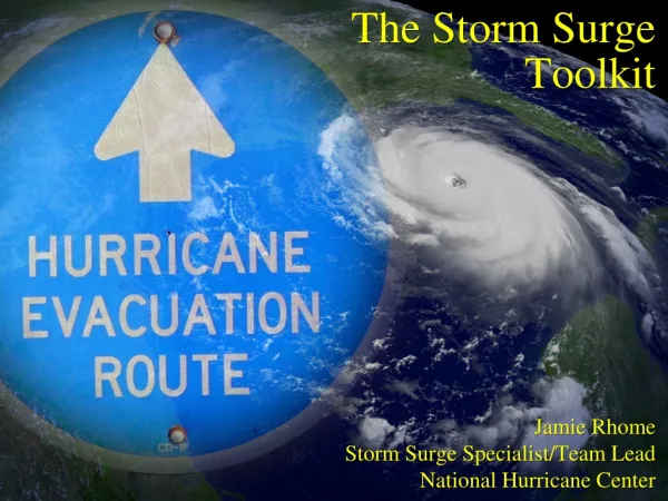
Hurricanes Storm Surge
Hurricanes Storm Surge. GEOL 4093 Risk Assessment. Hurricanes. Tropical cyclones Winds exceed 64 knots (74 mi/hr) Rotate counter-clockwise in the Northern Hemisphere (clockwise in the Southern Hemisphere). . Hurricane Formation. Formed from thunderstorms


Hurricanes Storm Surge
E N D
Presentation Transcript
HurricanesStorm Surge GEOL 4093 Risk Assessment
Hurricanes • Tropical cyclones • Winds exceed 64 knots (74 mi/hr) • Rotate counter-clockwise in the Northern Hemisphere (clockwise in the Southern Hemisphere).
Hurricane Formation • Formed from thunderstorms • Ocean water itself must be warmer than 26.5 degrees Celsius (81°F) • Hurricanes weaken rapidly when they travel over land or colder ocean waters
Hurricanes • Tropical cyclones (rotating air masses) • Tropical depression • Winds less than 38 mph • Tropical storm • Winds 39-73 mph • Hurricane • Winds 74 + mph
Recent North Carolina Hurricane Experience and the Need for a New Hurricane Impact Scale David M. Bush, Chester W. Jackson State University of West Georgia Robert S. Young Western Carolina University
Acknowledgements • Federal Emergency Management Agency • Public Entity Risk Institute • Natural Hazards Center • Orrin Pilkey, Duke University • Wil Shaffer, NOAA • Steve Lyles, NOAA/NOS
Recent NC Hurricanes Source: NOAA Tropical Prediction Center Reports
Storm Surge • Local, temporary rise in sea level caused by storm passage • Difference between measured high water and predicted astronomical tides • Controlled by • Storm strength (wind speed and wave heights) • Storm forward speed • Storm track • Barometric pressure • Conservation of vorticity • Coastal setting
Another way to look at the controls on storm surge: • Storm physical characteristics • Movement of the storm • Shape of the shoreline
Shelf Width • Wide shelf = higher storm surge • Narrow shelf = lower storm surge
Shoreline Shape • 200-km scale • Concave = higher storm surge • Straight, convex = lower storm surge
Combined EffectsShelf Width and Shoreline Shape • Wide + Concave = higher surge • Apalachee Bay, Florida • South Atlantic Bight • Carolina Capes • Narrow + Straight or Convex = lower surge • South Florida • Cape Hatteras, North Carolina
Why Spring High Tide Datum? • Instead of mean sea level • Spring high tide datum is a truer measure of storm surge damage potential • Few buildings below • Site specific
High Water Mark Spring High Tide Predicted Tide
Factors Andrew Hugo Frederic Opal SSS (wind) 4 4 3 3 Surge Height (above SHT/rank) 13.6/4 10.4/3 15.4/4 18.4/5 Surge Spread 1 5 3 4 HIS Rating 9 12 10 12 Normalized HIS 3.0 4.0 3.3 4.0 HIS Applied
Factors Fran Floyd SSS (wind) 3 2 Surge Height (ft above SHT/rank) 6.5/2 5.8/2 Surge Spread 1 1 HIS Rating 6 5 Normalized HIS 2.0 1.7 Fran vs. Floyd
Predictive (pre-storm) Shelf width Shoreline curvature (at several scales) Predicted storm track Predicted storm strength Predicted storm forward speed Historical storms Range of HIS scales Comparative (post-storm) Field measurements Surge height Surge spread Wind speeds NHC/NWS Single HIS rank assigned HIS Modes
In Terms of Earthquakes • Saffir-Simpson Scale = Richter Scale • Measure of energy released • Absolute scale • Hurricane Impact Scale = Mercalli Scale • Measure of impacts • How the storm was actually felt • Both EQ scales are post-event measurements • SSS and HIS both predictive and comparative • HIS attempting to refine predictive capability
Another Way to Look at it: • Every hurricane is different, has its own personality • SSS doesn’t take that into account, too rigid • SLOSH maps good for their application (evacuation and sheltering) but too inclusive • HIS will consider and predict “hurricanes as individuals” impacts
Conclusions I • SSS good for indicating hurricane strength • Storm surge height and extent is a good indicator of energy flux • Many controls on storm surge not handled by SSS • New scale needed to work in conjunction with SSS
Conclusions II • Same storm in different setting means different impacts • Hurricane Impact Scale will allow better communication of potential storm impacts as storm approaches • Pre-storm, a range of HIS values given • Post-storm, one final HIS rank determined
The Georgia Coast • Almost 100 miles of shoreline • 13 state/privately owned barrier islands • 4 developed barrier islands (Tybee, Sea, St. Simons, Jekyll) • 9 with little or no development • Recently (1998) adopted its Coastal Management Plan • Does not have good information on average erosion rates