PACIFIC RING OF FIRE
10 likes | 328 Vues
PACIFIC RING OF FIRE. Sam Franklin, Emily Snow, Scott Zeman. ABSTRACT:

PACIFIC RING OF FIRE
E N D
Presentation Transcript
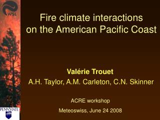
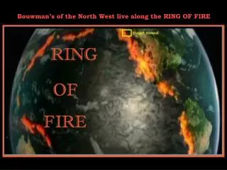
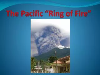
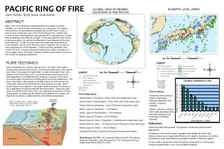
PACIFIC RING OF FIRE Sam Franklin, Emily Snow, Scott Zeman ABSTRACT: Many of the most dangerous natural disasters are related to seismic disasters, such as tsunamis, earthquakes, and volcanoes. The highest concentration of these disasters is located around the Pacific Ocean, in what is most commonly known as the Pacific Ring of Fire. Deaths may occur from all of these disasters, and populations in close proximity to these natural disasters may suffer the greatest. It was expected that there would be great population concentrations affected by these disasters all the way around the ring. To test this hypothesis, point data was acquired for all three disasters, and city point data was used to represent the proximity of major populations to these disasters. It was found that Japanese cities contain the most numerous populations affected by seismic disasters in a concentrated region. However, in general, areas of great seismic activity do not contain the greatest populations. PLATE TECTONICS: Seismic disasters are rooted in plate tectonics, the study of the earth’s crustal plates and how they interact. Since these plates move, they may hit each other, move away from each other, or slide across each other. As it relates to the Pacific Ring of Fire, convergent plate movements are the most applicable to understanding the disasters in this part of the world. Convergent plate movements are distinguished by density differences. The crust of the earth in the oceans is normally thinner but more dense than continental crusts, which are thicker but less dense due to age. When crustal plates move together in convergent plate movement, the denser of the crustal plate will slide beneath the less dense plate. Plates are most active around the Pacific Ring of Fire, so studying the movement of these crustal plates, by measuring the effects of the disasters they create, one may study the effects of plate tectonics of the affected populations. Map Created By: Scott Zeman, Emily Snow, Sam Franklin, GEOG 370 006, April 2008 • Discoveries: • Generally there exists an inverse relationship between population and number of seismic disasters. • Japan, however, contains both highly populated cities and high numbers of all three types of seismic disasters. • How It Was Done: • Select Data for Tsunamis – Since 1900 and Create New Layer • Select Data for Earthquakes – Since 1900 and Create New Layer • Select Data for Volcanoes – Since 1900 and Create New Layer • Buffer Layer for Tsunamis – 1 km Radius • Buffer Layer for Earthquakes – 16 km Radius • Buffer Layer for Volcano – 40 km Radius • Select Data for Cities – Population > 1000000 and Create New Layer • Select Data for Cities – 10 Cities in Pacific Ring and Create New Layer • Buffer Layer for Cities – 100 km Radius • Change City Buffer to Hollow to Reveal Disasters within Buffer Source: Furhman, Chris. “Earth’s Interior Plate Tectonics Part 1.” Lecture. GEOG 110 001. Spring 2008. April 15. • Reflections: • Since the study was general, the general conclusions reached were appropriate. • Problems in this study include: average buffer distances rather than distance based upon magnitude difference for seismic disasters, city buffers generalized rather than based on population density in different regions • Future study may best be done through the manipulation of raster data through reclassification, joins, and suitability analysis. Data Source: HAZPAC, An Interactive Map of Pacific Rim Natural Hazards, Population, and Infrastructure, U.S. Geological Survey, Digital Data Series DDS-76, 2002