Indian meteorological satellite activities
770 likes | 1.39k Vues
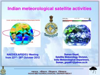
Indian meteorological satellite activities. NAEDEX/APSDEU Meeting from 22 nd - 26 th October 2012. Suman Goyal, Satellite Meteorology Division, India Meteorological Department, Suman_goyal61@yahoo.co.in. Introduction.

Indian meteorological satellite activities
E N D
Presentation Transcript
Indian meteorological satellite activities NAEDEX/APSDEU Meeting from 22nd - 26th October 2012 Suman Goyal, Satellite Meteorology Division, India Meteorological Department, Suman_goyal61@yahoo.co.in
Introduction • The meteorological data on a global scale are so important for initialization purposes in Numerical Weather Prediction. Particularly over data-sparse areas like Indian Ocean, can be met only through derivation of products indirectly from satellite data. • Since 1984, India Meteorological Department (IMD) routinely provides the processed imagery and derived quantitative products from various INSAT satellites to the user community
INSAT Series INSAT-1A – 10 April 1982 Two Channel VHRRINSAT-1B – 30 August,1983INSAT-1C – 21 July 1988INSAT-1D – 12 June,1990INSAT-2A – 10 July, 1992INSAT-2B – 23 July,1993INSAT-2E – 03 April 1999 Three Channel VHRRKALPANA-1 – 12 Sept.2002INSAT-3A – 10 April 2003
Meteorological Payloads on present Indian satellites At present the following two Geostationary satellites are in operation Kalpana –1launched in Sept. 2002 is located at 74.0°E INSAT-3A launched in April, 2003 is located at 93.5°E
KALPANA-1 VHRR
INSAT-3A (i) VHRR (ii) CCD At present volume of data : per day : appx. 2GB from Kalpana-1 & INSAT-3A
SPATIAL COVERAGE OF KALPANA-1 AND INSAT-3A
INSAT products availability • OLR,QPE, CMV,SST are available from 1990 onwards. • Water vapour imageries and related products were introduced from 1999 onwards. • UTH & NDVI are available from 2010 onwards.
INSAT Satellite Products OLR QPE CTT UTH AMV WVW NDVI SST
National Satellite Data Centre (NSDC) • NSDC has been commissioned in the SatMet Division w.e.f. 26.10.2005. The Center provides the following key capabilities: • Archival of processed imagery data (HDF-5 format ) of all available channels and all data of derived quantitative products from a number of operational satellites (INSAT-1D,2E,3A and KALPANA-1) is available online. • Data can also be transferred to the user in JPEG and ASCII format as well. • The system is also maintaining on-line storage of current data and products for last 2-3 months. • NSDC has its own weblink on IMD website to facilitate data availability and request for retrieval. Data can be disseminated to the user via: • ftp link; • CD or DVD; • Portable media
Digital Meteorological Data Dissemination System (DMDD) • The S - band broadcast capabilities of INSAT – 3C is being used for Digital Meteorological Data Dissemination (DMDD) and Cyclone Warning Dissemination System (CWDS). • A network of 37 nos. DMDD stations is operational at RMCs/MCs for receiving satellite imageries , synoptic data, analyzed weather charts and NWP outputs. Processed satellite data in digital form is also uplinked . • DMDD stations are also installed at Nepal, Sri Lanka and Male. Half Hourly Processed imageries are transmitted to forecasting centers in near real time in LRIT/HRIT format
Satellite Division Satellite images/data GTS and NWP outputs Digital Meteorological Data Dissemination System Insat-3C C - band uplink S- band Downlink DMDD Receiving Stations in India and neighbouring countries. 19
Cyclone Warning Dissemination System A network of 353 CWDS (252 analog and 101 Digital) stations is operational along the east and west coast of India for warning the coastal regions in their local language in case of a cyclone approaching those areas. This network is also going to be replaced by 500 nos. DTH modified type CWDS stations within a years time.
Calcutta Chennai Bombay Cyclone Warning Dissemination System (CWDS) INSAT-3C C band uplink S- band Downlink Earth Station ACWCs Coastal Stations of India
Automatic weather stations (AWS) Network At present data from 615 numbers of AWS stations are being received at PUNE and New Delhi through INSAT-3A.
Polar satellite Receiving systems Installation of data reception / processing systems from NOAA/Metop/MODIS polar orbiting satellites at New Delhi, Chennai and Guawahati is completed. The images and products from these systems are also displayed on IMD website for use in weather forecasting.
L-band level-2 products (NOAA/METOP) 3.1. Cloud detection 3.2. Cloud-top pressure (AVHRR) 3.3. Cloud-top height (AVHRR) 3.4. Cloud-top temperature (AVHRR) 3.5. Cloud type (AVHRR) 3.6. Cloud amount (AVHRR) 3.7. Sea-surface temperature (AVHRR) 3.8. Land-surface temperature (AVHRR) 3.9. Fog 3.10. Normalised Difference Vegetation Index 3.11. Temperature profile (ATOVS) 3.12. Moisture profile (ATOVS) 3.13. Total ozone (ATOVS) 3.14. Surface emissivity (ATOVS) 3.15. Total column precipitable water (ATOVS) 3.16. Precipitation index (ATOVS) 3.17. Surface pressure (ATOVS) 3.18. Cloud fraction (ATOVS) 3.19. Surface temperature (ATOVS)
X-band level-2 products (MODIS) 4.1. MODIS true colour 4.2. Aerosol optical depth 4.3. Total totals index 4.4. Lifted index 4.5. K index 4.6. Surface temperature 4.7. Surface pressure 4.8. Water vapour /Precipitable water amount 4.9. Temperature profile /Moisture Profile 4.10. Cloud top pressure 4.11. Cloud top height 4.12. Cloud top temperature 4.13. Cloud fraction 4.14. Cloud effective particle radius 4.15. Cloud optical thickness 4.16. Cloud effective emissivity 4.17. Cloud mask 4.18. Cloud phase 4.19 Cirrus reflectance 4.20. Tropopause height 4.21. Brightness temperature 4.22. Sea-surface temperature 4.23. Vegetation index 4.24. Thermal anomalies 4.25. Fog
Satellite Bulletins • Synoptic bulletins providing descriptions of the cloud organisation and coverage are also sent as advisory to forecasting offices every synoptic hour. • Whenever cyclones are detected in satellite imagery, these bulletins are sent every hour. Such advisories are also transmitted to the neighbouring countries.
SATELLITE BULLETIN DATED: 22/10/2010 TIME: 0300UTC TCIN50 DEMS 220300 SATELLITE BLLETIN BASED ON INSAT PIC OF 220300 UTC (.) AREA OF RESPONSIBILITY: EQ TO 40.0N LONG 60.0E TO 100.0E (.) SALIENT FEATURE: - VORTEX OVER EC ADJ NE BAY FURTHER INTENSIFIED AND NOW CENTRED AT 18.9N/92.9E (.) INTENSITY T5.0 REPEAT INTENSITY T5.0 (.) EYE VISIBLE (.) METEOSAT WINDS SHOWS WIND SHEAR IS BET 5 TO 10 KTS AND WIND SHEAR TENDENCY IS BET -10 TO –20 KTS SHOWS FURTHER CHANCES OF INTENCIFICATION (.) ASSTD BKN TO SOLID INT TO V INT CONVTN (CTT MINUS 81 DEG C) OVER BAY BET LAT 16.0N TO 21.0N EAST OF LONG 90.0E ARAKAN COT ADJ MYANMAR (.) BKN M/LAYERED CLOUDS OVER J&K ADJ PAK N HP EXT N PJB AND OVER AREA BET LAT 36.0N TO 47.0N LONG 74.0E TO 87.0E IN ASSW WD OVER THE AREA (.) NORTH: - SCT LOW/MED CLOUDS OVER REST PJB REST HP N UTRKND E UP ADJ W UP AND ISOL OVER W HARY (.) EAST: - BKN LOW/MED CLOUDS WITH EMBDD MOD TO INT CONVTN OVER S ASSAM AND E BD (.) BKN LOW/MED CLOUDS WITH EMBDD ISOL WK TO MOD CONVTN OVER REST PARTS OF THE REGIONAND BHUTAN EXCEPT SCT LOW/MED CLOUDS OVER BHR (.) WEST: - BKN LOW/MED CLOUDS WITH EMBDD ISOL WK TO MOD CONVTN OVER SE MP S M MAHA S KKN & GOA (.) SCT LOW/MED CLOUDS OVER REST MP REST MAHA N RAJ AND S GUJ (.) SOUTH: - BKN LOW/MED CLOUDS WITH EMBDD MOD TO INT CONVTN OVER E TLNGN RYLSM ADJ NIK COTL KRNTK ANDAMAN IDS AND LKSWDP (.) BKN LOW/MED CLOUDS WITH EMBDD ISOL WK TO MOD CONVTN OVER REST PARTS OF THE REGION EXCEPT SCT LOW/MED CLOUDS OVER S TN (.) Continue….
BAY OF BENGAL & ANDAMAN SEA: - SCT LOW/MED CLOUDS WITH EMBDD MOD TO INT CONVTN OVER REST EC BAY SW BAY AND WK TO MOD CONVTN OVER REST BAY ANDAMAN SEA GULF OF MARTABAN (.) ARABIAN SEA: - BKN LOW/MED CLOUDS WITH EMBDD MOD TO INT CONVTN OVER ARSEA BET LAT 9.5N TO 18.0N EAST OF LONG 67.0E (.) SCT LOW/MED CLOUDS WITH EMBDD ISOL WK CONVTN OVER REST S ARSEA (.) OUTSIDE INDIA: - BKN LOW/MED CLOUDS WITH EMBDD MOD TO INT CONVTN OVER N SUMATRA STR OF MALACCA AND OVER INDIAN OCEAN BET EQ TO 5.0N EAST OF LONG 90.0E (.) BKN LOW/MED CLOUDS WITH EMBDD ISOL WK TO MOD CONVTN OVER E TIBET ADJ CHINA REST MYANMAR ADJ THAILAND (.) TOO: 22/0940EF= TCIN51 DEMS 220300 INTENSE PRECIPITATION ADVISORY BASED ON INSAT PIC OF 220300 UTC (.) SCT INT PPTN LIKELY OVER J&K HP N PJB LKSWDP AP AND ISOL OVER KRNTK DURING NEXT SIX HOURS (.) TOO: 22/0942EF=
Severe weather Forecast Demonstration Project (FDP) • At present four sub-projects are there under this programme: • FDP on landfalling tropical cyclones over the Bay of Bengal • Severe Thunderstorm Observations and Regional Modeling (STORM ). • FOG
FDP on landfalling tropical cyclones over the Bay of Bengal • In addition to present services provided to all countries in our RSMC region some special products will be added like • Special satellite bulletins • Special satellite images for all vortices in the region • These products will also be sent to the other neighboring countries : Thailand, Vietnam, Laos and Cambodia.
SPECIAL SATELLITE BULLETIN DATE: 22-10-2010 TIME: 0400 UTC TCIN50 DEMS 220400 SPL SAT BLTN BASED ON INSAT PIC OF 220400 UTC (.) VORTEX OVER EC ADJ NE BAY CENTRED AT 18.8N/92.8E (.) INTENSITY T4.5 (.) EYE VISIBLE (.) METEOSAT WINDS SHOWS WIND SHEAR IS BET 5 TO 10 KTS AND WIND SHEAR TENDENCY IS BET -10 TO –20 KTS SHOWS FURTHER CHANCES OF INTENSIFICATION (.) ASSTD BKN TO SOLID INT TO V INT CONVTN (CTT MINUS 81 DEG C) OVER BAY BET LAT 16.0N TO 21.0N EAST OF LONG 90.0E ARAKAN COT ADJ MYANMAR (.) TOO: 22/1015EF=
FDP on Severe Thunderstorm Observations and Regional Modeling (STORM ) • This project taken up during pre-monsoon season from 2006 onwards. • Neighboring countries; Nepal, Bhutan and Bangladesh are also participating in this project. • Hourly satellite based bulletins are issued and concerned region is also informed by phone.
NWP Activities Data Assimilation NWP Model run Generate customize products To support various FDPs Model Validation R & D Capacity Building in NWP Coordination & Collaboration
Operational NWP System Medium Range Forecast > GFS T-574/L64 with GDAS ( 00 & 12 UTC) > MME based District Level Forecasts Short Range Forecast > WRF (ARW) VAR at 27 km and 9 km > WRF (NMM) at 9 km for TC 4 times a day > HWRF > MME based cyclone track prediction > Polar WRF for Antarctica Nowcast and Very Short Range Forecast > Hourly venue specific forecast- WRF (3 km) > ARPS with assimilation of DWR > Nowcast System with assimilation of DWR
GLOBAL DATA ASSIMILATION • Global Forecast System • Global Data Assimilation > NCEP Decoder PREPBUFR > NESDIS Sat Inputs> Other surface analysis: CEP> Grid Statistical Interpolation • Global Forecast Model GFS T574/L64
