Understanding the Hydrosphere: Groundwater and Surface Water Dynamics
This educational resource explores the critical aspects of hydrology, focusing on groundwater and surface water. It highlights the significance of freshwater as a limited resource, with only 2.5% of the world's water being freshwater and less than 0.5% being usable. The document discusses the hydrologic cycle, the importance of groundwater for domestic use, agriculture, and its vulnerability to depletion. With growing global demands projected to increase by 40% by 2025, understanding these water systems is essential for sustainable management of our natural resources.

Understanding the Hydrosphere: Groundwater and Surface Water Dynamics
E N D
Presentation Transcript
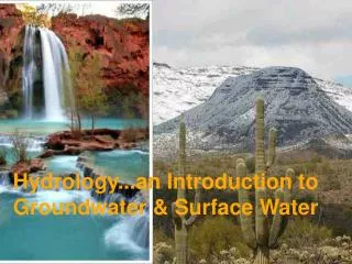
Hydrology...an Introduction toGroundwater & Surface Water subtitle
1st – General Perspective on the Hydrosphere 2nd – Groundwater 3rd – Surface water
Classroom Resources Cryosphere – 2nd largest reservoir of water on Earth Animation “draining the oceans” giving a feel for water in the oceans – largest water reservoir
Although groundwater is not very globally significant in volume, it is a critical source of domestic water, because it is part of the limited budget of fresh (non-saline) water. It can be viewed as a partially-renewable resource: It is possible to withdraw it faster than nature recharges it. Groundwater Focus
WHY HYDROLOGY IS IMPORTANT • Of total world water, 97.5% is salty water and only 2.5% is freshwater of which useable freshwater accounts for about 0.5% • Of the 0.5% useable freshwater, irrigation accounts for 70%, industry 20% and household 10% • Demand for and use of freshwater has tripled over the past half century,as world population has grown from 2.5 to 6.45 billion people • By 2025 global water needs will increase with 40% more required for cities and 20% for growing crops • The satellite photos show major freshwater depletion taking place on all continents, notably in the Dead Sea, the Aral Sea, Lake Chad, the Mesopotamian Marshlands, the Everglades and other water sources • According to UNESCO estimates, by 2030 global demands for fresh water will exceed the supply with potentially disastrous consequences Sources: Asian Development Bank; BBC; Earth Observatory; UNEP; UNESCO
WHY HYDROLOGY IS IMPORTANT • Water withdrawals are causing major rivers—such as the Colorado, the Nile, the Yellow Rivers—to run dry in sections, lakes to vanish and groundwater tables and aquifers to drop in many places • Over the next 20 years, average water supply per person is estimated to drop by a third, potentially endangering human health, agriculture and the environment • Water volume in the Aral sea has dropped by about 80% since 1960s, due to extensive irrigation primarily for cotton production • Current water levels in Lake Victoria are below normal and the lowest level since September 1961 • In 2002, around 3.16 billion people (82%) in the Asia Pacific region had access to improved water supplies, up from 74% in 1990 • Water pollution is a serious threat to the world’s water supply Sources: Asian Development Bank; BBC; Earth Observatory; UNEP; UNESCO
Groundwater & surface water are a most precious natural resources. Groundwater • According to U.S. estimates, groundwater provides: • 34% of agricultural use (mostly for irrigation) • 40% of the public water supply withdrawals • 53% of all drinking water for the total population • 97% of drinking water for the rural population
Introduction to Groundwater The zone of saturation occurs where water completely fills the open spaces in the soil and rock. The upper limit of this zone is called the water table. The zone above the water table is called the zone of aeration.
Material saturated with water lies below the water table. Materials that conduct water (are porous and permeable) are aquifers. Materials that do not conduct water (are well-cemented, unfractured, etc.) are aquicludes & aquitards. The Water Table One inch of rain on one acre of ground results in 27,192 gallons of water (~100,000 L).
Clay-rich sediments tend to be impermeable and retard water flow. Perched aquifers are common, since the geology of the near-surface can be fairly complex. Parts of an aquifer can become perched as a result of slight variations in the clay content of sediments.
Groundwater: aquifers must be permeable and porous • Any geologic unit through which water can move easily (i.e. it’s permeable) • Porosity: how much water a geologic material can hold
Porosity and Permeability Porosity: volume proportion made up of voids Permeability: connectedness of voids, dictating capacity to transmit flow
Opposite of an aquifer? • Aquitard / aquiclude Retards or Precludes the flow of groundwater • Shale (compressed mud) is the example
Aquicludes or Aquitard Aquifers Permeability
Groundwater in a Humid Landscape • Water infiltrating the ground is recharge. • Groundwater flowing out from the ground is discharge. • But water moves slowly (typical range 0.1 to 100 m/day)
Great Plains: water derived from the Colorado Front Range Characteristic US Aquifers Atlantic Coast: water moves through young, poorly hardened sediment Basin and Range: waters concentrate in gravels & sands of alluvial fans
Great Plains: Ogallala Aquifer being depleted in most places as water table declined 10 to > 100 ft.
Water Use in the USA The blue areas had relatively little water withdrawals in 1990.
Animated map (gif) Will play inside a powerpoint presentation, showing increasing reliance on groundwater withdrawal
Drawdown through Wells Whenever water is withdrawn from a well, the water table around the well is lowered. This is called drawdown. The conical shape of the drawdown region near well has led to it being called the cone of depression.
Groundwater Contamination A. The groundwater moves too rapidly through the cavernous limestone to be naturally purified. B. Groundwater movement in the permeable sandstone aquifer is slow enough to allow natural purification.
Leaky underground storage tanks Poorly constructed landfills and septic systems Improperly abandoned mines and wells The overuse of fertilizers, pesticides, and road salts Runoff from livestock confinement areas Careless industrial and manufacturing organizations From groundwater.org What causes groundwater contamination?
Subsidence Land subsidence due to groundwater withdrawal in the San Joaquin Valley of California began in the mid 1920’s and locally exceeded 8 meters (28 feet) by 1970.
Classroom Resource • Animation illustrating that groundwater removal allows grains to compact, and that compaction causes subsidence • Like squishing a moist sponge – once the water is gone, you can compact the sponge
Groundwater returns to surfaceas baseflow to streams (in humid areas)
Perennial is possible, because Groundwater returns to surfaceas baseflow to streams (in humid areas)
Intermittent Streams:Wet season raises water table so base flow feeds stream
Can return as Artesian Wells • Water flows freely out of an artesian well. • Two requirements must be met: • The aquifer must be inclined so that it is exposed to recharge. • The aquifer must be confined by aquitards above and below so the water does not escape.