Download
1 / 8
80 likes | 200 Vues
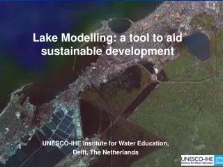
Lake Modelling: a tool to aid sustainable development. UNESCO-IHE Institute for Water Education, Delft, The Netherlands. Proposed Modelling Strategy. Strategic approach using a combination of models to maximise benefit in time available

E N D
Lake Modelling: a tool to aid sustainable development UNESCO-IHE Institute for Water Education, Delft, The Netherlands
Proposed Modelling Strategy Strategic approach using a combination of models to maximise benefit in time available Complementary methods with aim of maximising input to ALAMIM Project • 2D Hydrodynamic modelling of Lake • Gives spatial velocities, flow, water levels • Integrated point model for simulating Lake Ecosystems • Gives longterm predictions of nutrients, ecosystem etc RAW DATA 2D HYDRODYNAMIC LAKE ECOSYSTEM
FEASIBILITY/INITIAL DATA COLLECTION & ANALYSIS Lake Bathymetry & topography Lake inflows, outflows, water levels Nutrient loads, water quality concentrations NUMERICAL MODELING OF THE LAKE Model set up Model calibration Model validation Sensitivity analysis Model predictions MIKE 21 (2D Hydrodynamic) PCLAKE Water Quality/ecosystem RESULTS AND DISCUSSION Methodology • Feasibility assessment • Data collection • Model construction • 2D Hydrodynamic • Ecosystem • Model calibration/validation • MODEL BASELINE • SIMULATIONS DECIDED • Simulation runs • Benefit/risk assessed for differing development options (against BASELINE using indicators) • Feedback links to Monitoring, Management, Action Plan and Participation Working Groups plus information to DECISION MAKERS
2D Hydrodynamic model mesh generation Captures canals/preferential flow paths MODEL CONSTRUCTION: 2D Hydrodynamic
QALA DRAIN Flow (cms) EL MEX PUMPING Flow (cms) Time (days) Time (days) UMUM DRAIN NOBARIA DRAIN Flow (cms) Flow (cms) Time (days) Time (days) MODEL CONSTRUCTION:2D Hydrodynamic
FEASIBILITY/INITIAL DATA COLLECTION & ANALYSIS Lake Bathymetry & topography Lake inflows, outflows, water levels Nutrient loads, water quality concentrations NUMERICAL MODELING OF THE LAKE Model set up Model calibration Model validation Sensitivity analysis Model predictions MIKE 21 (2D Hydrodynamic) PCLAKE Water Quality/ecosystem RESULTS AND DISCUSSION Methodology: The Next Steps • Feasibility assessment • Data collection • Model construction • 2D Hydrodynamic • Ecosystem • Model calibration/validation • MODEL BASELINE • SIMULATIONS DECIDED • Simulation runs • Benefit/risk assessed for differing development options (against BASELINE using indicators) • Feedback links to Monitoring, Management, Action Plan and Participation Working Groups plus information to DECISION MAKERS
Thank-you for listening! UNESCO-IHE Institute for Water Education, Delft, The Netherlands