Download
1 / 16
160 likes | 258 Vues
Learn about AERLINE, EPA's dispersion modeling tool for near-roadway assessments, its development focus, algorithm, meteorological inputs, databases, and ongoing projects. Explore how AERLINE supports health studies and community-based tools.

E N D
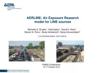
AERLINE: Air Exposure Research model for LINE sources Michelle G. Snyder1, Vlad Isakov1, David K. Heist1, Steven G. Perry1, Akula Venkatram2, Sarav Arunachalam3 1U.S.EPA/NERL/AMAD, 2UCR,3UNC/IE CMAS Conference 15-17 October 2012
Why was AERLINE Developed? • Based on Science Advisory Board and the National Research Council recommendations, EPA-ORD initiated research on near-road air quality and health effects. • Field measurements indicated that exposures to traffic-emitted air pollutants near roads can be influenced by complexities of roadway configurations (noise walls, depressed sections, etc.). • To improve exposure metrics for future health studies, ORD initiated model development project to account for these important parameters
What is AERLINE? • AERLINE is EPA -ORD's research dispersion modeling tool for near roadway assessments • based on a steady-state Gaussian formulation • currently formulated for near-surface releases • contains new formulations for the vertical and lateral • dispersion rates • accounts for low wind meander • includes M-O similarity profiling of winds near the surface • uses the surface meteorology provided by AERMET • includes user-friendly input requirements for road network
EPA-ORD: Model Development Focus • Account for near-road complexities and very near road concentrations (i.e. within a few meters of the road). • Design and conduct wind tunnel and field studies for development and evaluation of improved line source algorithms. • AERLINE is the initial modeling product of this development program. • It is a research tool that is designed primarily to support risk assessments and health studies related to near-road pollutants.
What AERLINE is NOT? • AERLINE is not designed for regulatory applications (e.g. NAAQS enforcement, New Source Review, PM Hot Spot Conformity, SIP analyses, etc). • It is contained in a research platform and has not gone through the rigorous review and public comment required for inclusion in the list of recommended regulatory models
Model Algorithm Steady-state, Gaussian based plume model and where Concentration at a receptor is the integrated contributions from points along the line using a Romberg Iteration Scheme. Plume For each point source within the integration, a wind-direction following plume is simulated. Meander • For each point source within the integration, meander is handled in the same way as • AERMOD point source meander.
Model Algorithm Mean Plume Height Concentration is a function of mean plume height (similar in nature to the effective parameter concept used in AERMOD). Meteorological Inputs AERLINE uses the meteorological inputs from the AERMOD met. preprocessor (u*, w*, mixing height, Lmo, z0, Wspd, Wdir, heat flux, T) then corrects u* for light wind conditions. Other surface parameters are then recalculated to be internally consistent with M-O theory. This method was developed and evaluated by Qian and Venkatram (BLM 2011).
Model Development Databases • Tracer Studies • Idaho Falls 2008 • Prairie Grass • Wind tunnel studies • Field studies
Model Algorithm New Dispersion Formulations Vertical Dispersion Convective Stable
Model Algorithm New Dispersion Formulations Lateral Dispersion Stable Convective Prairie Grass Prairie Grass
How is AERLINE being used? • The model can support health and risk assessments, epidemiology studies, and community based tools. • AERLINE is designed to handle urban situations with thousands of line sources and receptors. • AERLINE is used in “Near-Road Exposures to Urban air pollutants Study” (NEXUS) in Detroit examining the role of near-road exposures on asthmatic children who live near major roadways. • AERLINE can be used to estimate spatial variability in urban areas with many roadways.
How does AERLINE support community tools? AERLINE algorithm is used in STREET, a decision support tool for evaluating effects of alternate transportation options on community health
Ongoing Development Work • The model framework is designed to accommodate future algorithms for simulating the near-source effects of complex roadway configurations (noise barriers, depressed roadways, etc). • These configurations could be used in mitigation, to reduce exposure near high emission roadways. Idaho Falls 2008 tracer study _____ no barrier ------ barrier Finn et al., (2010)
Ongoing Development Work H = 6 m Wind tunnel studies Baldauf et al, (2009) Heist et al, (2009) Flat terrain Downwind barrier Depressed Roadway
Ongoing Development Work Field studies Field and wind tunnel studies show noise barriers and depressions reduce downwind concentrations under multiple stability conditions. These features will be added to the flat terrain AERLINE model.
How will AERLINE be available? • We plan to release the model through Community Modeling & Analysis System (CMAS) website with: • Explanation of model code, use, and inputs required • Documented evaluation and evaluation data • Qualifications on appropriate use Disclaimer: Although this work was reviewed by EPA and approved for publication, it may not necessarily reflect official Agency policy.