Download
1 / 14
140 likes | 268 Vues
Gilpin County Ground Water Level Review. Nov. 16, 2006. Background Information. 2 wells supply Justice Center and County facilities County became aware of concerns about dropping water levels in nearby wells County asked BBA to study water levels in nearby wells to determine if:

E N D
Gilpin CountyGround Water Level Review Nov. 16, 2006
Background Information • 2 wells supply Justice Center and County facilities • County became aware of concerns about dropping water levels in nearby wells • County asked BBA to study water levels in nearby wells to determine if: • The County’s wells are causing the water level decline in neighboring wells • If data indicate any potential long-term problems with wells
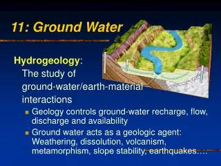
Summary of Local Geology and Hydrology • Bedrock in Gilpin County is igneous and metamorphic rocks of Precambrian age (hard rock), which contains numerous fractures near the surface • Ground water flows through fractures in rock • Geologic faulting locally controls ground water flow • Aquifer is recharged by snowmelt and precipitation • Aquifer is renewable and sustainable but can be stressed from pumping
Summary of Water Level Data and North Clear Creek Streamflow
Drought Conditions • Statewide drought since roughly 2002 • North Clear Creek Streamflow: • Average Discharge 1995 to 2005: 12,920 af/yr • Average Discharge 2000 to 2005: 8,387 af/yr • Less precipitation and runoff is recharging the aquifer • Conditions have improved since 2002 / 2003
Geology / Hydrology – cont. • Water level drawdown always greatest at pumping well • Pumping well can not cause more drawdown in other wells than in pumping well itself Static Water Level Pumping Water Level
Water Level Data • Shows seasonal fluctuations in County wells • Shows declines in the County wells and neighboring wells • Declines are greater in Adsel, Brown and Peters wells than in County wells • Data from neighboring wells is very limited, which is not adequate to determine conclusive results • Decline rates: • Justice Center Wells: 1.7 ft/yr (1996 – 2006), 2.6 (2002 – 2006) • Peters, Adsel and Brown: 5.2 ft/yr (2002 – 2006)
Findings • Water levels have fluctuated in County’s wells, which is expected and natural – seasonal fluctuations greater than 40 feet • Water levels are declining • Declines are less in County wells than in the Brown, Adsel and Peters wells • Indicates that other factors contribute to declines • Drought conditions contribute to declines • Declines in wells south of Justice Center probably result from factors other than County pumping
Factors Contributing to Water Level Changes • Well pumping by entities including: • Numerous Homeowners • The County • Black Hawk • Others • Drought Conditions • Land use and hydrologic changes
What do Water Level Changes Mean? • Most wells can continue to operate without any problem (wells can tolerate water level changes) • Some wells may require lowering of well pumps. In rare cases, wells may need to be drilled deeper • Future conditions will depend on whether or not water levels continue to decline • The aquifer, or zones within the aquifer, are limited in the amounts of ground water that can be produced. These limits are difficult to quantify
Recommendations • Continue to monitor and periodically review groundwater levels • Encourage neighboring well owners to maintain regular water level measurements to develop additional data points • Compare water levels to local hydrologic conditions as drought eases
- Questions - Chris Sanchez csanchez@bbawater.com Jeff Clark jclark@bbawater.com 303 806-8952