Download
1 / 1
10 likes | 156 Vues
A new global MODIS reflectance product. GLCF Earth Science Data Interface.

E N D
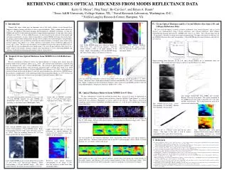
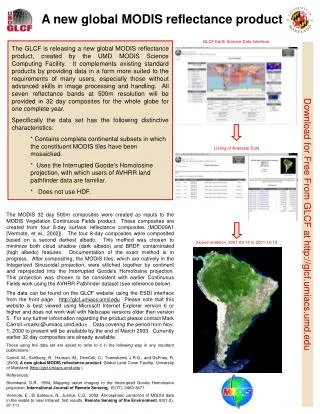
A new global MODIS reflectance product GLCF Earth Science Data Interface • The GLCF is releasing a new global MODIS reflectance product, created by the UMD MODIS Science Computing Facility. It complements existing standard products by providing data in a form more suited to the requirements of many users, especially those without advanced skills in image processing and handling. All seven reflectance bands at 500m resolution will be provided in 32 day composites for the whole globe for one complete year. • Specifically the data set has the following distinctive characteristics: • * Contains complete continental subsets in which the constituent MODIS tiles have been mosaicked. • * Uses the Interrupted Goode's Homolosine projection, with which users of AVHRR land pathfinder data are familiar. • * Does not use HDF. Listing of Available Data The MODIS 32 day 500m composites were created as inputs to the MODIS Vegetation Continuous Fields product. These composites are created from four 8-day surface reflectance composites (MOD09A1 [Vermote, et al., 2002]). The four 8-day composites were composited based on a second darkest albedo. This method was chosen to minimize both cloud shadow (dark albedo) and BRDF contaminated (high albedo) features. Documentation of the exact method is in progress. After compositing, the MODIS tiles, which are natively in the Integerized Sinusoidal projection, were stitched together by continent and reprojected into the Interrupted Goode's Homolosine projection. This projection was chosen to be consistent with earlier Continuous Fields work using the AVHRR Pathfinder dataset (see reference below). The data can be found on the GLCF website using the ESDI interface from the front page. http://glcf.umiacs.umd.edu Please note that this website is best viewed using Microsoft Internet Explorer version 6 or higher and does not work well with Netscape versions older than version 5. For any further information regarding the product please contact Mark Carroll <markc@umiacs.umd.edu> . Data covering the period from Nov. 1, 2000 to present will be available by the end of March 2003. Currently earlier 32 day composites are already available. Those using the data set are asked to refer to it in the following way in any resultant publications: Carroll, M., Sohlberg, R., Hansen, M., DimiCeli, C., Townshend, J.R.G., and DeFries, R. (2003) A new global MODIS reflectance product. Global Land Cover Facility, University of Maryland (http://glcf.umiacs.umd.edu ). References: Steinwand, D.R., 1994, Mapping raster imagery to the Interrupted Goode Homolosine projection, International Journal of Remote Sensing, 15(17), 3463-3471. Vermote, E., El Salleous, N., Justice, C.O., 2002, Atmospheric correction of MODIS data in the visible to near infrared: first results, Remote Sensing of the Environment, 83(1-2), 97-111. Download for Free From GLCF at http://glcf.umiacs.umd.edu 3-band rendition, 2001-09-14 to 2001-10-15