Coasts
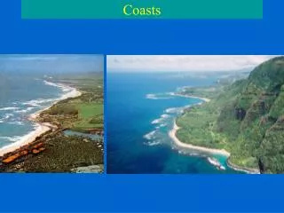
Coasts. Coasts. Coastal areas join land and sea Coasts are temporary junctions (of land and sea) that are subject to rearrangement by waves, tides, sea level, biological processes and tectonic activity 50% of the world’s population lives on the coast

Coasts
E N D
Presentation Transcript
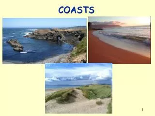
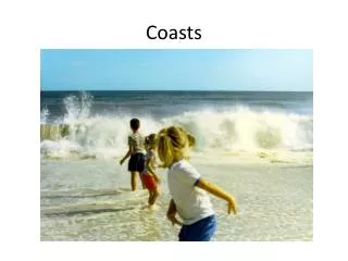
Coasts • Coastal areas join land and sea • Coasts are temporary junctions (of land and sea) that are subject to rearrangement by waves, tides, sea level, biological processes and tectonic activity • 50% of the world’s population lives on the coast • The term ‘coast’ includes the shore (where ocean and water meet) as well as marshes, dunes, and cliffs inland of the beach
You are going to coast through this chapter • Remember coastal margins? • These were the submerged portions of continental crust • Coastal regions are constantly subject to change, most dramatically by tides and erosion (short-term effects) and rising or lowering sea level (long-term effect) • The coast is an active and dynamic place
Changes in sea level: eustatic • Several factors can influence global, or eustaticsea level variations • Sea level is lower during periods of glaciation (more water held up in ice) and higher during warm periods (when glaciers are smaller) • High rates of seafloor spreading produce larger rises, decreasing the volume of the ocean basin compared to slower rates of spreading • Thermal expansion: water occupies a greater volume when warmed
Changes in sea level: local • Other factors can influence regional or local sea level changes • Isostasy; continental plates weighed down by ice or sediment sink deeper into the aesthenosphere, raising local sea level! • Wind, currents, storm surges, El Niño/La Niña can force more (or less) water on the shore
Isostasy and Local sea level change Ice Continental crust LITHOSPHERE Oceanic crust AESTHENOSPHERE
Isostasy and Local sea level change Ice Continental crust LITHOSPHERE Oceanic crust AESTHENOSPHERE
Local sea level change • The flooding Mississippi River delta is one example of subsidence or land sinking, caused by an accumulation of several hundred feet of sediments forcing the lithosphere to sink deeper into the asthenosphere • The continent of Antarctica is another example; massive ice sheets weigh down the continent raising local sea levels www.magazine.noaa.gov/storiesmag101.htm
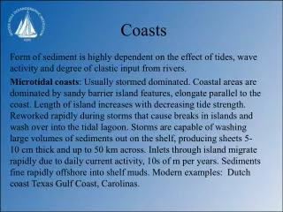
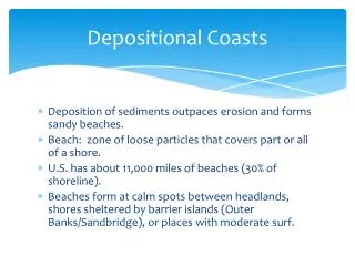
Erosion • The immense power of the waves abrades the coasts and can cause erosion, the removal of coastal material • When erosive forces dominate over depositional forces, erosion occurs • Most rapid on high energy beaches; areas frequently battered by large waves (ex. Maine, southern tip of South America and Africa) • When deposition meets or exceeds erosion, the coast is stable or growing, respectively • Low energy beaches (ex. NJ to Florida)
Erosion • Erosion tends to produce a smooth coastline (imagine what erosion does to sea cliffs over time) • The sediment eroded away from the coast eventually collects as beaches and may actually protect the shore from the incoming energy (and erosive power) of the waves
Let’s go to the beach… • A beach is a zone of loose particles that covers part of a shore (dunes, vegetation and/or sea cliffs are technically not part of the beach) • Beaches result when waves (or rivers) transport sediment – usually sand – to the shore • Beaches are constantly changing – what you see during our field trip to Smith Point is different from what your children will see (or what your parents have seen)
What Smith Point used to look like Courtesy of Prof. Pamela Lynch
What Smith Point used to look like Courtesy of Prof. Pamela Lynch
It’s a shore thing • The material that makes up a beach can range from boulders, cobbles, pebbles and gravel to very fine silt • The black beaches of Hawai’i are made of lava! • Some beaches consist of shells or coral fragments
Parrotfish Poop = Paradise • Parrotfish feed on coral engulfing the animal and its CaCO3 skeleton; they ingest the polyp and excrete the CaCO3, which ends up on local beaches as soft, fine sand between your toes! www.flickr.com/photos/mikesegal/1571667591/
Beaches have distinct profiles • In general, the flatter the beach, the finer the material from which its made • Water from waves washing onto the beach carries particles onshore (“swash”); water returning to the ocean (“backwash”) carries material back to sea • The amount of particles transported by the swash and backwash are not always equal, resulting in sloped beaches
Beaches have distinct profiles • The berm is an accumulation of sediment that runs parallel to shore, and marks the normal limit of sand deposition by wave action • The peaked top of the highest berm is called the berm crest, and is usually the highest point on the beach; it corresponds to the shoreward limit of wave action during the most recent high tides
Is Oceanography fun? Shore! • The steepness of beaches changes with storms and the seasons • Summer and calm periods build upbeaches • Winter and storms erode and flatten beaches • WHY???
Light versus heavy wave activity • During light wave activity, much of the swash soaks into the beach, and so backwash is reduced • Results in anet movement of sand up the beach • During heavy wave activity, the beach is saturated with water from previous waves, so very little swash soaks into the beach; more particles are moved offshore by backwash • Results in a net movement of sand away from the beach
Summer versus winter beaches • Light and heavy wave activity alternates with the seasons • Light wave activity dominates during summer, and so a wide, sandy berm develops • Heavy wave activity dominates during winter, and transports sediment/particles offshore • A wide berm developed over many months during summer can be destroyed in hours by high-energy winter storm waves
No (or reduced) berm Sand deposited offshore
Longshore currents • Longshore currents transport sand along the coastline • Recall that most wind waves approach the shore at an angle, and then refract to break nearly parallel to the shore • With each breaking wave, swash moves onto the beach at a slight angle, then gravity pulls the backwash straight down (no angle); thiszig-zag movement of water along a shore is called a longshore current
c c
Break the grip of the rip • Rip currents is a dangerously strong current of water flowing offshore with speeds averaging 1-8 feet per second! • Water streams along the shore until it finds an exit back to sea, usually a narrow trench between sandbars
To escape a rip current, it is extremely important to swim parallel to shore as you cannot outswim the rip tide current and you will eventually exhaust yourself (and drown) in the process. The rip current is found only along a narrow portion of shoreline • Topography and surging seas determine whether a rip tide will occur; can be visualized by rough, brown water offshore
Longshore currents • Longshore currents transport sediments away from the beach and towards regions ‘downwind’ • Jetties, groins, and breakwaters serve to intercept, or stop the transport of sediment away from beaches Longshorecurrent
Barrier Islands • Depositional coasts (coasts where depositional forces dominate over erosive) may develop narrow, exposed sand bars that run parallel to, but are separated from, land; known as barrier islands • Fire Island, NY; Atlantic City, NJ; Ocean City, MD; and Miami Beach, FL are barrier islands!
Barrier Islands • Barrier islands protect the coast behind them, but are very unstable themselves
What about Long Island? Net transport of sediment is from east to west
A state park your great-grandparents never had… • Since the Fire Island lighthouse was constructed 100 years ago, nearly 5 miles of barrier island have been added to the west forming what is now Robert Moses State Park! www.pbase.com/image/66549546
The importance of dunes • Dune plants prevent erosion by trapping sediments in their roots • Removal (or destruction) of beach vegetation, and the hardening of shorelines (bulkheads) increases erosion • Plant rhizomes can extend 20 feet from the plant! Courtesy of Prof. Pamela Lynch
And don’t forget about overpopulation! • http://www.snopes.com/politics/quotes/guamtip.asp