Download
1 / 18
180 likes | 286 Vues
Discover the intricacies of Earth's topography, from land altitudes to sea depths, using satellite geophysics. Learn about the instruments and data sources used for measuring changes in altitudes and depths. Explore how satellites like SRTM, ENVISAT, and RADARSAT aid in studying Earth's surfaces.

E N D
Satellite geophysics. Topography, lec_day_10_1.ppt • Altitude of land areas • Depth of lakes • Altitude and depth of ice and sea areas. • Changes of these altitudes/depths. C.C.Tscherning, University of Copenhagen, 2013-12-15 1
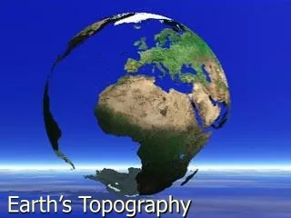
Satellite geophysics. Topography. C.C.Tscherning, University of Copenhagen, 2013-12-15 2
Satellite geophysics. Topografi. • Satellittes: • http://database.eohandbook.com/database/missiontable.aspx • Instruments • http://database.eohandbook.com/database/instrumenttable.aspx • Data sources • http://database.eohandbook.com/measurements/overview.aspx C.C.Tscherning, University of Copenhagen, 2013-12-15 3
Satellite geophysics. Satelitter I, USA. SRTM, - Space Shuttle TPX – Radar altimetry and SAR ICESAT – Laser altimetry ASTER Landsat 5 og 7 NMP EO-1 C.C.Tscherning, University of Copenhagen, 2013-12-15 4
Satellite geophysics. Satelittes II, EU/CDN ENVISAT, (ESA) RADARSAT, (CDN) CryoSat2 (ESA) SPOT-4,5, (CNES) RapidEye (DLR) TanDEM-X (DLR) TerraSAR-X (DLR) C.C.Tscherning, University of Copenhagen, 2013-12-15 5
Satellite geophysics. Satelittes III, Rus mm. Monitor-E Rus) Resurs DK 1 (Rus) THEOS (Tailand) C.C.Tscherning, University of Copenhagen, 2013-12-15 6
Satellite geophysics. Instruments, I. Radar and Laser altimeters Interferometrisk altimetri MSS – Multispectral scanner (80 m res.) TM , ETM+. Thematic mapper (30 m res.) ALI, optical imager (10 m res.) Hyperion, Hyperspectral imager (30 m res.) LEISA AC – correction for atmosphere C.C.Tscherning, University of Copenhagen, 2013-12-15 7
Satellite geophysics. Instruments, II. HRVIR (Visible, infrared), (10 m res., styrbar !) X-band SAR (1.2 – 1.4 m res.) PAN (GISTDA), High Res. Optical (2m res.) PSA (Pancromatic Imag. System), (8 m res.) GEOTON – optical (1 m res.) ARINA – electromagnetic field variations C.C.Tscherning, University of Copenhagen, 2013-12-15 8
Satellite geophysics. Generelt. Some instruments only look ”down” Some instruments may be turned around one axis There is large differences in resolution and coverage. Most are sun-syncroneous Repeat cycle varies a lot: From 1 day (with 5 satellitter) C.C.Tscherning, University of Copenhagen, 2013-12-15 9
Satellite geophysics. Dephts. From sea-surface height minus sea-surface topography (approximately the geoid) gravity may be computed due to the validity of the Laplace equation. Then inverse problem is solved, and dephts are obtained using density of sea-water and a bottom with constant density.. C.C.Tscherning, University of Copenhagen, 2013-12-15 10
Satellite geophysics. Land is-tykkelse. From airplane or truck: http://www.geophysical.com/iceandsnow.htm C.C.Tscherning, University of Copenhagen, 2013-12-15 11
Satellite geophysics. Ice thicknesses. C.C.Tscherning, University of Copenhagen, 2013-12-15 12
Satellite geophysics. SRTM. The Shuttle Radar Topography Mission (SRTM) obtained elevation data on a near-global scale to generate the most complete high-resolution digital topographic database of Earth. SRTM consisted of a specially modified radar system that flew onboard the Space Shuttle Endeavour during an 11-day mission in February of 2000. C.C.Tscherning, University of Copenhagen, 2013-12-15 13
Satellite geophysics. SRTM. C.C.Tscherning, University of Copenhagen, 2013-12-15 14
Satellite geophysics. SRTM. C.C.Tscherning, University of Copenhagen, 2013-12-15 15
Satellite geophysics. .SRTM - UCPH C.C.Tscherning, University of Copenhagen, 2013-12-15 16
Satellite geophysics. ASTER Flying on ”TERRA” Covers up to 81 gr. C.C.Tscherning, University of Copenhagen, 2013-12-15 17
Satellite geophysics. ASTER. Maule Volcanic Field, Chile-Argentina C.C.Tscherning, University of Copenhagen, 2013-12-15 18