Download
1 / 27
270 likes | 551 Vues
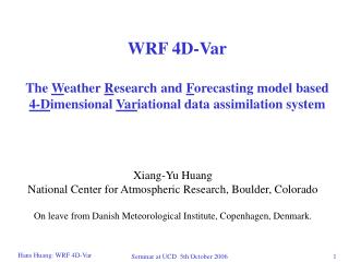
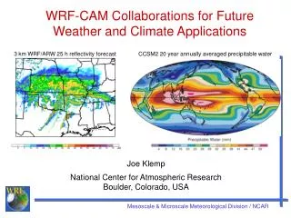
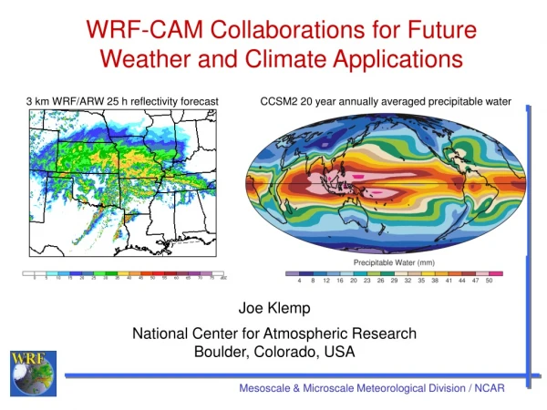
Convection Resolving NWP using WRF. Joe Klemp National Center for Atmospheric Research Boulder, Colorado. 36h WRF Precip Forecast. Analyzed Precip. 27 Sept. 2002. Weather Research and Forecasting Model.

E N D
Convection Resolving NWP using WRF Joe Klemp National Center for Atmospheric Research Boulder, Colorado
36h WRF Precip Forecast Analyzed Precip 27 Sept. 2002 Weather Research and Forecasting Model Goals: Develop an advanced mesoscale forecast and assimilation system, and accelerate research advances into operations • Collaborative partnership, principally amongNCAR, NOAA, • DoD, OU/CAPS, FAA, and university community • Multi-agency WRF governance; development conducted • by 15 WRF Working Groups • Software framework provides portable, scalable code with • plug-compatible modules • Ongoing active testing and rapidly growing community use • Over 1,400 registered community users, annual • workshops and tutorials for research community • Daily experimental real-time forecasting at NCAR , • NCEP, NSSL, FSL, AFWA, U. of Illinois • Operational implementation at NCEP and AFWA in FY04
1 10 100 km Resolved Convection Cumulus Parameterization 3-D Radiation Two Stream Radiation LES PBL Parameterization Model Physics in High Resolution NWP Physics “No Man’s Land”
Convection Resolving NWP using WRF Questions to address: • Is there any increased skill in convection-resolving forecasts, measured objectively or subjectively? • Is there increased value in these forecasts? • What can we expect given that the detailed aspects of convection may be inherently unpredictable at forecast • times of O(day)? • If the forecasts are more valuable, are they worth the cost?
WRF Mass Coordinate Core • Terrain-following hydrostatic pressure vertical coordinate • Arakawa C-grid, two-way interacting nested grids (soon) • 3rd order Runge-Kutta split-explicit time differencing • Conserves mass, momentum, dry entropy, and scalars • using flux form prognostic equations • 5th order upwind or 6th order centered differencing • for advection • Physics for CR applications: Lin microphysics, YSU PBL, • OSU/MM5 LSM, Dudhia shortwave/RRTM longwave • radiation, no cumulus parameterization
Model Configuration for 4 km Grid • Domain • 2000 x 2000 km, 501 x 501 grid • 50 mb top, 35 levels • 24 s time step • Initialization • Interpolated from gridded analyses • BAMEX: 40 km Eta CONUS analysis • Isabel: 1o GFS global analysis (~110 km) • Computing requirements • 128 Processors on IBM SP Power 4 Regatta • Run time: 106 min/24h of forecast
10 km WRF forecast domain 4 km WRF forecast domain Bow Echo and Mesoscale Convective Vortex Experiment (BAMEX) Goal: Study the lifecycles of mesoscale convective vortices and bow echoes in and around the St. Louis MO area Field program conducted 20 May – 6 July 2003
Real-time WRF 4 km BAMEX Forecast Valid 6/10/03 12Z 4 km BAMEX forecast 36 h Reflectivity 4 km BAMEX forecast 12 h Reflectivity Composite NEXRAD Radar
Real-time WRF 4 km BAMEX Forecast Initialized 00 UTC 9 June 03 Reflectivity forecast Composite NEXRAD Radar
Real-time WRF 4 km BAMEX Forecast Initialized 00 UTC 10 June 03 Reflectivity forecast Composite NEXRAD Radar
Real-time 12 h WRF Reflectivity Forecast Valid 6/10/03 12Z 4 km BAMEX forecast 10 km BAMEX forecast 22 km CONUS forecast Composite NEXRAD Radar
Real-time WRF 4 km BAMEX Forecast Valid 5/30/03 23Z 23 h Reflectivity Forecast Composite NEXRAD Radar Line of Supercells
Realtime WRF 4 km BAMEX Forecast Valid 6/23/03 06Z 30 h Reflectivity Forecast Composite NEXRAD Radar 6” hail 00Z Squall line
Realtime WRF 4 km BAMEX Forecast Valid 6/12/03 06Z 30 h Reflectivity Forecast Composite NEXRAD Radar Missed
Realtime WRF 4 km BAMEX Forecast Initialized 5/24/03 00Z Reflectivity Forecast Composite NEXRAD Radar 12 h Squall line 24 h Persists Dissipates
Observed Forecast Preliminary BAMEX Forecast Verification Number of MCSs for each 36 h forecast initialized at 00 UTC. (Done, Davis, and Weisman)
Hovmoller Depiction of Hourly Precip Observed Model Data have been averaged in the latitudinal direction
Preliminary BAMEX Forecast Verification Subjective analysis of organized convection Criteria for successful forecast: forecast system within 400 km and 3 h of those observed. Yes No Probability of detection (POD) = 58% False alarm rate (FAR) = 28% (Done, Davis, and Weisman)
Preliminary Findings for BAMEX Forecasts • Rapid spinup of storm-scale structure from large-scale IC • Forecasts were helpful to field operations planning, particularly • on the number of systems, their mode and location • 4 km WRF replicates overall MCS structure and character better than 10 km WRF with cumulus parameterization • More detailed representation of convective mode • No improvement in precipitation threat scores • Skill in forecasting systems as high after 21 h as during the • first 6-12 h, suggesting mesoscale control of initiation • Convective trigger function wasn’t needed Convection resolving forecasts should be a useful tool for predicting significant convective outbreaks and severe weather
Hurricane Isabel NOAA –17 AVHRR 13 Sep 03 14:48 GMT
Hurricane Isabel Track 18/1700Z 4 km WRF Initialized 17/0000Z 10 km WRF Initialized 15/1200Z
Hurricane Isabel 3 h Precip Forecast WRF Model 10 km grid 5 day forecast Initialized: 12 UTC 15 Sep 03
48 h Hurricane Isabel Reflectivity Forecast Initialized 00 UTC 17 Sep 03 Radar Composite 4 km WRF forecast
Hurricane Isabel Reflectivity at Landfall 18 Sep 2003 1700 Z 41 h forecast from 4 km WRF Radar Composite
Hurricane Isabel Surface-Wind Forecast WRF Model 4 km grid 2 day forecast Initialized: 00 UTC 17 Sep 03
Problems with Traditional Verification Schemes forecast 1 forecast 2 truth Issue: the obviously poorer forecast has better skill scores From Mike Baldwin NOAA/NSSL
Scientific Questions for Storm-Scale NWP • What is the predictability of storm-scale events, and will resolution of • fine-scale details enhance or reduce their prediction? • What observations are most critical, and can high-resolution data • from national networks be used to initialize NWP models in real time? • What physics is required, and do we understand it well enough • for practical application? • How can ensembles be utilized for storm-scale prediction? • What are the most useful verification techniques for storm and • mesoscale forecasts? • What networking and computational infrastructures are needed • to support high-resolution NWP? • How can useful decision making information be generated from • forecast model output?