Team Members:
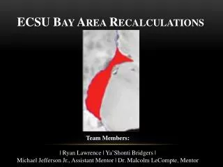
ECSU Bay Area Recalculations. Team Members: | Ryan Lawrence | Ya ’ Shonti Bridgers | Michael Jefferson Jr., Assistant Mentor | Dr. Malcolm LeCompte, Mentor. O verview. Abstract Key Terms Background Purpose of Research Methodology Results Conclusion Future Work. A bstract.

Team Members:
E N D
Presentation Transcript
ECSU Bay Area Recalculations Team Members: | Ryan Lawrence | Ya’Shonti Bridgers | Michael Jefferson Jr., Assistant Mentor | Dr. Malcolm LeCompte, Mentor
Overview • Abstract • Key Terms • Background • Purpose of Research • Methodology • Results • Conclusion • Future Work
Abstract In 2011, an ECSU research team discovered a small ice shelf in Pine Island Bay, Antarctica had progressively receded until it disappeared completely in 2003. The ice shelf found to have disappeared is the furthest south of any similar such event known to have occurred since satellite monitoring of Earth South Pole began over 30 years ago. As a result of this discovery, the bay in which the ice shelf formerly resided has been named Elizabeth City State University (ECSU) Bay. This discovery was accomplished by undergraduate student using EXELIS ENVI Image processing software on archived Landsat imagery and a new, NASA-developed, Basal Stress Boundary.
Abstract Cont. The original calculations for the temporal progress of the ice shelf’s area reduction were done during a summer undergraduate research program and reported in a paper accepted for publication by the International Electrical and Electronics Engineers (IEEE) Journal of Selected Topics in Applied earth observations and Remote Sensing (JSTARS). Area estimates for each image were derived from multiple trials to obtain a first-order estimate of the decrease in area of the ice shelf. The effort was problematic due to inherent subjectivity of the methodology resulting in a larger than acceptable standard deviation. Up to 10% of the area estimate.
AbstractCont. With publication of the paper pending it was deemed appropriate to improve the accuracy of the estimate of the original calculations. Higher accuracy was obtained by exploiting ENVI’s ability to present a higher resolution image of the area being measured and by improving the visibility of the Basal Stress Boundary used as a boundary for the ice shelf. Common warped images were created and used by participants to create a uniform basis upon which the area estimates were made. The more accurate results, with their lower statistical variability were inserted into the JSTARS paper in its final review opportunity assumed to occur in early April.
Key Terms • Landsat: The Landsat Program is a series of earth-observing satellites jointly managed by NASA and the USGS • ENVI: ITT Visual Information Solutions ENVI product family provides a variety of software solutions for processing and analyzing geospatial imagery • Glacier: a large, slow moving mass of ice resting on land that formed from an accumulation of snow over time • Ice-Shelf: a thick mass of ice that is still attached to a glacier but floats on water • Basal Stress Boundary (BSB): the boundary between“grounded” ice resting on land and any associated floating ice comprising a retaining ice shelf
Area of Interest Figure 2a, 2b, 2c. Dessiminating ice-shelf, formally named ECSU Bay, spanning the years of 1986-2013. Adopted from the LeCompte, 2013 (In-print).
Background • Summer 2011: • Calculations for the temporal progress of the ice shelf’s area reduction were completed • 2010-2011 Academic year • ECSU students observed the gradual reduction of an ice shelf in Pine Island Bay, now know as ECSU Bay Picture adopted from Summer 2011 team.
Background Cont. Summer 2011: Area calculation efforts were problematic larger than acceptable standard deviation Up to 10% of the area estimate
Purpose of Research • To improve (lower) the statistical variability of the “original” results derived by the Summer 2011 team • Report the new and potentially improved figures in the JSTARS paper in its final review opportunity assumed to occur in early April
Methodology Methodology I) Methodology II) • Common warped images were created and used by participants to create a uniform basis upon which the area estimates were made • Utilized the zoom feature, where 1 < x ≤ 4 • Image to image registration • Increased width of BSB to 2.0 pt. • Use common warped images to complete area measurements in the zoom window • Increased the number of measurements for each image • Landsat images were co-registered using GCP’s to one of two NLASP reference images. • Individual warps and area measurements
Results Cont.: Comparison of original vs. improved measurements
Results Cont.: Comparison of original vs. improved measurements =Sheet1!$E$32:$E$42
Conclusion • Utilizing the zoom feature in ENVI, coupled with increasing the width of the BSB yieldedimproved (lowered) standard deviation values.
Future Work • Complete area calculations using the improved methodology for various areas found in the 2011-2012 Academic Year URE Antarctic Survey
References/Acknowledgements • The research team would like to thank Dr. Linda B. Hayden (CERSER PI), Dr. LeCompte (Mentor), and Mr. Michael Jefferson (Assistant mentor) for their mentorship and invaluable contributions to the research project.