Download
1 / 20
200 likes | 312 Vues
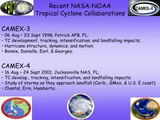
Recent NASA-NOAA Tropical Cyclone Collaborations. CAMEX-3 06 Aug – 23 Sept 1998; Patrick AFB, FL; TC development, tracking, intensification, and landfalling impacts; Hurricane structure, dynamics, and motion; Bonnie, Danielle, Earl, & Georges;. CAMEX-4

E N D
Recent NASA-NOAA Tropical Cyclone Collaborations • CAMEX-3 • 06 Aug – 23 Sept 1998; Patrick AFB, FL; • TC development, tracking, intensification, and landfalling impacts; • Hurricane structure, dynamics, and motion; • Bonnie, Danielle, Earl, & Georges; • CAMEX-4 • 16 Aug – 24 Sept 2001; Jacksonville NAS, FL; • TC develop., tracking, intensification, and landfalling impacts; • Study of storms as they approach landfall (Carib., GMex, & U.S. E coast); • Chantal, Erin, Humberto;
Recent NASA-NOAA Tropical Cyclone Collaborations • TCSP • July 2005; San Jose, Costa Rica; • TC genesis (early life cycle); • collect temp., humidity, precip., and wind information related to TCs • Dennis, Emily, pre-Eugene, Gert; • NAMMA • 16 Aug – 24 Sept 2006; Sal, Cape Verde; • study the formation and evolution of TCs & AEWs in the E and Centr. Atl; • study the composition and structure of the Saharan Air Layer; • study how aerosols may affect cloud precipitation and TC development; • Debby, Pre-Ernesto, pre-Florence, Helene, 3 AEWs
NAMMA TCSP Domain: • Terrain • AEWs vs. In Situ NAMMA Domain: • Dusts • AEWs TCSP
NOAA’s Intensity Forecasting Experiment (IFEX) Program Motivation
IFEX (NOAA NHC, EMC, HRD) Goal 1 Collect observations that span the TC lifecycle in a variety of environments; GOAL 2 Develop and refine measurement technologies that provide improved real-time monitoring of TC intensity, structure, and environment; GOAL 3 Improve our understanding of the physical processes important in intensity change for a TC at all stages of its lifecycle;
P-3 TC Missions by Lifecycle Stage (1976-2004) Tropical Disturbance 3% (n=19) Tropical Depression 5% (n=30) Tropical Storm 24% (n=140) Hurricane 68% (n=387)
NOAA Operational Priorities • TC intensity change • 2) Early lifecycle, including genesis • 3) NOAA Joint Hurricane Testbed Priorities: (TPC-1) Guidance for tropical cyclone intensity change, with highest priority on the onset, duration, and magnitude of rapid intensification events. Similar guidance is also needed on when rapid over-water weakening (such as had been observed in recent Gulf of Mexico hurricanes) will occur; (TPC-2) Improved observational systems in the storm and its environment that provide data for forecaster analysis and model initialization; (TPC-11) Guidance for tropical cyclone genesis that exhibits a high probability of detection and a low false alarm rate, and/or provides probability of genesis; (EMC 1) General model improvements to advance track and intensity forecasts; (EMC 3) Model validation techniques suitable for three dimensional high resolution verification for all phases of the tropical cyclone life cycle;
Scientific Needs • Multi-scale processes (synoptic, mesoscale, convective, microscale) • 2) Multiple platforms needed to cover storm- and synoptic-environments
Proposed Science • Develop scientific goals that represent a fusion of TCSP & NAMMA science • Merging of overlapping goals & available assets to address multi-scale nature of the problem; • Genesis/early lifecycle studies;
Some Questions to Address • 1) What are the precursors for rapid intensification? • Synoptic scale: vertical shear, SST, OHC, PI, humidity; • Vortex-scale: size of incipient vortex, humidity; 2) What is the impact of variations in the synoptic-scale environment (e.g., dry air, vertical shear, aerosols, wave deformation/accumulation) on developing tropical cyclones? 3) What governs interaction between the synoptic environment and incipient vortex (e.g., size of vortex, “marsupial” hypothesis)? 4) What is the role of deep convection (e.g., convective bursts, VHTs) in TC genesis and intensity change? 5) What are the differences in the precipitation morphology and related microphysical structures at various lifecycle stages?
Studying TCs in the EPAC vs Atlantic • EPAC • well defined SST gradients • vertical shear tends to be more uniform • main development region tends to have higher moisture content • TC “factory”…prime region for genesis studies • not an ideal location for current NOAA IFEX interests (e.g. U.S. impact) • doesn’t fuse some of NAMMA’s main objectives (SAL & aerosol studies) • Atlantic • land interactions, fronts (e.g. GMex & U.S. east coast) • >atmospheric variability over <distance • Saharan Air Layer (dry air, dust, enhanced vertical wind shear) • GMex: horizontal heterogeneity in mixed layer depths • marginal basin (early lifecycle studies more of a challenge) • better overlap with NOAA IFEX interests • likelihood of better fusion of TCSP & NAMMA objectives • deployment “east”: probably ideal for NOAA (Barb, St. Croix, San Juan?) • -reduced chance for conflicts with operational tasking • -better chance for life cycle studies (research initiates missions, operations picks up if systems threaten coastline) • -accessible to the central Atlantic and Caribbean region
NOAA Aircraft Assets • 1) Two P-3s (inner core) • GPS dropsondes, airborne Doppler radar, microphysics, SFMR, flight-level data; • 2) G-IV (environment) • GPS dropsondes, airborne Doppler radar (2009), flight-level data; • 3) UAV (inner core, environment) • Flight-level thermo & winds;
NOAA P-3 Orions 50N 40N 30N San Juan 20N MDR St. Croix Barbados 10N 50W 40W 30W 20W 100W 90W 80W 70W 60W
NOAA G-IV 50N 40N 30N San Juan 20N MDR St. Croix Barbados 10N 50W 40W 30W 20W 100W 90W 80W 70W 60W
Aerosonde 50N 40N 30N Key West San Juan 20N MDR St. Croix Barbados 10N 50W 40W 30W 20W 100W 90W 80W 70W 60W
Rapid Intensification in the EPAC vs Atlantic • HRD RI Index (Atlantic) • RI threshold: 30 kt in 24 hr • RI cases: 185 out of 2504 overall TC cases (10-yr dataset) • HRD RI Index (EPAC) • RI threshold: 35 kt in 24 hr • RI cases: 125 out of 1950 overall TC cases (10-yr dataset) • Rapid Intensifiers: EPAC (94th perc) vs Atlantic (93rd perc) • 75% less skill in the Atlantic (relative to RI climatology)
Spatial Distribution of Intensity Error (2003-2006; tau=48h) Tim Marchok, GFDL DSHP GFDI SHIFOR Official
Spatial Distribution of Intensity Skill (2003-2006; tau=48h) DSHP GFDI Official • GFDL & SHIPS have trouble in Caribbean & Bahamas region, but still beat SHIFOR • SHIFOR is tough to beat in the north central Atlantic region • Note: Deeper blues & purples indicate greater skill; deeper oranges a lack of skill. Tim Marchok, GFDL
NOAA To Dos • Check on updated NOAA Aircraft allocation plans for the 2009-2011 timeframe; • Estimate costs (expendables, manpower, etc) for various field program scenarios being discussed; • Early discussions between HRD and its other IFEX partners (NHC & EMC)…summer 2007; • More formal follow-up discussions between NASA reps and IFEX partners…fall 2007?