Download
1 / 25
260 likes | 635 Vues
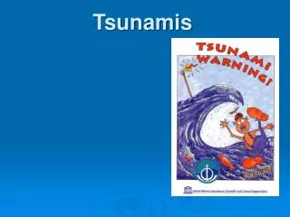
December 26, 2004 The Sumatra Earthquake & Tsunami. Nick D’Anna Plainedge Schools. Great Wave off the Coast of Kanagawa, by Hokusai This print is somewhat misleading in that tsunamis do not always manifest themselves as the huge breaking waves. What is a tsunami?.

E N D
December 26, 2004The Sumatra Earthquake & Tsunami Nick D’Anna Plainedge Schools
Great Wave off the Coast of Kanagawa, by Hokusai This print is somewhat misleading in that tsunamis do not always manifest themselves as the huge breaking waves.
What is a tsunami? • From the Japanese word tsunami meaning "harbor wave“ • Often mistakenly called "tidal waves“. • They have nothing to do with tidal action. • Seismic sea waves caused by earthquakes, submarine landslides, and, infrequently, by eruptions of island volcanoes.
Tsunami waves are sent out radially from the point of thrust. A tsunami wave can travel enormous distances. The Dec. 26th tsunami eventually made its way to the pacific ocean and noticeably affected the sea on the west coast of the US.
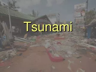
Most tsunamis do not result in giant breaking waves. • Rather, they come in much like very strong and very fast tides (i.e., a rapid, local rise in sea level). • Much of the damage inflicted by tsunamis is caused by strong currents and floating debris.
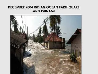
The Facts about December 26th A great earthquake occurred at 00:58:50 (UTC), at 6:58 a.m. local time, on Sunday, 26 December 2004. The magnitude 9.0 event was located off the West coast of Northern Sumatra. This is the fourth largest earthquake in the world since 1900 and is the largest since the 1964 Prince William Sound, Alaska earthquake. The earthquake had a depth of 10 km
Page 5 of your ESRT At Sumatra, the Indian plate was subducted beneath the overriding Burma plate. The Indian plate begins its decent into the mantle at the Sundra trench (west of the epicenter). The relative motion of the two plates has been 6cm/yr. Image curtsey of Eric Cohen
Indian Ocean Tsunami Natl. Inst. of Advanced Industrial Science & Technology
A section of the northern shore of Aceh, Sumatra, Indonesia, pre- and post-tsunami (by Digital Globe)
A section of the northern shore of Aceh, Sumatra, Indonesia, pre- and post-tsunami (by Digital Globe)
A section of the northern shore of Aceh, Sumatra, Indonesia, pre- and post-tsunami (by Digital Globe)
Tsunami Warning Systems do exist. Unfortunately, there was no such system in place among the nations around the Indian Ocean. Within 15 minutes of the megaquake, officials from the PTWC were calling nations in danger to warn them. The information was slow to get to the locations in greatest risk.
Tsunami Warnings There are currently two tsunami warning centers for Canada and the US: • The West Coast / Alaskan Tsunami Warning Center (WC/ATWC) • The Pacific Tsunami Warning Center (PTWC)
Seismographs record Earthquake activity world wide. • Buoys in the ocean send signals to satellites about the level of the sea surface. • That information is sent to the Tsunami warning centers which in turn make decisions about weather to issue a warning.
If a warning is issued, there are a few ways to notify the public. • Locally, sirens are used. • For distant tsunamis, NOAA radio stations notify the public • The best immediate response is to head for higher ground. • Locations within 1 mile of the coast and at elevations lower than 100 ft are at the greatest risk.
Links for more information on this event • www.NYTimes.com • USGS Sundra Trench Earthquake and Aftershock Map at http://www.oceansonline.com/sunda_trench_earthquake.pdf • Tectonic Summary of Sumatra Earthquake, http://www.oceansonline.com/Tectonic%20Summary%20USGS.pdf • 2004 Indian Ocean Earthquake graphichttp://www.oceansonline.com/images/745px-Harta_Ocean_Indian_Quake.png • Tsunami Great Waves, http://www.oceansonline.com/great_waves_en_2002.pdf • Dr. C’s Remarkable Ocean World http://www.oceansonline.com/tsunami2004.htm