Download
1 / 16
160 likes | 338 Vues
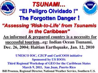
TSUNAMI… “El Peligro Olvidado !” The Forgotten Danger !. “Assessing ‘Risk-to-Life’ from Tsunamis in the Caribbean” An informed & prepared country is a necessity for successful tourism ... eg : Indian Ocean Tsunami, Dec . 26, 2004; Haitian Earthquake, Jan. 12, 2010

E N D
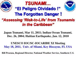
TSUNAMI… “El PeligroOlvidado !” The Forgotten Danger ! “Assessing ‘Risk-to-Life’ from Tsunamis in the Caribbean”An informed & prepared country is a necessity for successful tourism...eg: Indian Ocean Tsunami, Dec. 26, 2004; Haitian Earthquake, Jan. 12, 2010 UNESCO IOC, CZCP and CariCOOS initiative Sponsored by US IOOS: Third Regional Workshop of GEO for the Caribbean States March 9, 2011, San Juan, Puerto Rico Bill Proenza, Regional Director, National Weather Service, Southern U.S.
Fatalities 1842 Haiti 300+ 1853 Venezuela 600+ 1867 Virgin Islands (U.S.) 23 1882 Panama 75+ 1906 Jamaica 500 1918 Puerto Rico 140 1946 Dominican Republic(1) 1790 1946 Dominican Republic(2) 75 2010 Haiti 7 TOTAL3510 + Despite Infrequency, 168 Years of Deadly Caribbean Tsunamis Ref:Caribbean Tsunamis, A 500-Year History from 1498-1998by Karen Fay O'Loughlin and James F. Lander (2003: ISBN 1-4020-1717-0); Tsunamis of the Eastern US, NGDC, 2002 Science of Tsunami Hazards, vol 20, #3, pg 120; PRSN on Haiti,2010
The Caribbean has many tsunami-genic sources, most of them short-fused (nearby)… Earthquakes (tectonic subduction zones & numerous faults) Landslides(continental shelves, PR trench, coastal slides Volcanoes (submarine & land) Tele-tsunamis (e.g. “Lisbon” Nov. 1, 1755)
The Caribbean Situation ! Last major deadly tsunami(s) was in 1946, at the Dominican Republic: 1865* deaths. Since 1946, tremendous post WW-II coastal population growth has occurred across the Caribbean along with explosive tourism . Therefore, if we use Caribbean’s historical tsunami deaths, it will greatly understate the current 21st century potential loss of life! So, how do we assess our current potential loss of life from tsunamis? *Statistics fromCaribbean Tsunamis, A 500-Year History from 1498-1998 by Karen Fay O'Loughlin and James F. Lander (ISBN 1-4020-1717-0 2003 edition)
Assessing:Risk to Life *Risk (potential loss of life) = Hazard Frequency x Amount of Exposure x Mortality Rate (%) R = HF x AE x MR *Source: J. Nott (2006): Extreme Events – Physical Reconstruction and Risk Assessment, Cambridge University Press. http://www.srh.noaa.gov
Applied to Caribbean tsunamis:Hazard Frequency: historical rateExposure: current number of “beach dwellers” in harm’s wayMortality Rate: percent death rate *HAZARD FREQUENCY (history based) *EXPOSURE (people at the beach) TODAY’s RISK TO LIFE *MORTALITY (2-meter fatality rate…a percent) *Source: J. Nott (2006): Extreme Events – Physical Reconstruction and Risk Assessment, Cambridge University Press. http://www.srh.noaa.gov
Today’s risk to beach life from a 2-meter tsunami Caribbean beaches have a potential loss of life exposure 40 times greater per century. (K = a thousand e.g. 100K means 100,000 people)
Today’s risk to beach life from a 2-meter tsunami Both have a “very high” potential loss of life exposure. (K = a thousand e.g. 50K means 50,000 people)
Other sources of data and footnotes. • *1 – NOAA Sea Surface Temperatures. • *2 - NOAA National Geophysical Data Center. • *3 - Landers, Lockridge, Whiteside, O’Loughlin. • *4 – Potential loss of life exposures values are estimates from the World Tourism Organization, Tourism Market Trends, 2006 Edition and tourism numbers from state government or tourism sources from Alaska, Hawaii etc.
So, how do tsunami deaths since 1842 in the Caribbean (PR, USVI & Neighbor Nations) compare historically with the northeastern corner of the “Pacific Rim” (Alaska, Hawaii, the “West Coast” Canada & U.S.) ?The Caribbean with only 1/6 the area had six (6) times the deaths ! 1842-2010: 3510+ deaths 1842-2010: 579 deaths http://www.srh.noaa.gov
A Historical Summary Comparing 168 years of reasonable data… • …an area only 1/6 the size of our northeastern Pacific rim… (Alaska, Hawaii, west coasts of Canada & US)… • …the Caribbean has produced 6 times more tsunami deaths ! • Today, the Caribbean Basin has a much greater population of coast/beach residents and tourists at risk to nearby… short-fused, tsunami-genic sources!
The risk to life from tsunamis has increased dramatically with coastal population increases and tourism growth. Here we see the port at Charlotte Amalie Bay, St. Thomas 20 Foot tsunami, November 17, 1867 Same bay in St. Thomas today with the lives of 25,000 tourists & residents at risk ! 30 people lost their lives on November 18, 1867 in a 20 ft tsunami. Today there can upwards of 15,000 to 25,000 people at risk because of cruise ships. Almost all these people are in the tsunami inundation zone around the bay, docks, beaches and shops.
October 11, 1918, a Mona Passage earthquake caused a 5 - 20 foot tsunami in western PR killing about 140 R-F Intensity Scale Modified after Reid and Taber, 1919 2010 Risk to Life:~30,000 around Mayagüez vicinity
Some Sobering Conclusions …The Indian Ocean and Caribbean have much in common: • Attractive climate and year-round warm waters • Large beach/coastal tourism (still growing) • Relatively flat beach/coastal topography • Infrequency... NOAA Geophysical Data Center says our Caribbean Basin has had 8% of the world’s tsunami events and the Indian Ocean, 7%. …such similar infrequency did not protect Indian Ocean nations from their horrific tsunami loss of life (12/26/04) estimated around 250 thousand people !
Caribbean Tsunami Warning Services – Now and Future • InterimCaribbean Tsunami alerts & info. comes from Alaska and Pacific Tsunami Warning Centers • A Caribbean Tsunami Warning Center (CTWC) co-located at the world-renown Puerto Rico Seismic Network maximizes regional expertise and cultural insight to warning lead-times & preparedness • UNESCO Caribbean member nations (and U.S. State Department) endorse the US phased-in CTWC implementation at Mayaguez • The National Weather Service appointed a Caribbean Tsunami Warning Program Manager at Mayaguez in February, 2010.
A “tsunami-ready” community welcomes your visitors ! Bill Proenza, Regional Director National Weather Service, Southern U.S.A. bill.proenza@noaa.gov Office: 817-978-1000