Download
1 / 11
110 likes | 135 Vues
Create and manipulate dynamic geometric objects online with GeoSVG, providing features of a DGS. Collaborate and share manipulatives via GeoSite, a server-side support platform. Submit and save manipulatives seamlessly.

E N D
GeoSVG: A Dynamic Geometry Authoring Tool • Written in SVG and Javascript • Providing most of the capabilities of a traditional Dynamic Geometry System (DGS) • Inherent web-oriented • What GeoSVG generates automatically can be viewed and manipulated online • The entire GeoSVG authoring tool is online • User does NOT need to install software and compose web pages • Server Geosite provides File open, File edit, and File save for GeoSVG.
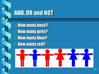
What a DGS should be able to do • Dynamic geometric object construction and manipulation (All mathematical relations are preserved while objects are being dragged by mouse or values are changing) • Transformation of geometric objects (Translate, Rotate, Dilate, and Reflect) • Measurement • Animation • Calculation (A dynamic calculator) • Analytic Geometry (Plotting functions, coordinate systems) • Locus (a totality of all points, satisfying the certain given conditions) • Iteration (Geometric iteration and numerical iteration) • Script/Macro (A sequence of steps that can be defined as a new function)
Current status of GeoSVG • Initial design closely followed Geometer’s SketchPad • Disadvantages of initial design: • Basic building blocks are too primitive (point/circle/line) • SketchPad is not able to generate most of the manipulatives in WME pilot site • Even a manipulative can be generated, user may have to create tens or hundreds of hidden objects. • Current Design will provide more native support for high-level objects such as geometric shapes
GeoSite: Server-side support for GeoSVG • Logged-in user can create unlimited levels of folders under his/her account and store manipulative under any folder (implemented by MySQL) • Users can create new manipulative, edit existing manipulative or delete a manipulative. • Users can share manipulative across the entire GeoSite • Link or copy other user’s manipulative • Access control can be defined • Search • A user who doesn’t log in can only view/manipulate manipulative • Manipulative can be embedded in pages outside GeoSite
Three phases of a manipulative • GeoSite invokes different environments for three phases of a manipulative: author, configure, and view/manipulate • Disadvantage of traditional DGS • Authoring phase (invoked by new or edit): the entire GeoSVG authoring environment will be provided • Configuring phase (invoked by configure): Each object in a manipulative has some public interface. The configuring page will list all the configurable parameters for tuning for users who doesn’t want to use the authoring environment. • configuration example page • Viewing/Manipulating phase: All the menus and buttons in the authoring environment are NOT provided. • An author can export a menu function as a button to extend the capability of the viewing environment.
Submission-type Manipulative • How: An author exports a submit button during authoring • Any user including guest can manipulate the submission-type manipulative and hit the submit button. The submission will be saved back to the GeoSite. • The owner of the submission-type manipulative can check all the submissions.
Implementation of submitting a drawing to GeoSite • Both the editing of a manipulative or submission of a submission-type manipulative need to save the manipulative back to the server GeoSite • Current implementation uses inter-document communication (xhtml-svg), then submits a xhtml form to the server. • Only works under Windows/IE due to the inter-document communication problem • Future implementation uses getURL() and postURL provided by Adobe SVG Viewer. • Works under Windows/IE/Mozilla, Unix/Mozilla, Mac(?) • ExampleExample2
Server Connection Example • getURL( “URL”, callback); • function callback( urlRequestStatus ) { if ( urlRequestStatus.success ) { xmldoc=parseXML( urlRequestStatus.content ).documentElement; } else { alert(“Error!"); } }
More on GeoSite • http://geositeURL/username/path/manipulative • Define access control of folders and manipulatives • Private, viewable, copyable / friend, group, anybody • Password protected • Who can submit the submission-type manipulative • Search • Possibility of interaction between WME sites and GeoSite • Mostly important, a good GeoSVG should be developed before a good GeoSite.
Advantages of GeoSite and GeoSVG over Traditional DGS • Users don’t have to install software • A manipulative constructed by a user can be viewed immediately by other users • GeoSite provides a bank of manipulatives. A teachers can quickly find a manipulative he/she wants. • Submission-type manipulatives enable students to answer questions in graphics. • Submission of a drawing is also useful in Assessment for teachers to author questions with graphics