Download
1 / 74
740 likes | 765 Vues
Explore considerations in managing forest roads, soil sustainability, and access structures. Learn about historical context, statutory and non-statutory considerations, and sustainability protocols.

E N D
Roads: Considerations in managing the aisles to our library of forest resources Mike Curran, PhD, PAg. Soil Scientist / Adj. Professor B.C. Forest Service (UBC)
Outline • “Big picture” • History • “Sustainability” protocols • Statutory considerations • Non-statutory considerations • Summary
Outline • “Big picture” • History • “Sustainability” protocols • Statutory considerations • Non-statutory considerations • Summary
Historical context • Civilizations have come and gone based on how well they have treated the soil • Many famous politicians and writers have been quoted underscoring this fact: • "The thing about land is, they ain't makin' no more.“ Mark Twain • “A nation that destroys its soil, destroys itself. Forests are the lungs of our land, purifying the air and giving fresh strength to our people.” Franklin D. Roosevelt
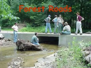
Roads are a permanent land change • Roads are the most permanent change we make in the forested landscape • Roads have been a major cause of slope stability, erosion, and sedimentation problems • A well built road will last for centuries (e.g., Roman roads in Europe) • Good drainage is key to longevity
We live and operate in a naturally active environment (Silt happens)
Drainage control is number one, At all times
Road problems one of the major “mudslingers” in the face of more responsible forest practices Etched in memory and the landscape
“Legacy disturbance” • Old harvesting disturbance is a big deal in areas with longer harvesting history (e.g., US) • What kind of legacy do we want to leave for future generations? • Will future generations need the same roads? • For example, look at the innovations in filing systems, libraries, etc… different “aisles” now
1960’s Era Skid Trails Iron Canyon II
Iron Canyon II Soil Monitoring Pre- vs. Post-Harvest Disturbance
[ Disturbance Std. for permanent access = ___ % ] [ Disturbance Std. on reforested area = __ % ] [ Ameliorated ]
Overall context • “Forestry is not rocket science, it’s more complicated” • Just like a library, we can’t access our resources without “aisles” • We need to balance environmental and socio-economic costs
Outline • “Big picture” • History • “Sustainability” protocols • Statutory considerations • Non-statutory considerations • Summary
“Sustainable Forest Soils” • “Ensuring that the biological, chemical and physical integrity of the soil remains for future generations of ___(people, trees, etc.) • Addressed at many levels, through operations, standards, and now protocols • Often tracked in terms of Criteria and Indicators (e.g., land lost to roading)… • BUT the adaptive management process is likely just as important as the indicators
Adaptive Mgt. Process(maybe need to apply to roads more?) Strategy / Database Execution Data/results Tools / Guidelines Research Monitoring (C&E) Training OPERATIONS Best Mgt.Practices
“Sustainability Protocols” • Set Criteria and specific Indicators of sustainable forestry • Encourage countries to report on the status of these Indicators • However, protocols like the Montreal Process have a number of “b-type” indicators that require field validation (eg, compaction) • Therefore, compliance with standards is often used as a proxy (eg, CCFM C&I)
“Sustainability Protocols” • CCFM targets: • loss to permanent access (%), and • stream crossings (rate of compliance with locally applicable standards) • BC “State of the Forest” report tracks loss to permanent access • Third party (eco) certification schemes focus in on permanent access as well
Outline • “Big picture” • History • “Sustainability” protocols • Statutory considerations • Non-statutory considerations • Summary
BC Soil disturbance standards • 1988 start, then FPC in 1995 • Amount for roads and landings has remained about the same since the beginning – not sure if this should be the case
Legislative Framework • Evolving to a “Results-Based” Approach • Maintain Environmental Standards • Monitor (Enforce) Compliance • Definition of “Soil Disturbance” • “objects of concern” (growth, hydrology)
FPRA Objectives for Soils • “conserve the productivity and hydrologic function of soils.”
Some FRPA Standards (FPPR) • Invasive plants17 • Natural range barriers18 • Soil disturbance limits 35 (TAS, Rehab) • Permanent access structure limits36(1) • Landslides37 (don’t cause one, eh) • Gully processes38 • Natural surface drainage patterns39Revegetation40
"permanent access structure" • means an access structure in a cutblock that (a) at the time of its construction, is reasonably expected to provide access for timber harvesting and other activities that are not wholly contained in the cutblock, or • (b) is constructed on or through, or contains, materials unsuitable for the establishment of a commercial crop of trees and is not an excavated or bladed trail, but does not include an area that contained an access structure before rehabilitation of the area under section 36;
"temporary access structure" • means an access structure that (a) is in a cutblock, and (b) does not conform to the criteria described in paragraph (a) or (b) of the definition of "permanent access structure" and does not include a pit or quarry;
FRPA Standards • Permanent access 7 % or less • Temporary access up to 5 % • Sensitive Soils 5 % “disturbance” • Less-sensitive 10 % • Roadside work areas 25 % • Based on soil sensitivity
“Rehabilitation” • Determine where needed based on off-site concerns and on-site validation data • Ameliorate where tree growth, hydrology, and other values indicate functions are significantly impaired and can be corrected. • Should be part of BMPs…to minimize area needing amelioration and to correct problem areas, or perhaps use for economic reasons
Rehabilitation steps • Starts with careful construction (topsoil, drainage) • a) remove or redistribute woody materials that are on the surface • (b) de-compact compacted soils, • (c) return displaced surface soils, retrievable side-cast and berm materials.
Rehab (amelioration) Plot on LTSP Rehabilitated Haul Road
Planning framework • Was 3 prescriptive plans that required approval • Now 1 “results based” FSPlan for large area • More responsibility / liability on the Licensee • Government not providing peer review • Standards from legislation (eg, soils), • or proposed (eg, biodiversity) • Districts do compliance monitoring based on risk • Effectiveness monitoring a Government responsibility
Roads also figure into Timber supply reviews • Permanent access deducted from the timber harvesting landbase • Numbers can be quite low (too low?) • Incentive to keep them low • [Put them on the least productive land, eh?]
Cost-effective Assessing / Monitoring of Disturbance • Remote sensing images are now being used (Satellite, standard and custom airphotos) • Useful for C&E and Effectiveness (Resource Stewardship) Monitoring • Landscape level to Soils Value now – to track permanent access, slides, etc. at a higher level.
Outline • “Big picture” • History • “Sustainability” protocols • Statutory considerations • Non-statutory considerations • Summary
Non-statutory considerations • “80 % of practice should be outside of FRPA” • Common law may prevail in some instances • R. Reader currently drafting a guidance document on the non-statutory realm • Professional reliance • Ethics of the profession (public safety, environment)
Permanent access in other jurisdictions • Most of our neighbouring jurisdictions require lower levels of permanent access at the cutblock level (e.g., 5 %)
Permanent versus Temporary access • Be clear on definitions • Strategies • Sliding file cabinets • Pros and cons • Maintenance cost • liability
The “hassle factor” • The deeper you dig, the more drainage and seepage you will have to deal with • The deeper you dig, the more fill you will have to deal with • (Temporary roads minimize the above, but need some drainage control in case a runoff event occurs during use.)
Environmental Framework • Wildfire – have to expect much larger runoff events after one (e.g., Kuskanook) • Climate change / extreme weather • Have to expect more “Flathead floods” • 100 year-event likely in a rotation anyways…
Environmental Framework • Inherent Soil Sensitivity: (HAZARD) • Mass Wasting [non-alcoholic]) • Erosion • Compaction • Displacement Potential Effects: (CONSEQUENCE) • On-site (forest productivity) • Off-site (fish, water, property, life) • View-shed aesthetics (amelioration)
Mass Wasting • “Minor” cut and fill failures • Often result in drainage diversion • Can lead to larger landslides • Loss of productive growing site • Impacts on downslope values • Safety concerns • Tools: Hazard key and stability indicators
Mass Wasting • Controlling factors: parent material, climate, slope, topography • Manageable factors: amount and extent of excavation, drainage control, machine traffic, seasonal soil conditions (wetness, snow, frost)
Erosion • Surface soil eroded primarily by water (splash, sheet, rill erosion) • Loss of fertile topsoil layers • Loss of effective rooting volume • Exposure of unfavourable subsoils • Drainage diversion • Sedimentation of watercourses • Tools: Erosion key, related tables