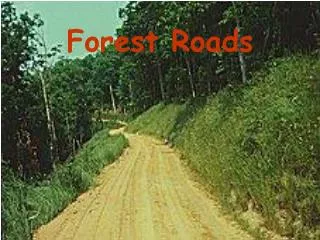
Forest Roads
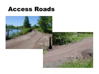
Forest Roads. Forest Roads: Guidelines. Build for intended uses Products to be hauled Type of vehicles Seasons of use Road width limits Grade limits Limits on stream crossings . Forest Roads: Guidelines. Design road for soils Use soils map

Forest Roads
E N D
Presentation Transcript
Forest Roads: Guidelines • Build for intended uses • Products to be hauled • Type of vehicles • Seasons of use • Road width limits • Grade limits • Limits on stream crossings
Forest Roads: Guidelines • Design road for soils • Use soils map • Use topographic map and aerial photos to layout preliminary route • Plot proposed route on maps, considering • Drainage and slope • SMZ’s • Inter alia
Forest Roads: Guidelines • Check proposed route on the ground • Flag route • Adjust for problem areas • Minimize number and size of stream crossings • Design adequate stream crossing • Design adequate water control devices
Forest Roads: Guidelines • Plan for stable outlets for water control devices • Plan for adequate right-of-way width • Revegetate ASAP • Plan for maintenance Roadway seeded to hold until next use
Soils and Slopes • Problems related to soil and slope combinations • Wetness
Soils and Slopes • Problems related to soil and slope combinations • Erosion
Soils and Slopes • Problems related to soil and slope combinations • Sloughing (slumping)
Sandy Soils • Wetness and sloughing not a problem • Load carrying capacity greater when wet • Erosion is major concern
Clayey Soils • Holds water well • Wetness can be problem on flat and poorly drained areas • Road crown and side ditches may be needed • Keep cut banks at 3 to 1 to prevent slumping
Loamy Soils • Usually well drained • Wetness not a major problem except in bottomlands • Erosion potential increases with slope
Water Control Devices • Road design • Don’t use natural drainages as road ways • Don’t locate roads directly on top of ridges, but slightly down from the crest • Avoid flat areas that can pond water • Use natural, small cross-drains • Additional drainage can be obtained using turns and curves
Water Control Devices • Road construction • Avoid in-slopping and inside ditches whenever possible • If use inside ditches provide route for water to cross over road • Use water control devices to reduce slope length • Use curves when possible to shed water from road • Rolling and broad-based dips are very effective Out slope In slope
Water Control Devices • Road construction • Water bars and traffic are not compatible • Install wing-ditches (runouts) as frequently as possible • Empty water control devices onto stable outlets • Outlets should be as level and wide as possible
Water Bars • Purpose • Gather and shed water off of surface • Divert water from inside ditch • Prevent erosion until vegetation established • Where suitable • Little or no traffic • Abandoned or retired roads and trails • Firebreaks
Water Bars • Construction guidelines • Angle across road in down-grade direction • Tie upper end into inside ditch bank • Empty onto stable outlets • Construct mechanically or by hand • Blade on skidder can be used
Broad-Based Dips • Carefully out-sloped section of road which acts as catchment and drainage channel • Where suitable • Not for constantly flowing water • On roads and trails that are being used • Flat and moderate grades only
Other Types of Water Breaks • Rubber conveyor belt • Installed so that only 3 inches of belting extends above the road surface to turn water aside.
Other Types of Water Breaks • Open-top wooden box culvert • To function properly, careful installation and regular maintenance are necessary • Hard to clean out • Limit to small amounts of runoff
Cross Drainage Culverts • Provide cross drainage of inside ditches • Installation • Install in low points and small cross drains • Place at downhill angle • Seat firmly • Inlet at same grade as ditch • Protect outlet from erosion with rip-rap, etc. • Size to handle flow • Extend well beyond road fill
Water Turnouts (Runouts) • Divert water from diversion device and disperse it onto stable surface • Construction • Begin with bottm at same level as road ditch • Angle away from road • Then, curve it across hill to flatten out grade • Blend or feather end onto duff • Never run directly into streams, even intermittent
Stream Crossings • Peak runoff – flow in cubic feet per second from drainage area for a designated level of storm event • Head – vertical column of water temporarily stacked over culvert’s entrance. Provides energy to force water through pipe • Spillway – flat bottom channel across road to downstream side. It handles peak flows exceeding culvert’s capacity without washing out pipe.
Estimating Stormwater Runoff • Use map to estimate drainage area • For standard topo map (1:24,000, 7.5 minute) 1 square inch is 90 acres • Using soils map or experience to determine primary soil type • Determine average slope class for whole drainage • Use table • One square mile is 640 acres
Culvert placed too low, plugs easily, hard to clean out Culvert placed too high, creates pond on uphill side, washes out more easily
Improperly installed culverts can block fish passage: • (A) water velocity too great, • (B) water in culvert too shallow, • (C) no resting pool below culvert, and • (D) jump too high.
Culvert Placement • Placement critical for fish migration Undersized and perched culvert on McCabe Creek before restoration Open bottom box culvert on McCabe Creek after restoration
Other Stream Crossings: Fords • Use only with low stream banks and solid stream bed • Look for stream sections that can accommodate 50 ft. level approaches on both sides • Cross at right angle in straight section of stream • Install defectors to keep road surface runoff from entering stream • Only use if water quality standards allow disturbance
Other Stream Crossings: Bridges • Get engineering help as needed to assure carrying capacity • Use easily removed temporary structure if possible • Get needed permits, if any • Choose site to allow gradual approaches and installation of water deflectors
Common Mistakes of Road Construction and Maintenance • Culverts too small • Poor route placement • Wet spots • SMZ’s • Loose soil • Not enough runouts • Grades too steep • Use of fill material taken from SMZ to cover culvert • Blocked culverts • Improperly maintained road crown
Common Mistakes of Road Construction and Maintenance • Failure to stabilize erosive soils with grass • Clogged ditches • Inadequate planning • Inadequate soil compaction or “set-up” time before heavy use • Failure by landowner to discuss road uses, plans and BMP’s with logger or timber buyer