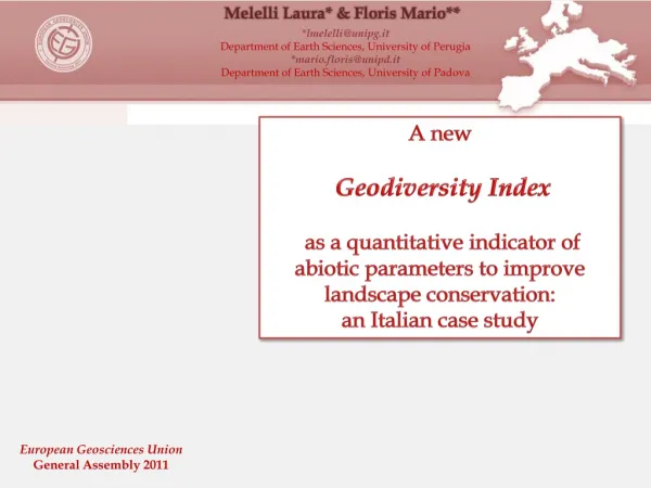
A new Geodiversity Index
Melelli Laura* & Floris Mario**. *lmelelli@unipg.it Department of Earth Sciences, University of Perugia *mario.floris@unipd.it Department of Earth Sciences, University of Padova. A new Geodiversity Index

A new Geodiversity Index
E N D
Presentation Transcript
Melelli Laura* & Floris Mario** *lmelelli@unipg.it Department of Earth Sciences, University of Perugia *mario.floris@unipd.it Department of Earth Sciences, University of Padova A new Geodiversity Index as a quantitative indicator of abiotic parameters to improve landscape conservation: an Italian case study European Geosciences Union General Assembly 2011
Geodiversity:definition Geodiversity: definition Study area Data analysis Geodiversity Index Conclusion Biodiversity Naturaldiversity GEODIVERSITY GEODIVERSITY “the natural range (diversity) ofgeological(rocks, minerals, fossils), geomorphological(landform, physical processes) andsoilfeatures” (Gray, 2004) “… and also topographyand elements of hydrosphere…” (Serrano & Ruiz-Flano, 2007) • Intrinsicvalue: “refersto the ethicalbeliefthat some things (in this case geodiversity) are of values simplyforwhatthey are ratherthanwhatthey can beusedforbyhumans (utilitarianvalue)” (Gray, 2004). • Cultural and aesthetic values: assignedby a community forwhich a particular site playsanimportantrole in termsof cultural and historicalheritage. • Scientific and educationalvalue: the importanceof geodiversity as a topicofscientificresearch, teaching and dissemination. • Economicvalue: the geo-diversity can beaneconomicresource, sometimesof prime importancefor the areas in whichitisrecognized.
Geodiversity:definition Geodiversity: definition Study area Data analysis Geodiversity Index Conclusion
Geodiversity:definition Geodiversity: definition Study area Data analysis Geodiversity Index Conclusion GEODIVERSITY INDEX Geological f. Geomorphological f. Land cover f. Topographic f. Maps, fieldsurvey Maps, fieldsurvey Maps, Remote Sensed data DigitalElevationModel • GEOLOGICAL FORMATIONS • Geologicalcomplex • Bedding • Soiltype • LANDFORMS • Landformsactivity • Morphogeneticprocesses • LANDUSE • Hierarchicalclassificationoflanduse • TOPOGRAPHIC PARAMETERS • Roughness • Slope • Aspect • Curvature
Geodiversity:definition Study area Study area Data analysis Geodiversity Index Conclusion Geosites in the Umbria Region Regional and National Parks
Geodiversity:definition Study area Study area Data analysis Geodiversity Index Conclusion Geology Fluvial Lacustrine Deposits (Olocene-Pliocene) Low slope values Terrigenous Complex (Miocene) Medium slope values Calcareous Complex (Trias up. – Oligocene) High slope values SubasioRegional Park
Geodiversity:definition Study area Study area Data analysis Geodiversity Index Conclusion The Subasio Mountain Regional Park Subasio Mt. Subasio Mt. 1287m
Geodiversity:definition Study area Data analysis Data analysis Geodiversity Index Conclusion GEODIVERSITY INDEX G.I.S. GRID format GI = Eg IR/lnS Serrano & Ruiz-Flano, 2007 Vi = each abiotic factorthatcontributesto GI withmappingcharacteristicsofspatial CONTINUITY (geologicalsubstrate, soil cover, landuse). Gmi = each abiotic factorcontributingto the geodiversity definitionwithmappingcharacteristicsofspatial DISCONTINUITY (morphogeneticprocesses). Sa = "surface area”: a grid in which the cell values reflect the topographicsurface area withinthatcell. Pa = "planimetric area”, the squareof the resolutionof the elevationmodel. ln Sa = naturallogarithmof Sa GI = Geodiversity Index Eg = numberofdifferentelements in the studysquare (total diversity). IR = roughnessparameter ln = naturallogarithm S = area of the square (ha)
Geodiversity:definition Study area Data analysis Data analysis Geodiversity Index Conclusion FocalFunctions NeighborhoodStatics Variety Input layer Cellsize – 25m Low Output layer Medium High ArcGIS 9.3 SpatialAnalysttools – Neighboorhood - Focalstatistics - Variety
Geodiversity:definition Study area Data analysis Data analysis Geodiversity Index Conclusion Localfunctions SUM Mass wasting MERGE Input layer Fluvialprocess MERGE Overlay layer 1 Output layer Anthropic Karst Mass wasting Fluvial Structural • ArcGIS 9.3 SpatialAnalysttools – Merge - Raster Calculator–-Sum(ingrid1, ingrid2, ingrid3…)
Geodiversity:definition Study area Data analysis Data analysis Geodiversity Index Conclusion Arithmeticoperators “+” Geologicalvariety Geomorphological variety Landcovervariety ArcGIS 9.x SpatialAnalysttools – Raster Calculator - Arithmeticoperators “+”
Geodiversity:definition Study area Data analysis Data analysis Geodiversity Index Conclusion Planimetric area Surface area Sa1 < Sa2 < Sa3 Model 1 IR = 1.1 Landscapemodelwhere the geomorphological processes are more active and withmuchvariability … Model 2 IR = 2 Terrain roughness is a term used to describe how “irregular” an area is ROUGHNESS INDEX Sa Pa Surface area / Planimetric Area Terrain roughness is a term used to describe how “irregular” an area is ROUGHNESS INDEX Model 3 IR = 3
Geodiversity: definition Study area Data analysis Data analysis Geodiversity Index Conclusion • Roughnessisdipendentonly on DEM, not on fields data. • - Roughness can becomeanimportantindicatorfor GI identification Jenness, J. 2009. Surface Area and Ratio for ArcGIS (surface area.exe). http://www.jennessent.com/arcgis/surfacearea.htm. • ArcGIS 9.x - Surface-area.ext
Geodiversity:definition Study area Data analysis Geodiversity Index Geodiversity Index Conclusion 1) High values correspondingto geosites 44% LowGI 19% 37% High GI Medium GI
Geodiversity:definition Study area Data analysis Geodiversity Index Geodiversity Index Conclusion 2) High values correspondingto high topographicindex (roughness)
Geodiversity:definition Study area Data analysis Geodiversity Index Geodiversity Index Conclusion 3) High values correspondingtoactive geomorphological processes
Geodiversità: definizione Geodiversity:definition Area di studio Study area Elementi di geodiversità Data analysis Analisi dei dati Geodiversity Index Indice quantitativo Conclusion Conclusion Conclusioni PRELIMINARY RESULTS FUTURE PLANS • The advancementofknowledgeon the identificationof geodiversity for the developmentof the naturalheritage, • A quantitativeapproachto the geodiversity assessmentcomparable in differentareas, • A upgradabledigital database, • A tooltoidentifyareaswithpotentialvalueof the abiotic component, • An instrumentforeconomicdevelopment and conservation management “in order to predict future evolution, changes and impacts of different land uses, management and planning actions and climatic inputs”… • Repeate the process in severalareaswithdifferentmorphogenetic and geologicalcontext • The improvementof the topographic data role in the GI assessment • Repeate the processwithdifferentcellsizeresolutiontoobserve the differences in GI behaviour Thanksforyourattention!