Download

1 / 60
620 likes | 981 Vues
The Manual of Surveying Instructions and the Practice of Land Surveying in Montana and North Dakota. Presented by: Jim Claflin, BLM Acting Chief Cadastral Surveyor Montana/North Dakota/South Dakota State Office, Billings, MT and Bob Dahl, BLM Cadastral Surveyor

E N D
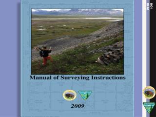
The Manual of Surveying Instructionsand the Practice of Land Surveyingin Montana and North Dakota Presented by: Jim Claflin, BLM Acting Chief Cadastral Surveyor Montana/North Dakota/South Dakota State Office, Billings, MT and Bob Dahl, BLM Cadastral Surveyor Division of Lands, Realty & Cadastral Survey Washington, D.C. Montana Association of Registered Land Surveyors and North Dakota Society of Professional Land Surveyors Joint Seminar Medora, ND - June 18, 2010 June 2, 2010
Agenda Why is the Manual relevant to the Private, County and State Surveyor in North Dakota and Montana?
Agenda How is the Manual different from the 1973 edition? How is the Manual the same as the 1973 edition? Highlight of “new” issues in the 2009 edition. Examples.
What is the Manual of Surveying Instructions? (Manual) Who/What is affected?
Why is the Manual Relevant to the Private, County and State Surveyor in Montana and North Dakota?
MONTANA STATUE LAW Title 76 Land Resources and UseChapter 3 Local Regulation of SubdivisionsPart 4 Survey Requirements § 76-3-402 Survey and platting requirements for subdivided lands. (3) All division of sections into aliquot parts and retracement of lines must conform to the Manual of Surveying Instructions
NORTH DAKOTA STATUTE LAW Title 11 CountiesChapter 11-20 County Surveyor § 11-20-07 Form of surveys All surveys made by the county surveyor must be made in accordance with the rules and regulations laid down by the GLO Commissioner
NDSPLS – Recommended Guidelines for the Practice of Land Surveying in North Dakota (2001) In the restoration of lost or obliterated corners and subdivision of sections the Land Surveyor will perform all surveys in accordance with the BLM Restoration and Subdivision of Sections circular The procedure by which a government section is to be subdivided is set forth in the current Manual of Surveying Instructions
NDSPLS – Recommended Guidelines for the Practice of Land Surveying in North Dakota (2001) Oil & Gas Well Location Surveys Ascertain that the monuments used to determine section lines are the section corner monuments according to the rules as defined by the BLM Manual of Instructions.
Administrative Rules of Montana Title 36: Department of Natural Resources and Conservation Chapter 22: Oil and Gas Conservation Sub-chapter 6: Permit to Drill 36.22.602. Notice of Intention to Drill and Application for Permit to Drill. (1) Must include a survey plat certified by a registered surveyor and showing the location of the proposed well with reference to the nearest lines of an established public survey.
SUPREME COURT OF MONTANA Vaught v. McClymond, 116 Mont. 542 (1945) “The survey should be made … in accordance with instructions and regulations issued … by the general land office for the guidance of county surveyors and others in ascertaining boundary lines created by the government survey and
SUPREME COURT OF MONTANA Vaught v. McClymond, 116 Mont. 542 (1945) in relocating corners or monuments theretofore established which may have become lost or obliterated.”
SUPREME COURT OF MONTANAReel v. Walter, 131 Mont. 382 (1957) The Manual contains the proper procedure for resurveys and subdivision of sections
SUPREME COURT OF MONTANAYellowstone Basin Properties, Inc. v. Burgess,255 Mont. 341 (1993) Surveyors who comply with the Manual, and who uses the best evidence obtainable meets the standard of care required for Registered Land Surveyors in Montana
NORTH DAKOTA SUPREME COURTNystrom v. Lee, 16 N.D. 561 (1907) The courts of this state in the matter of restoration of corners and subdivision of sections are governed by the laws of the U.S., and the instructions issued by the officers thereof, in charge of the public land surveys
NORTH DAKOTA SUPREME COURTOdegaard v. Craig, 171 N.W.2d 133 (N.D. 1969) Subdivision of section lines shall be established by a survey made in accordance with § 11-20-07
NORTH DAKOTA SUPREME COURTRadford v. Johnson, 8 N.D. 182 (1898) The controlling law of an individual boundary will be that law under which that boundary was created Federal or State?
NORTH DAKOTA SUPREME COURTPark District v. Bertsch, 152 N.W.2d 401 (N.D. 1967),cert. denied, Erling v. Park District, 390 U.S. 904 (1968) Congress has confided to BLM the execution of the laws which regulate the surveying, the selling, and the general care of the public lands; and its [survey] administration falls wholly and absolutely within its jurisdiction
MANUAL The Manual of Surveying Instructions describes how cadastral surveys are made in conformance with statutory law and its judicial interpretation. (Sec. 1-3.) The Director of the Bureau of Land Management has the authority to determine what lands are Federal interest lands, what lands have been surveyed, what are to be surveyed, what have been disposed of, what remains to be disposed of, and what are reserved. (Sec. 1-15.)
Technology AreasManual 2009Chapter 2 How Horizontal Distances are reported on Cadastral plats Astronomic vs Geodetic (GPS) Lines of constant bearing discussion Coordinate Systems NSDI Use of statistical analysis of survey data
Units of MeasureManual 2009Secs. 2-41 to 2-43 Accuracy requirements Authorize use of feet on Cadastral plats Conversions for acres, arpents, hectares and varas U.S. Survey Foot
Limit of ClosureManual 2009 – Original SurveySec. 3-50 New maximum allowable error of closure listed in this Manual is 1/4000 of the perimeter in either latitude or departure. If original surveys do not meet this limit, corrective steps are needed to find the errors. Individual BLM state offices can adopt stricter closure limits when necessary.
Closing CornersSec. 3-79 Determination of the point of intersection by calculation alone is not permissible. Once a corner is monumented at the point of intersection, without gross error, it will ordinarily be accepted as control for both lines. Subsequent technical repositioning of the line closed upon will be avoided.
Quarter Corner of Minimum ControlManual 2009Secs. 3-74 to 3-79, and 7-23 to 7-31 • Now this edition of the Manual gives more consideration to corners of minimum control and more direction to the surveyor than the 1973 Manual. • And reference to previously established corners of minimum control.
Fractional SectionsManual 2009Secs. 3-118 thru 3-124 Weighted Mean Bearing is generally the preferred method and is better defined in the 2009 Manual.
Riparian Presentation ChangesManual 2009 – Secs. 3-158 to 3-207, Chapter 8, and Chapter Notes Greatly expands the instructions on dealing with water boundaries. Includes concepts and case studies of water boundaries in addition to a discussion of survey methods. Discusses the most relevant court cases and administrative law decisions effecting water boundaries within the PLSS.
Supplemental PlatsManual 2009Secs. 9-88 to 9-102, and 10-68 In-depth and updated instructions on the preparation and use of supplemental plats.
Alaska Specific IssuesManual 2009Sec. 10-55 Alaska Native Village Corporations
Retracing Patented Mineral ClaimsManual 2009Secs. 10-101 to 10-231 In-depth updated instructions on the resurvey procedures for mineral surveys.
Subdivision of Section –Three-Mile MethodManual 2009Secs. 10-16 to 10-20 Three-Mile Method better defined in the 2009 Manual
Closing Corners What has changed? Manual does not give positive guidance on whether to establish them. How to mark and describe them is within the discretion of the State Office Chief Cadastral Surveyor. What is important to the Manual is not "what" a corner is called but "how" it was established. The latter must be clearly stated in the record.
Closing CornersManual 2009, Secs. 7-41 to 7-49 What are they? What were they?
Witness CornersManual 2009Sec. 6-27 What are they? A witness corner is not the corner point but a witness to the true point for the corner. The corner point being witnessed is recovered when the witness corner is recovered.
Witness Corners When are they used? When the true point for a corner cannot be established or occupied. The use of Reference Monuments (RM) is strongly encouraged if possible. WCs are not to be confused with a Witness Point (WP).
Witness Corners Basic Rules Corners normally reestablished by double proportionate measurement will be determined by extending the line through the WC at record distance.
Witness Corner & Section Corner
Witness Corners Basic Rules Corners normally reestablished by single proportionate measurement will be determined by single proportionate measurement between the WC and opposite controlling corner.
Witness Corner & Quarter-Section Corner
Witness Corners Basic Rules The true point for the corner determined from an off-line witness corner will normally be fixed by record bearing and distance. Off-line WCs are normally treated like a RM, BT or BO.
Off-line Witness Corner
Controlling Intermediate CornersManual 2009Secs. 6-27 to 6-31, and 7-30 What are they? Line Trees Witness Corners Witness Points Meander Corners State Boundary Monuments Junior Corners
Controlling Intermediate Corners What are they? Closing Corners Crossing Closing Corners Angle Points Minor Subdivisional Corners Lot Corners Miles Posts
Local CornersManual 2009Secs. 6-45 to 6-49 Local Corners defined in the 2009 Manual With a more detailed discussion regarding acceptance or rejection of local points of control. Added language from the 1947 and earlier Manuals.
Double Proportionate MeasurementManual 2009Secs. 7-8 & 7-9 Better definition/example of the double proportion measurement. Discussion of cardinal equivalents.