
Tsunami !
E N D
Presentation Transcript
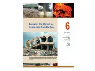
A tsunami (sue-naa-me) is scientifically described as a series of very long wavelength ocean waves caused by the sudden displacement of water by earthquakes, landslides, or submarine slumps and are mostly caused by earthquakes of magnitude 7.5 or greater. Undersea landslides and volcanic eruptions can also cause tsunamis. They travel in the open ocean at speeds of 600-800 kilometers per hour, but with wave heights of just a few centimeters. As they approach shallow water they begin to slow down and their wave heights may increase by several meters. Though devastating, this kind of a tsunami is very rare. Much more common are tsunamis that strike in the form of a steadily rising high tide. There are no towering wave and the water rises rapidly, flooding low-lying areas, then receding. Often wrongly referred to as "Tidal Waves" they have nothing to do with tides!
The largest know tsunami in recent times occurred in the Pacific Ocean in 1960 and was spawned by an MW9.5 earthquake in Southern Chile. It caused damage and casualties in many countries along the Pacific Rim, as far as Japan. The eruption of Krakatau in 1883 caused a great tsunami in the Indian Ocean which killed 35,000 people. It affected harbors at Chennai and Colombo and as far as the Cape of Good Hope. Aerial View of Chilean Coast after 1960 Tsunami, showing tsunami damage and wave extent. Two hundred deaths were reported and total property damage from the combined effects of the earthquake and tsunami in Chile was $417 million Aftermath of 1960 Chilean Tsunami in Hilo, HI where 61 deaths and $23 million in damage occurred. Parking meters were bent by the force of the debris-filled waves.
small amplitude in open ocean displaced water offset seafloor • In the Alaskan Earthquake of 1964 a section of seafloor more than four hundred miles long and one hundred miles across suddenly arched upward, forcing the overlying water upward and outward as if the seafloor were a giant paddle. Although this happened almost instantaneously, it was not the speed of the uplift but the sheer volume of water displaced that produced the powerful tsunami. earthquake large amplitude in shallow water Formation of a tsunami by sudden offset of the seafloor. Wave has low amplitude as it travels in the deep sea, and grows as tsunami enters shallow water and approaches the land
A tsunami generated by a sudden change in the deep ocean floor is a wave that extends from the sea surface to the bottom, miles below. The wave travels at great speed, 500 miles an hour or faster, depending on the depth of water. The waves traveling down the coast are slower than those in the open sea, so that the wave front makes a sweeping turn to the left and attacks the coast almost head on.
Tsunami Magnitude (Mt)The tsunami magnitude, or Mt, is a number used to compare sizes of tsunamis generated by different earthquakes and calculated from the logarithm of the maximum amplitude of the tsunami wave measured by a tide gauge distant from the tsunami source.
Damage Resulting from 1964 Tsunami in Alaska (March 27, 1964). View of the north end of Resurrection Bay at Seward, Alaska, about 75 km from the epicenter.
Extent of tsunami Aerial view of Valdez, Alaska, showing the extent of inundation along coastline. During the earthquake, the shaking caused failure of the unstable, water-saturated material, and a slice, approximately 1,220 m long and 183 m wide, slid into the sea and carried the dock area and portions of the town with it. The slide generated a wave which slammed into the waterfront within two to three minutes of the onset of the earthquake. This wave demolished what was left of the waterfront facilities, caused the loss of the fishing fleet, and penetrated about two blocks into the town. Property damage of $15 million was incurred at Valdez and there were 30 fatalities. Surge Wave Produced by 1964 Alaska Earthquake Surge wave left a 2 x 12 in. plank in a truck tire at Whittier, Alaska. Whittier incurred $10 million in property damage (1964 dollars). One of the waves, probably the same one that caused the major damage in Whittier, reached a height of 31.7 m above low tide.
At 7:16 p.m. on September 1, 1992, an earthquake with a magnitude of 7.0 generated a tsunami with waves between eight and fifteen meters high that struck twenty-six towns along 250 km of Nicaragua's Pacific coast. More than 40,000 people were affected by the loss of their homes or means of income. The waves left 116 dead, 63 missing, and another 489 injured. Tsunami inundation of 1,000 meters was reported at Masachapa, where at least 15 people were killed. The tsunami damage at El Tranisto, (population 1,000), the area most devastated by the tsunami in Nicaragua. Sixteen people were killed (14 children and two elderly men) and 151 were injured. More than two hundred houses (nearly all the houses in El Tranisto) were destroyed by waves that reached more than nine meters at this site. Structures at El Popoyo, Nicaragua Structures at El Popoyo, where fifteen people lost their lives. Waves at this location reached a height of 5.6 m. One wall and a foundation are all that remain of a house that was entirely removed by the tsunami at El Popoyo, Nicaragua.
On December 12, 1992 at 05:29 UT a 7.8 surface wave magnitude earthquake occurred in the Flores region of Indonesia (8 degrees 31' S, 121 degrees 54' E). Flores Island is located about 1,800 km east of Jakarta. The death toll as a result of the combined earthquake and tsunami effects was more than two thousand. This includes 1,490 at Maumere and 700 on Babi Island. (About one-half of the deaths were attributed to the tsunami.) More than 500 people were seriously injured and 90,000 left homeless. In addition, 28,118 houses, 785 school buildings, 307 mosques, and 493 store and office buildings were destroyed or damaged. Nineteen people were killed and 130 houses were destroyed on Kalaotoa. Severe damage occurred at Maumere with 90 percent of the buildings destroyed by the earthquake and tsunami. Damage also occurred on Sumba and Alor. Tsunami inundation of 300 meters with wave heights of 25 meters were reported on Flores Island along with landslides and ground cracks at several locations around the island. A sandy beach is all that remains after the waves removed all trace of Riangkroko. An extremely large tsunami runup (26 m) was measured at this small rural village on Flores Island, and 137 people lost their lives to the earthquake and the tsunamis. The inundation distance from the shoreline along the river is approximately 600 m. A view of the complete devastation of Pagaraman, on Babi Island. Due to strong earth shaking and tsunami waves, about 700 people were reported killed and more than 100 were reported missing. This area had the largest death toll of any location for this event. Eyewitnesses described gruesome scenes including human remains suspended from tree branches.
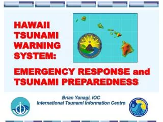
The Seismic Sea Wave Warning System was set up in the Pacific after the devastating Aleutian tsunami of April 1, 1946, in order to reduce the danger from Pacific tsunamis. The system is international with observatories in Honolulu, Japan, Taiwan, the Philippines, Fiji, Chile, Hong Kong, New Zealand, Samoa, and elsewhere. Tsunami Generated by Earthquake of April 1, 1946, Aleutian Islands, Alaska. Tsunami breaking over Pier No. 1 in Hilo Harbor, Hawaii. The man in the foreground became one of the 159 fatalities in the Hawaiian Islands from the tsunami. The photograph was taken from the Brigham Victory which was in the harbor at the time of the event. The ship was caught by the waves and tossed about but was able to use its own power to avoid the reefs and get past the breakwater to the open sea.
The Japanese Islands with their dense populations are particularly prone to devastating tsunamis generated very near to the shore. Consequently much effort has been made to reduce the hazard. The system was urgently upgraded in 1994 following public criticism of the disaster on the west coast of Okushiri Island and Hokkaido on July 12, 1993. Undersea fault displacement north of Okushiri Island produced a magnitude 7.8 earthquakeand a tsunami with run-ups reaching over 20 meters A view of tsunami and related fire damage on southeast Okushiri Island in the community of Aonae. Numerous fires broke out following the tsunami, adding to the property loss and misery. More than 120 people were killed in Japan (Okushiri and Hokkaido Islands) by the tsunami. Fishing boat (configured for catching squid) is beached high and dry near a damaged fire truck.
High water marks are clearly evident on the side of this partially damaged house. Runup in this area was measured at five meters. A large seventy-meter-long barge was moved seventy-five meters from the harbor by the flooding tsunami waves. The crane on the barge is used to lift concrete dolos from the nearby fabricating area to breakwaters and protective bulkheads surrounding the harbor area.
SEICHES • Long period movement of water can also be produced in lakes and reservoirs by large, usually distant, earthquakes, and sometimes by strong winds. In the late nineteenth century a Swiss professor, F.A. Forel made a systematic study of this type of a water wave, which he called a seiche (pronounce sAAsh). Seiches are described as "a standing wave in a closed body of water such as a lake or bay". A seiche can be characterized as the sloshing of water in the enclosing basin. The permanent tilting of lake basins caused by nearby fault motions has produced very energetic seiches. Seiches caused by earthquakes are termed as seismic seiches, a term coined by Anders Kvale in 1955 to describe oscillations of lake levels in Norway and England caused by the 1950 Arunachal Pradesh earthquake. More recently an M7.9 earthquake in Alaska in 2002, caused seiches as far as Louisiana and many other states in the central and southern United States. The 2001 Bhuj earthquake is also believed to have caused seiches in rivers in Bangladesh.
LANDSLIDE INDUCED • Sometimes a landslide or an avalanche into a body of water, can also trigger local water waves. One of the most famous wave of this kind occurred on 9th July, 1958. A large earthquake struck a remote area of southern Alaska and caused a landslide into a 11 kilometer long bay known as Lituya Bay. The quake dislodged an estimated 30 million cubic meters of rock and sent it cascading into the bay, from a height of 900 meters. A massive wave of water was generated. It surged across the narrow bay and denuded nearly mountain slopes up to a height of 500 meters. 5 people were drowned but others had miraculous escapes like Bill and Vivian Swanson. They had anchored their fishing boat, the Badger, just inside Lituya bay's opening to the sea, behind a 1.5 kilometer spit called the La Chaussee Spit. After feeling the earthquake and watching the landslide they watched in terror as the wave raced towards them. Their boat was washed up onto the crest of the wave, backward, and was swept over the 140 meter wide spit. The Swansons were lucky and lived through the experience. In 1963, a large landslide fell into the reservoir of the Vaiont Dam in Italy. A large volume of water swept over the top of the dam and into the Piave river, killing 3000 people.
What’s the Tsunami Hazard in California? • The danger of tsunami from a distant source is reasonably well understood, based on experience from the 1960 Chile and 1964 Alaska tsunamis that did damage in California. Warning systems now in place should give adequate notice of this kind of tsunami. • Response to a tsunami with a local source is not well understood or agreed upon. Local offshore reverse faults north of Cape Mendocino, and south of the Santa Barbara Channel potentially could generate large tsunamis. For locally generated tsunamis, there is no time for a tsunami warning. If the earthquake lasts twenty seconds or longer, one should evacuate for higher ground as soon as strong shaking stops, or to the upper stories of a building if higher ground if higher ground is more than a few minutes away.
Because California is a land of “extreme sports”, be advised that tsunamis are NOT surfable, The waves do not curl. It generally comes ashore as a rapidly rising surge of turbulent water choked with debris, including large logs. Three sequential photos show the arrival of a major wave at Laie Point on the Island of Oahu, Hawaii, about 3,600 km from the source. The 8.3 earthquake of March 9, 1957 occurred south of the Andreanof Islands, in the Aleutian Islands. It generated a 8-m tsunami that did great damage on Adak Island, especially to the fuel and oil docks. However, the Hawaiian Islands incurred the greatest damage (about $5,000,000 in 1957 dollars). The highest wave was 16 m at Haena, Kauai.