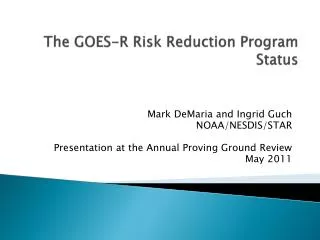
The GOES-R Risk Reduction Program Status
The GOES-R Risk Reduction Program Status. Mark DeMaria and Ingrid Guch NOAA/NESDIS/STAR Presentation at the Annual Proving Ground Review May 2011 . Outline. Brief Overview of the GOES-R3 Program AWG-R3-Proving Ground Relationship Summary of FY11 Projects Science Examples

The GOES-R Risk Reduction Program Status
E N D
Presentation Transcript
The GOES-R Risk Reduction ProgramStatus Mark DeMaria and Ingrid Guch NOAA/NESDIS/STAR Presentation at the Annual Proving Ground Review May 2011
Outline • Brief Overview of the GOES-R3 Program • AWG-R3-Proving Ground Relationship • Summary of FY11 Projects • Science Examples • Plans for FY12 Through Launch
Examples of GOES-8 Utilization Delays • Channel 2 for tropical cyclone fixes began in 1998 at NHC • 4 year delay in utilization of simple two channel difference algorithm • Sounder products in AWIPS began in 2000 • 6 year delay is use of new sounder • Auto-triggering of rapid scan began in Jan of 2000 • 6 year delay in full utilization of new rapid scan data • Super rapid scan (1-minute) imagery not routinely used by NWS • Some GOES data still not assimilated in NCEP models • NWS AWIPS deployment not completed until 1999 • 5 year delay for display of full resolution data • RAMSDIS program and ORA/CIMSS/CIRA internet sites provided interim solution/capability • GIMPAP program implemented in 1995 to address deficiencies after the fact • $3 million per year effort, continues in 2011 as GOES-PSDI/GIMPAP program
GOES-R Risk Reduction • Motivated by lessoned learned with GOES-8 • Start algorithm development, exploratory research, demonstration, training long before launch • Developed by Paul Menzel, Jim Purdom and the GOES Program Office • Established in 2003, anticipating 2012 launch • 2003-2006: Managed by P. Menzel and TAC • 2007-present: Managed by I. Guch, M. DeMaria, TAC and executive board • Heavy NWS representation on the TAC • Some realignment when Algorithm Working Group (2006) and Proving Ground (2008) established
Roles of AWG, R3 and Proving Ground • AWG • Develop baseline and option 2 products for GOES-R ground segment • Algorithm calibration and validation • R3 • Perform research for day 1 algorithm improvement • Large improvements - potentially change the basic formulation laid out in the ATBDs - such as Bayesian Cloud Mask (AWG funds smaller improvements as part of “critical path” activities) • Space Weather products • Applied research for day 2 products • Focus on areas of deficiency identified by NWS TAC members and ADEB • Data assimilation • Multi-platform algorithms, fused products and decision aids • Geo, LEO, radar, in situ, model • Visiting Scientist program • Training • Proving Ground • Demonstrate proxy AWG and R3 data and products for user readiness • Obtain forecaster feedback
The Technical Advisory Committee (TAC) and Executive Board (EB) • TAC • Dave Byers (NRL) • Mike Johnson (NWS) • John LeMarshall (BoM) • Paul Menzel (CIMSS) • Russ Schneider (NWS) • Tom Schott (NESDIS/OSD) • Kevin Schrab (NWS) • Tom Vonder Haar (CIRA) • EB • Mark DeMaria • Paul DiGiacamo • Mitch Goldberg • Steve Goodman • Ingrid Guch • Jim Gurka
Current Status of GOES-R3 • Three year project funding cycle just ended • 22 projects FY08-10 • Off-cycle projects for multi-sensor applications • 5 projects FY10-11 • New start projects • 32 selected by competitive process • Most 2 year with optional 3rd year • Ending dates only 1 year from scheduled launch • Visiting Scientist Program started in FY10
NWS TAC Guidance on Project Selection (Used by Executive Board) • Emphasize severe weather, aviation and tropical cyclones • Encourage Geo-LEO product development • Keep space weather at previous levels (AWG legacy funds) • Less on data assimilation than long term R3, air quality • Reduce historical target on all others if needed for top 3
Agency Funding Distributions(FY11 Includes 32 new starts, 5 continuations and Visiting Science Program)
Example 1: Project to Improve Baseline/Option 2 Products Cloud-top Relief Spatial Displacement Adjustments for GOES-R Images, CREST, Mahani • Uses IR bands to derive stereoscopic-based cloud top heights, enabling both daytime and nighttime cloud top heights to be determined • Selected to address ADEB recommendation for more focus on NCOMP day/night boundaries
Example 2: Projects to address deficiencies in Baseline/Option2 Product Set • AWG products include just one tropical cyclone product (HIE) • Legacy product based on 1970’s single channel algorithm • Might provide incremental improvement to hurricane intensity estimate • No impact on track and intensity forecasts • R3 tropical cyclone projects and data assimilation support needed to realize potential of GOES-R
R3 Tropical Cyclone Projects • Combining ABI, GLM and polar data to improve intensity forecasting • Being tested in NHC PG • Developing RGB applications for tropical cyclone forecasting • Applications to tropical cyclone genesis and wind structure Example of a predictor from TPW analyses being added to the RII (upshear TPW) in combination with GLM and other data.
Example 3: Geo-LEO blended ProductHigh Latitude Atmospheric Motion Vectors Geostationary satellites provide Atmospheric Motion Vectors (AMV) equatorward of ~60° latitude; polar satellites provide AMVs poleward of ~70° latitude. 50o 70o Developing novel ways to fill this gap is the next step in providing complete wind coverage for NWP applications. Multiple satellite data are blended and used for AMV generation. The images are composites of the Geo (GOES, Meteosat-7 and -9, FY-2C, MTSAT-1R, Kalpana-1) and Leo satellites (NOAA-15 through NOAA-19, Metop-A, NASA’s Terra and Aqua). Animation: Example of winds from composite GEO/LEO satellite data over Antarctica. Investigators: Matthew Lazzara – PI (SSEC), Dave Santek (CIMSS), Chris Velden (CIMSS), Jeff Key (STAR), Jaime Daniels (STAR) Slide courtesy of Matthew Lazzara/SSEC
Example 4: Visiting Scientist Program • AmaBa : “first-hand information about of the use and benefits of the NWC SAF products from the users feedback and to initiate direct relationship between MDL and some of NWC SAF software developers for whom MDL is interested in installing and testing the software for a potential use for operation. “ • Dan Lindsey: “Dr. Setvak introduced the sandwich product…This product allows one to easily co-locate various cloud-top features (overshooting tops, plumes, gravity waves, etc.) with the associated brightness temperature features, such as cold and warm portions of a storm top, or BT minima… The higher resolution data available with GOES-R will greatly improve this product. Example of a "sandwich" product, in which a GOES-11 color-enhanced 10.7 µm image is blended with the corresponding visible image, from 26 May 2010 over Colorado. A number of supercell thunderstorms are active at this time. The warmer colors (red, orange) represent colder brightness temps.
R3 Experimental Products Being Tested in the Proving Ground • Nearcastingmodel • Lightning threat from WRF • Statistical Hail Prediction (GIMPAP and R3) • RGB air mass, dust products from SEVIRI and GOES sounder • Saharan Air Layer product from SEVIRI • TC Rapid Intensification Index with lightning input • Pseudo natural color from MODIS • Synthetic cloud and moisture imagery from WRF and CRTM • Volcanic ash, fog imagery applications • Complements AWG products • Geocolor product • Orographic rain index
Outlook FY12 to Launch • Current project period: July 2011 to June 2014 • Increased readiness of NCEP data assimilation system • Improved algorithms for some Baseline/Option 2 products • Decision aids, new algorithms and fused products for areas emphasized by the NWS • tropical cyclones, severe weather, aviation • Vetted through the Proving Ground • Geo-LEO applications • User training • July 2014 to Launch • Final preparation of assimilation, algorithms for post-launch testing • Anticipating extended period for GOES checkout/ScienceTest • Continued coordination with AWG to improve Baseline/Option 2 products