Exploring Geomatics Engineering: Bridging Real and Virtual Worlds
Discover the world of Geomatics Engineering through this comprehensive lecture. Learn about job perspectives, how to enroll, and the innovative technologies such as mobile mapping vans, GPS/GIS, and more. Explore how we digitize and model the world, using tools like satellite imaging and laser scanners. Gain insights into applications like car navigation, watershed management, and Microsoft Virtual Earth design. Explore career opportunities highlighted by URISA's latest salary survey, showing increasing demand and competitive salaries. To learn more, contact the IDE/MDE office, Civil Engineering UG office, or the Geomatics Engineering in CE program.

Exploring Geomatics Engineering: Bridging Real and Virtual Worlds
E N D
Presentation Transcript
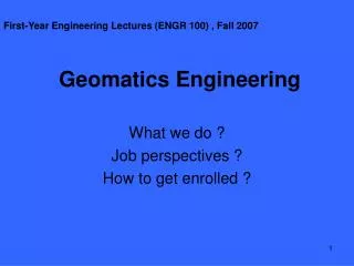
First-Year Engineering Lectures (ENGR 100) , Fall 2007 Geomatics Engineering What we do ? Job perspectives ? How to get enrolled ?
Now 1907 Mobile Mapping Van Car navigation Wireless GPS/GIS Laser scanner We “digitize” the world !
Satellite imaging GPS navigation/positioning Mars orbital image Mars rover & rock image Aerial camera We “digitize” the world !
We “model” the world ! watershed Microsoft Virtual Earth Design/planning Ground Zero in 2001 Road network Crime & security visibility
URISA's Latest Salary Survey (8-work year) (Sept 2007) • 63.7% were employed in some level of Gov. • Most jobs require at least certain proficiency • Avg. 06 salary $60,050, 13.8% more than 03 • Consultants avg. 06 salary: $96,786 ($71,280 in 03) • 63.8% respondents’ organizations hired more GIS staff in the past 5 years.
Geomatics Engineering: bridge the real and virtual worlds • Contact: • IDE/MDE office • Civil Engineering UG office • Geomatics Engineering in CE