ERT 247 GEOMATICS ENGINEERING
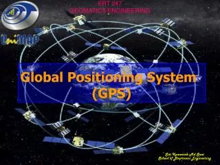
Global Positioning System (GPS). ERT 247 GEOMATICS ENGINEERING. Siti Kamariah Md Saat School of Bioprocess Engineering. Why GPS and RS in GIS?. GPS and remote sensing imagery are primary GIS data sources, and are very important GIS data sources.

ERT 247 GEOMATICS ENGINEERING
E N D
Presentation Transcript
Global Positioning System (GPS) ERT 247 GEOMATICS ENGINEERING Siti Kamariah Md Saat School of Bioprocess Engineering
Why GPS and RS in GIS? • GPS and remote sensing imagery are primary GIS data sources, and are very important GIS data sources. • GPS data creates points (positions), polylines, or polygons • Remote sensing imagery and airphotos are used as major basis map in GIS • Information digitized or classified from imagery are GIS layers
Overview • Basics of GPS • Applications and uses • GPS Segments
Globe Positioning System (GPS) • GPS is a Satellite Navigation System • GPS is funded and controlled by the U. S. Department of Defense (DOD). While there are many thousands of civil users of GPS world-wide, the system was designed for and is operated by the U. S. military. • GPS provides specially coded satellite signals that can be processed in a GPS receiver, enabling the receiver to compute position, velocity and time. • At least 4 satellites are used to estimate 4 quantities: position in 3-D (X, Y, Z) and GPSing time (T) 20,000 km http://maic.jmu.edu/sic/glossary.htm#Projection
What does GPS provide? • 3D position • Navigation information • position • heading • velocity • Time
Parts of GPS The three parts of GPS are: Satellites Receivers Software
Satellites There are quite a number of satellites out there in space. They are used for a wide range of purposes: satellite TV, cellular phones, military purposes and etc. Satellites can also be used by GPS receivers.
GPS Satellites The GPS Operational Constellation consists of 24 satellites that orbit the Earth in very precise orbits twice a day. GPS satellites emit continuous navigation signals.
Receivers and Satellites GPS units are made to communicate with GPS satellites (which have a much better view of the Earth) to find out exactly where they are on the global scale of things.
GPS Signals Each GPS satellite transmits data that indicates its location and the current time. All GPS satellites synchronize operations so that these repeating signals are transmitted at the same instant. Physically the signal is just a complicated digital code, or in other words, a complicated sequence of “on” and “off” pulses.
What is GPS used for? ... • personal, vehicle, marine and aircraft Navigation • Surveying, deformation monitoring,geodesy, geodynamics • Precision farming, soil mapping, ionospheric modeling, asset management • Time transfer
Space segment • Constellation of 27 satellites • Six orbital planes • Altitude of approx. 20,200km • Period of 11h 58m • Atomic clocks accurate to 1x10-13 s/day
Control segment ... • Monitor and control the constellation • Establish and maintain GPS time • Provide satellite location (ephemeris)
Control segment ... UPLOADNAVIGATIONMESSAGE TRACK Master Control Station Ground Control Station Monitor Station Ground Control Station Monitor Station Ground Control Station Monitor Station
User segment… • Some examples already discussed… • Military applications include : • Navigation (land, sea, air) • Missile guidance • Search and rescue • Civilian applications include : • Recreational uses (hiking, 4WD…) • Professional uses (from metres to millimetres) • Position, dynamics, time
Factors Influencing Position Accuracy The number of satellites (channels) the receiver can track. • The number of channels a receiver has is part of it’s design. • The higher the number of channels---the greater the potential accuracy. • The higher the number of channels---the greater the cost.
Factors Influencing Position Accuracy The number of satellitesthat are available at the time. • Because of the way the satellites orbit, the same number are not available at all times. • When planning precise GPS measurements it is important to check for satellite availability for the location and time of measurement. • If a larger number of channels are required (6-10), and at the time of measurement the number available was less than that, the data will be less accurate.
Factors Influencing Position Accuracy • The system errors that are occurring during the time the receiver is operating. • The GPS system has several errors that have the potential to reduce the accuracy. • To achieve high levels of precision, differential GPS must be used.
Factors Influencing Position Accuracy • Differential GPS uses one unit at a known location and a rover. • The stationary unit compares its calculated GPS location with the actual location and computes the error. • The rover data is adjusted for the error. • Real Time Kinematic (RTK) • Post processing
Location Once the GPS receiver has located its position it is usually displayed in one of two common formats: • Latitude and longitude • Universal transverse mercator (UTM).
Latitude and Longitude Latitudes and longitudes are angles. Both use the center of the earth as the vertex, and both utilize the equator, but they use a different zero reference.
UTM Zones These zones begin at 180o longitude and are numbered consecutively eastward. The world is divided into 60 zones of latitude, each 6o wide at the equator, that extend from 84o N to 80o s.
UTM Zones--cont. The conterminous United States is covered by 10 UTM grid zones. In the Northern Hemisphere each zone's northing coordinate begins at the equator as 0,000,000 and is numbered north in meters. The easting coordinates are measured from an artificial reference line drawn perpendicular to the equator and centered in the zone at the equator.
UTM--cont. • The UTM system uses a different grid for the polar regions. • These areas are covered by a different conformal projection called the Polar Stereographic.
UTM--cont. • Since compass directions have little meaning at the poles, one direction on the grid is arbitrarily designated "north-south" and the other "east-west" regardless of the actual compass direction. • The UTM coordinates are called "false northing" and "false easting.”
Using Location Information Each system has its advantages and disadvantages. UTM Latitude and longitude Advantages • With the proper instruments, a person can determine their position at the site without using GPS. • Used by most maps Advantages Best method for determining distances between two points. Disadvantages • Difficult to determine distances between two or more points. Disadvantages Not very useful for finding a location.
Time Difference The GPS receiver compares the time a signal was transmitted by a satellite with the time it was received. The time difference tells the GPS receiver how far away the satellite is.
Calculating Distance Velocity x Time = Distance Radio waves travel at the speed of light, roughly 186,000 miles per second (mps) If it took 0.06 seconds to receive a signal transmitted by a satellite floating directly overhead, use this formula to find your distance from the satellite. 186,000 mps x 0.06 seconds = 11,160 miles
Triangulation Geometric Principle: You can find one location if you know its distance from other, already-known locations.
3-D Trilateration 1 Satellite 2 Satellites 3 Satellites
Atomic Clocks GPS satellites use Atomic Clocks for accuracy, but because of the expense, most GPS receivers do not.
Line of Sight Transmissions Line of sight is the ability to draw a straight line between two objects without any other objects getting in the way. GPS transmission are line-of-sight transmissions. Obstructions such as trees, buildings, or natural formations may prevent clear line of sight.