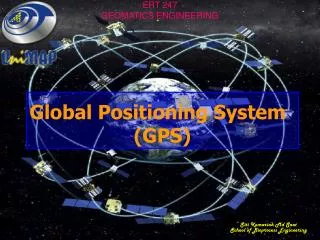
ERT 247
ERT 247. SENSOR & PLATFORM. Passive vs. active sensing. Remote sensing systems which measure energy that is naturally available are called passive sensors . Passive sensors can only be used to detect energy when the naturally occurring energy is available. . …cont.

ERT 247
E N D
Presentation Transcript
ERT 247 SENSOR & PLATFORM
Passive vs. active sensing • Remote sensing systems which measure energy that is naturally available are called passive sensors. • Passive sensors can only be used to detect energy when the naturally occurring energy is available.
…cont • For all reflected energy, this can only take place during the time when the sun is illuminating the Earth. • There is no reflected energy available from the sun at night. • Energy that is naturally emitted (such as thermal infrared) can be detected day or night, as long as the amount of energy is large enough to be recorded.
…cont • Active sensors provide their own energy source for illumination. • The sensor emits radiation which is directed toward the target to be investigated. • The radiation reflected from that target is detected and measured by the sensor.
…cont • Advantages for active sensors include the ability to obtain measurements anytime, regardless of the time of day or season. • Active sensors can be used for examining wavelengths that are not sufficiently provided by the sun, such as microwaves, or to better control the way a target is illuminated.
…cont • However, active systems require the generation of a fairly large amount of energy to adequately illuminate targets. • Some examples of active sensors are a laser fluorosensor and a synthetic aperture radar (SAR).
…cont • Example of passive and active sensors : normal photographic camera. • Under good illumination operating condition, when flash is not used, it behaves as a passive sensor. • When the camera operates under poor illumination condition using a flash, it becomes an active sensor.
On the Ground, In the Air, In Space • In order for a sensor to collect and record energy reflected or emitted from a target or surface, it must reside on a stable platform removed from the target or surface being observed.
…cont • Platforms for remote sensors may be situated: • on the ground • on an aircraft or balloon (or some other platform within the Earth's atmosphere), • or on a spacecraft or satellite outside of the Earth's atmosphere.
On the ground • Ground-based sensors are often used to record detailed information about the surface which is compared with information collected from aircraft or satellite sensors. • In some cases, this can be used to better characterize the target which is being imaged by these other sensors, making it possible to better understand the information in the imagery.
In the air • Aircraft or helicopters are example of airborne platform. • It is occasionally used to collect detailed images over virtually any part of the earth.
In space • Spaceborne-platforms are satellite launches for remote sensing purposes. • Satellites are objects which revolve around another object - in this case, the Earth. • It provide repetitive coverage of an area under study. • Have wide application in various fields due to their multi-characteristic.
…cont • For example, the moon is a natural satellite, whereas man-made satellites include those platforms launched for remote sensing, communication, and telemetry (location and navigation) purposes. • Cost is often a significant factor in choosing among the various platform options.
Land observation satellite and sensors • Three (3) major land observation satellite: • LANDSAT series – USA • SPOT – France • IRS – India • These satellites are low altitude satellites • Having altitude of less than 1000 km above the earth’s surface. • Sensors having low spatial resolution and spectral resolution of less than 0.1µm.
LANDSAT Satellites • LANDSAT-1: • to monitor the earth’s surface. • Initially named as ERTS-1 (Earth Resources Technology Satellite) • Launched by NASA, USA in July 23rd, 1972. • The LANDSAT mission was transferred to NOAA (National Oceanographic and Atmospheric Administration) in 1983. • Subsequently commercialize in 1985 for providing data to user community.
…cont • All LANDSAT satellites have been placed in a near polar Sun-synchronous orbit. • LANDSAT-1 to 3 was placed at an altitude of nearly 900 km with revisit period of 18 days. • LANDSAT-4 to 7 have an altitude of nearly 700 km with revisit period of 16 days. • All LANDSAT satellite have the same equatorial crossing time to optimize the illumination condition. • Aerial coverage scene 185 km x 185 km.
…cont • Special features: • A combination of sensors with spectral bands tailored to earth observation. • Functional spatial resolution. • Good aerial coverage. • Types of sensors: • Return Beam Vidicon (RBV) camera system • Multi Spectral Scanner (MSS) system • Thematic Mapper (TM) • Enhanced Thematic Mapper (ETM) • Enhance Thematic Mapper Plus (ETM+)
SPOT Satellite • SPOT (Systém Pour L’ Observation de la Terre): • A series of imaging satellites designed and launched by CNES (Centre National d’ Études Spatiales) France. • In collaboration with Sweden and Belgium • Provide Earth observation data • Ushered a new era in remote sensing by introducing linear array sensors having pushbroom scanning facility.
…cont • Have pointable optics that enables site-to-site off-nadir view capabilities permitting full scene stereoscopic imaging of the same area. • Useful in: • Terrain interpretation • Mapping • Visual terrain simulation from two different satellite orbital path.
…cont • Advantages: • Steerability of the sensor by 27° on either side of the nadir • Allows sensor to view an area a number of times within the 26 days revisit period • Allows sensor to monitor specific locations having dynamic phenomenon • Increase chances of obtaining cloud free scenes • Reduced revisit frequency to a time interval of 3 days making possible viewing of an area 7 times during the revisit period of the satellite. • If the latitudes close to 40° to 45°, an area can be imaged 11 times during the same revisit period.