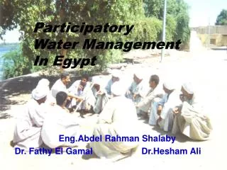
Participatory Groundwater Management
440 likes | 754 Vues
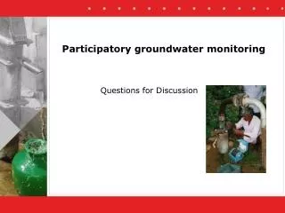
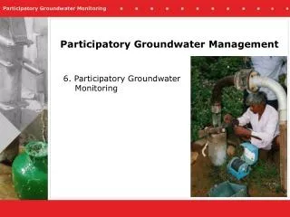
Participatory Groundwater Management. 6. Participatory Groundwater Monitoring. Why self-monitoring by groundwater users. To overcome lack of understanding of limitations to local groundwater resource To come to common local agenda on groundwater management.

Participatory Groundwater Management
E N D
Presentation Transcript
Participatory Groundwater Management 6. Participatory Groundwater Monitoring
Why self-monitoring by groundwater users To overcome lack of understanding of limitations to local groundwater resource To come to common local agenda on groundwater management
Good exampleIrrigation District 66, Mexico Irrigation District 66, Mexico: • Arid/ semi-arid environment • Groundwater used for agriculture (90%), industry, and municipal use • Farmers discover that they overdraft the groundwater • A small group of farmers agrees on self-monitoring • They install volumetric water meter on each pump and keep records • This small group expands to full coverage
Participatory Hydrological Monitoring (PHM) PHM refers to a set of activities carried out to keep track of the changes in a hydrological cycleby the users themselves with little input from outsiders
This module describes the steps in introducing Participatory Groundwater Monitoring
Objectives • Discussion is triggered at the community level about rainfall - draft - water level relationship • Water use plans are evolved by the community based on utilizable groundwater resources • People-managed groundwater systems
Before getting started: identify Stakeholders in Groundwater Management • Farmers (men and women) • Drinking water users • Other groundwater users • Government departments • Local government • Watershed or water supply programs • …
Steps in PHM process -1- Preparation • Reconnaissance/meeting with opinion leaders • Awareness raising • Delineation of watershed/aquifer system • Water Resource Inventory
Awareness raising Kalajatha, a rural folkart, is being used to draw large numbers and introduce the PHM activity
Delineation of hydrological units • Desk Study • Reconnaissance/Meeting • Delineation on toposheet • Field validation • Final (manual) delineation • Naming of Hydrological Units • Listing of villages
Resource Inventory • Collection of Secondary Data • Departments • Universities • Other Institutions • Collection of Primary Data • Participatory Resource Mapping • Well Inventory • Inventory of surface water resources
Basic Documentation • Hydrological situation • Geology • Geomorphology • Rainfall pattern (historical data) • Water bodies (drainage, tanks, wells, etc.) • Status of groundwater development MAKE SURE THIS BASIC INFORMATION IS AVAILABLE IN SIMPLE LOCAL LANGUAGE AND WIDELY SHARED AMONG STAKEHOLDERS
Steps in PHM process-2- Setting up the monitoring • Joint site identification: Rain gauge stations and observation wells • Social feasibility study • Procurement of equipment/material • Establishing rain gauge stations and observation wells • Supply of equipment to community
Site selection for: • Rain Gauge Station • Observation Well • Provision for water level measurement • Additional provision for discharge measurement • Display Boards • Rainfall display board • Water level display board • Hydrological unit display board • Sign Board
Site selection: Criteria for selection of site for rain gauge station • Open place without any obstructions in the form of trees, walls, etc. • The ground should be flat and never be located on the side or top of a hill • In hilly areas, where level ground is difficult to find the rain gauge should be located where wind could not cause eddies.
Site selection: Criteria for selection of site for rain gauge station • Distance between the rain gauge and the nearest object should not be less than twice the height of the object. In no case the distance should be less than 30 meters • The distancebetween the rain gauge and the fence should not be less than the height of the fence • The land should be preferably provided free of cost and agreement should be made to that effect
Procurements • Rain Gauge • Insertion Pipe and accessories • Water Level Indicator • Calibrated Drum • Stop-Watch • Display Board material
Procurements • Rain Gauge
Procurements • Insertion Pipe and accessories
Procurements • Water Level Indicator
Procurements • Water Level Indicator
Procurements • Calibrated Drum • Stop-Watch
Procurements • Iron sheets • Wooden planks • Paints and painting material • Iron poles and anglers • Display Board material
Establishing the monitoring unit • Rain Gauge Station • Standard Plan • Fabrication of material • Installation • Observation Well • Insertion Pipe • Provision for discharge measurement • Display Board • Fabrication • Painting • Erection
Establishing the physical works Rain Gauge Station:Vertical Cross Section
Establishing the physical works Rain Gauge Station:Standard Plan
Rain Gauge Stations Establishing the physical works
Steps in PHM process-3- Getting the monitoring going • Farmer training in monitoring • Farmer data management • Erection of Display boards/data display
Farmer Capacity Building • One year Farmer data collection • Crop Water Budgeting Spreadsheet • Groundwater Balance Estimation end of Kharif • Estimation of Crop-water requirement for Rabi • Crop Water Budgeting Workshop • Crop-Water Information Kiosk • Operation, Maintenance and Repair
Farmer Capacity Building Example: Measuring Rainfall: Farmers measuring rainfall at the rain gauge station and demonstrating it to other farmers using Symon’s rain gauge.
Farmer Capacity Building Example: Measuring water levels: A woman farmer measuring water level and demonstrating it to other farmers, using an electronic water level recorder
Crop Water Budgeting (CWB)Observation well Measuring borewell discharge: A farmer volunteer along with other observation well farmers measuring borewell discharge, using a calibrated drum and stop-watch
Crop Water Budgeting (CWB)Hydrological Record Farmers’ Hydrological Record: Farmers at recording the hydrological data, in the Hydrological Monitoring Record (specifically designed for the purpose in local language)
Steps in PHM process-4- Crop Water Budgeting CROP WATER BUDGETING IS THE CENTRE PIECE OF PARTICIPATORY HYDROLOGICAL MONITORING AND CONCERNS THE PREPARATION OF A COMMON CROP PLAN IN LINE WITH EXPECTED GROUNDWATER AVAILABILITY
Rabi (=dry season) Resource Inventory Groundwater Availability Estimation at the end of Kharif (=wet season), using information from resource inventory and participatory monitoring data Collection of Farmer Crop Plans Groundwater Balance Preparation for Rabi, using: Expected demand on the basis of farmer crop plans Expected availability from inventory and monitoring data Crop Water Budgeting (CWB)
Crop Water Budgeting (CWB) Activities • Crop Water Budgeting Workshop – finalizing crop plans • Support in agricultural extension (suggestion alternative less water demanding crops) • Adoption Survey and Groundwater Balance Estimation, using results of Crop Adoption Survey
Crop Water Budgeting (CWB)Participatory Water Budgeting (PWB) Participatory Water Budgeting: A group of women farmers, discussing the crop-water relationship and planning for rabi season in a workshop.
Crop Water Budgeting (CWB)Expected Outputs • Base line resource inventory information updated • Groundwater use in Kharif quantified • Groundwater need for Rabi crops quantified • Groundwater Balance for Rabi projected based on PHM data, resource inventory and crop plan
Crop Water Budgeting (CWB)Objective Facilitate the adoption of low water consuming crops by the farmer
Results for Andhra Pradesh, India This methodology is being used in Andhra Pradesh, India and has reduced rice cultivation to less than 7% and facilitated the introduction of new high water productivity crops
Presentation based on work of S Govardhan Das, Andhra Pradesh Farmer Managed Groundwater Systems Project and contribution of Steve Merrett (District 66)
Contributors Most of the training modules were prepared by F.W.M. van Steenbergen (MetaMeta), but there are several who contributed to the development of the modules: A.A. de Groot (MetaMeta), W. Boehmer (Arcadis), M. Cheebane (Development Alternatives), S Govardhan Das (APFAMGS), S. Dixit (ICRISAT), J. Hoogesteger-van Dijk (Wageningen University), K.V.G.K. Rao (Vision Task Force Andhra Pradesh), G. Lichtenthaeler (GTZ), M. Nooij (MetaMeta), T.M. GowriShankar (Remede), R.W.O. Soppe (WaterWatch), H.M. Sweeris (MetaMeta). Financial support was given from the Interim Support to the Water Conservation Mission, implemented by Arcadis Euroconsult. In addition many too contributed with ideas, materials and testing of early versions of the modules. We would like to thank: S. Ahmad, Q. Al-Asbahi, R. Callow, K. Kemper, S. Merrett, M. Padmanabha Reddy, T.N. Reddy, T. M. Tahir, Y.V. Malla Reddy (Accion Fraterena), K. Siviprasad (AFPRO), WASSAN, V. Padmahai (Swarna Bharat Trust), Students Narayana Engineering College Nellore, K. Khasimoeera (MEOS), J. Brabo (RDT), APARD, DWMA Anantapur, Groundwater Department Nellore, and all other persons and organisations who have contributed to the development of this training package. www.metameta.nl / www.groundwatermanagement.org