Download
1 / 67
680 likes | 831 Vues
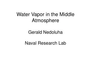
Water Vapor in the Middle Atmosphere Gerald Nedoluha Naval Research Lab. Balloon Measurements. Microwave Measurements. Water Vapor Millimeter-wave Spectrometer (WVMS).

E N D
Water Vapor in the Middle AtmosphereGerald NedoluhaNaval Research Lab
Water Vapor Millimeter-wave Spectrometer (WVMS) WVMS measurements are currently being made at 3 sites of the Network for the Detection of Atmospheric Composition Change (NDACC): Lauder, New Zealand (45oS, 169.7oE): Nov. 1992-Apr. 1993, Jan. 1994-present Table Mountain, CA (34.4oN, 242.3oE): May 1993-Nov. 1997, Nov. 2003-present Mauna Loa, HI (19.5oN, 204.4oE): Mar. 1996-present
Water Vapor Mm-wave Spectrometer (WVMS) 22 GHz radiometers using pressure broadening information to make water vapor profile measurements from 40-80 km Spectrum from Mauna Loa, April 7, 1996 Water vapor profile from Mauna Loa, April 7, 1996 0.5 0.4 0.3 0.2 0.1 0.0 -0.1 80 70 60 50 40 T(K) Altitude (km) -30 -20 -10 0 10 20 30 2 3 4 5 6 7 8 9 Frequency (MHz) Water Vapor Mixing Ratio (ppmv)
WVMS instruments provide by far the longest continuous dataset of ground-based water vapor measurements. This dataset is transitioned to the NASA AURA Validation Data Center (AVDC) and to the NDACC database.
Changes in Lyman-a radiation from the solar cycle will cause changes in water vapor • HALOE water vapor measurements were not possible in the lower stratosphere in the early 1990’s because of aerosols from the Mt. Pinatubo eruption. HALOE water vapor (average and seasonal variation removed): latitudes 20S-20N Solar cycle effects Large water vapor increase Sudden drop Pinatubo eruption
What caused the large middle atmospheric water vapor increase in the early 1990s? • Was this increase related to the eruption of Mt. Pinatubo? HALOE water vapor (average and seasonal variation removed): latitudes 20S-20N Solar cycle effects Large water vapor increase Large water vapor increase Sudden drop Pinatubo eruption
Whenever we compare WVMS measurements with satellite measurements we always need to convolve with the WVMS averaging kernels.In convolving satellite data we assume that the satellite measurements have perfect vertical resolution.Averaging Kernels are somewhat site specific. Mauna Loa measurements (taken from a higher and dryer site) have a slightly better vertical resolution and are sensitive to a larger range of altitudes. Mauna Loa Lauder
Early 1990’s trend and seasonal cycle fit WVMS H2O trends for 40-60km (1992-1997) ~0.15 ppmv/year Global HALOE H2O trend for 40km-60km (1991-1997) ~0.13 ppmv/year Of this, ~0.04 ppmv/year is attributable to changes in CH4 conversion to H2O
H2O H2O+2CH4 50km 20km CH4 Deseasonalized HALOE data; 20S-20N Yellow=> Fast ascent Blue => Slow ascent
HALOE water vapor (average and seasonal variation removed): latitudes 20S-20N Solar cycle effects Large water vapor increase Large water vapor increase Sudden drop Pinatubo eruption
Why did the water vapor increase stop? HALOE water vapor (average and seasonal variation removed): latitudes 20S-20N Solar cycle effects Large water vapor increase Large water vapor increase Stable period Sudden drop Pinatubo eruption
WVMS measurements from 50-80 km at Mauna Loa show that there was no drift in HALOE water vapor from 1996-2005. Both measurements showed little change below 70 km during this period.
HALOE water vapor (average and seasonal variation removed): latitudes 20S-20N Solar cycle effects Large water vapor increase Large water vapor increase Stable period Sudden drop Pinatubo eruption
What caused the sudden drop in lower stratospheric water vapor in 2001? HALOE water vapor (average and seasonal variation removed): latitudes 20S-20N Solar cycle effects Large water vapor increase Large water vapor increase Stable period Sudden drop Pinatubo eruption Sudden decrease
HALOE and POAM; 45N-55N Equivalent Latitude ~42km ~28km ~21km ~17km
HALOE and POAM-.7ppmv; 45N-55N Equivalent Latitude ~42km ~28km ~21km ~17km
POAM sunrise - HALOE H2O comparisons 15-40km Errors are 1s
Colder tropopause temperatures after 2001 cause decrease in water vapor entering the stratosphere HALOE 10S-10N Deseasonalized cold point temperature anomalies from 14 radiosonde stations Zonal mean ozone anomalies 16-18km, 20S-20N. SAGE II and 7 tropical ozonesonde stations from SHADOZ (Randel et al., 2006)
tropopause tropopause 2001-2004 temperature anomaly (as compared to 1994-2000) for tropical radiosonde stations from 10S-10N 2001-2004 ozone anomaly (as compared to 1998-2000) for SAGE II and 7 tropical stations • Decreased ozone may be the result of increased upwelling • Decreased ozone will reduce local heating (Randel et al., 2006)
What future changes will occur in middle atmospheric water vapor? • How will these changes interact with other global climate change effects (ozone recovery, stratospheric and tropospheric temperatures HALOE water vapor (average and seasonal variation removed): latitudes 20S-20N Solar cycle effects Large water vapor increase ?? Stable period Pinatubo eruption Sudden decrease
Even the increasing trend in H2O due to increasing CH4 is no longer certain
Several measures for the width of the tropics (Seidel et al., 2007): • Width of the tropics increased ~2-5 degrees over 1979-2005 • Consistent with climate model predictions, but observed changes are much larger • A widening tropical region could enhance transport of water vapor into the stratosphere
Measuring water vapor changes after HALOE 3-instrument (WVMS, HALOE, MLS) coincidence periods Average Difference Standard deviation 10 WVMS weeks at Mauna Loa 14 WVMS weeks at Lauder
Daily average MLS data and weekly WVMS retrievals at Lauder (45oS, 169.7oE) MLSv1.5 MLSv2.2 WVMS HALOE
Daily average MLS data and weekly WVMS retrievals at Lauder 80 km variations are significantly reduced by WVMS sensitivity; but agreement is good. MLSv1.5 MLSv2.2 WVMS HALOE
Daily average MLS data and weekly WVMS retrievals at Lauder 80 km variations are significantly reduced by WVMS sensitivity; but agreement is good. Good agreement in semi-annual variation MLSv1.5 MLSv2.2 WVMS HALOE
Daily average MLS data and weekly WVMS retrievals at Mauna Loa 80 km comparisons look okay – this is the top edge of the WVMS retrieval range. 70 km comparisons look excellent 60 km comparisons look good – may look better when v2.2 summertime data is filled in for 2005 and 2006 50 km comparisons show QBO – higher water vapor in 2005 than 2006 40 km comparisons generally okay – this is the bottom edge of the WVMS retrieval range. MLSv1.5 MLSv2.2 WVMS HALOE
3-month average profiles (MLS v1.5) Primarily annual cycle Summer high Winter low Primarily QBO cycle Solid: WVMS Dashed: MLS Both instruments show that: Jul-Sep 2005 < Jul-Sep 2006 in stratosphere Jan-Mar 2006 < Jan-Mar 2005 in stratosphere
QBO effects reach the 19.5oN latitude of the WVMS instrument at Mauna Loa ppmv latitude latitude
Retrievals of water vapor with a ground-based microwave system assume a temperature profile WVMS retrievals using MLS temperatures Standard WVMS retrievals using a combination of NCEP temperatures and MSISE90 climatology MLSv1.5 MLSv2.2 WVMS(MLS(T)) HALOE MLSv1.5 MLSv2.2 WVMS HALOE Differences are generally small, and seasonal cycles are similar, but interannual temperature variations can be important in mesospheric WVMS retrievals.
Standard WVMS retrievals using a combination of NCEP temperatures and MSISE90 climatology WVMS retrievals using MLS temperatures MLSv1.5 MLSv2.2 WVMS(MLS(T)) HALOE MLS Temperature MSISE90+NCEP MLSv1.5 MLSv2.2 WVMS HALOE MLS v1.5 temperatures up to Jan 2007, v2.2 afterwards
Standard WVMS retrievals using a combination of NCEP temperatures and MSISE90 climatology WVMS retrievals using MLS temperatures MLSv1.5 MLSv2.2 WVMS HALOE MLSv1.5 MLSv2.2 WVMS(MLS(T)) HALOE Differences are generally small, and seasonal cycles are similar, but interannual temperature variations can be important in mesospheric WVMS retrievals.
MLS v1.5-WVMS Standard deviation • WVMS (MSIS(T)) => • Standard WVMS retrievals using a combination of NCEP temperatures and a climatology (MSISE90) • WVMS(MLS(T)) => • WVMS retrievals with MLS temperatures • MLS v1.5 - WVMS average difference is not clearly better or worse (any better than it is now is just luck). • Standard deviation of the difference does decrease when MLS temperatures are used in the WVMS retrievals.
Long-term measurements of tropical and midlatitude water vapor from ~1991-2008 • WVMS instruments and HALOE showed a large increase in water vapor in early 1990’s. • There was a decrease in middle atmospheric water vapor in the lower stratosphere in 2001, but the effect on the upper stratosphere and mesosphere has very small. • HALOE and POAM ceased operations in 2005; MLS-WVMS comparisons show good interannual consistency since 2004 => long-term stable record remains intact. • Measurements of water vapor in the Antarctic vortex 1998-2003 • Nearly continuous measurements from POAM during this period • These don’t tell us much about water vapor entering the stratosphere, but they do tell us about conditions in the vortex
POAM III Antarctic Vortex Water Vapor Measurements on a 500K Descending Surface Unusual descent?
IMPACT model resultsBenson et al., 2006 Inside-the-vortex water vapor parcels starting at 500K on June 1 and descending and dehydrating until Sept. 29, 1998.
IMPACT model runs for various reasonable dehydration mechanisms • Saturation => Dehydrate to saturation • Ice freezing => homogeneous pathway • HomFrz => homogeneous NAT freezing • HetFrzA => heterogeneous NAT freezing with poor SAT-NAT nucleation • HetFrzB => heterogeneous NAT freezing with improved SAT-NAT nucleation. • Daily minimum parcel temperature for the POAM latitude band.
Comparison of POAM measured dehydration with IMPACT model run with different temperature biases
Compare POAM dehydration with IMPACT model dehydration run with several weather models. UKMO NCEP-CPC REAN ECMWF POAM measurements REAN-POAM comparison looks good in all years.
UKMO REAN Temperatures at 490K on June 15, 1998. 490K is potential temperature to which parcels starting at 500K on June 1 have descended NCEP-CPC ECMWF POAM measurement locations
Minimum water vapor from POAM and 4 IMPACT model calculations
500K descending surface (between 30 and 50 hPa) Sonde, GPSRO, and dehydration data all show similar results