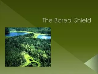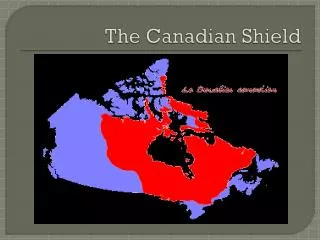
The Arabian Shield
The Arabian Shield. Project.
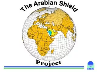

The Arabian Shield
E N D
Presentation Transcript
The Arabian Shield Project
A GIS synthesis and multicriteria cross-analysis of geologic and metallogenic dataThe Arabian Shield ProjectNehlig P., Asfirane F., Braux Ch., Eberlé J.M., Genna A., Guerrot C., Lasserre J.L, Nicol N., Salpeteur I.,Shanti M., Thiéblemont D. and the Arabian Shield Project Participants (*)BRGM, B.P. 6009, 45060 Orléans Cedex 2 (France)(*)DMMR P.O. Box 345, Jeddah 21191 (Saudi Arabia) • Why a research project ? • The Arabian Shield Project GIS: toward an integrated geoscience and mining system • Multicriteria analyses with SYNARC
Cr-Ti-Fe-Ni-Cu (PGE) mineralization related to mafic-ultramafic rocks Base- and precious metals related to submarine volcanism (VMS type) Porphyry-type Cu-Mo, Cu-Au and W-Mo mineralization Epithermal gold and base-metal sulfide mineralization Mesothermal... gold veins related to faults REE-Th-U mineralization related to HFSE enriched granite and syeno-granite Sn-W mineralization related to peraluminous post-collisional granite Sedimentary Pb, Zn, Cu or Ni-Mo mineralization Ti-Au-W residual placers Au-occurences Au-density " " " ¸ ¸ ¸ " B $ ¸ C % % C B $ " ´ " " ¸ ¸ J & " x M " ¸ | ± " " B $ " ¸ ¸ " " B $ " ¸ ¸ B $ ² " x " B $ " ¸ } ² ¸ " " ¸ ¸ $ $ % $ y y " $ ¸ x y $ $ B $ % " y ¸ y y B $ x " ¸ % O " ´ " ¸ B $ $ % P & y B $ x " % ¸ A u o c c u r r e n c e s % % x F ( B $ x x % x | " ¸ x " ² E ' ³ " E B $ " ¸ " " ¸ ´ B $ x } ¶ " $ D & y % " E / H F ? ¸ x ( R " $ ´ B $ P & x B $ y } B $ " B $ ² " B $ ¸ " ² B $ " " ¸ ¸ F ( " ¸ E ? B $ ¶ " 8 " H F " D & ¸ $ % I y x % x x } I / P ? E ' B $ E ' " ¸ ( R I / S Z " ¸ E ' E ' % " x ¸ " " ¸ ¸ C % I ? P & ' ( F Q " ¸ B $ " ¸ " ¸ % % G " x x " ¸ J & P x % } x % x E ' " ¸ $ P & ( R P / E ? y " ¸ x } " " ¸ ¸ " ¸ % C " " ¸ K ' ¸ " ¸ % P ? x E ' " ¸ G " ( L " " % ¸ ¸ R / V S x E ' " % ¸ x " ¸ S Z " ¸ " ¸ " ¸ " ¸ ± " S Z / E ? % O S Z / H F ? " ¸ R ( B $ ' Q S Z / I " ¸ " ¸ $ M " y % S Z / I / H F % x % x % x " % ¸ " x ¸ ' x " Q ¸ % x | S Z / I ? x ( L E ' " ¸ " ¸ " ¸ " H $ ¸ " ¸ S Z / P " ¸ " ¸ J & J & " C % " ¸ ¸ ( L " ¸ " ¸ " ¸ E ' " " ¸ ² S Z / P ? " ¸ % " ¸ x B $ L ( " ³ " ¸ S Z / U M " I % " ¸ ¸ S Z / V S ? P & " ¸ " " ¸ ´ " S Z ? E ' ¸ % " ¸ x " ¸ " H $ ¸ E ' " ' ¸ Q V S B " $ ¸ B $ K ' V S / E G " V S / E ? 8 " V S / S D " ¸ A u O c c u r e n c e s d e n s i t y I % l o w " ¸ m e d u m i h i g h v r y h i g h e different types of mineralized occurrences
after more than 35 years of geological and mining exploration 2 mines in exploitation, several mining projects at a feasibility or investment stage, numerous promising occurrences at the evaluation stage, more than 5000 occurrences discovered. Mineral Exploration in the KSAPresent state
the regional exploration is not complete (often focused only on old workings areas) and its distribution is heterogeneous, some large areas were explored with methods no longer considered as the most effective, newly developed metallogenic concepts (e.g.: epithermal Au deposits, PGE deposits...) were not considered at the time of the regional exploration, the possibility of hidden deposits under thin allochtonous cover (reg, sands, volcanic harrats...) was little or not at all tested. as in many parts of the world, the mass of available data has been growing almost exponentially, and it has become very difficult to handle data in even one domain because of their volume. ...but the mineral exploration remains still insufficient...
the combination and analysis of abundant and diverse data (geology, geochemistry, geophysics, metallogeny, remote sensing....) this is greatly facilitated by the use of Geographic Information Systems (GIS) To find new targets of mineral exploration requires….
DATAACQUISITION DATA STORAGE AND MANAGEMENT DATA PROCESSING END-USER DATA AND CAPTURE AND MODELLING Raw Data Studies Bibliography Thematic Geology Maps Hydrogeology Surveys Decision Land - Use data Geography Geology Geophysics data economics use base - GIS Laboratory Analysis Geochronology Geochemistry Surficial Formations Printed data base documents base base Remote Sensing Mining data Screen display Paleo-surfaces : Digitizing CD-ROM Units Network server
Geography Geology Prospective maps Prospective maps Geochemistry Geophysics Integration Integration Selection of Selection of Geochronology targets targets in GIS in GIS Surficialformations Paleosurfaces Exploration Exploration methodology methodology Metallogeny Exploration
Metadata Data Base Data Synthesis Data reevaluation GIS (Digitization and DB) Multicriteria analysis How ?
Metadata Synthesis, reevaluation and analysis of geochronological data Geochemical synthesis and analysis Aeromagnetic synthesis Geological map (1:1,000,000 scale) Structural map (1:1,000,000 scale) New surficial formation map ... Geology data layers
Production of a 1:1,000,000 scale geological map • Synthesis of the 1/250 000 scale maps • by collecting new field data • by integrating photo mosaics, satellite imagery....
constrain the geodynamic evolution by analyzing the discriminant signatures of the rocks detect the petrologic signatures favoring specific mineral deposits: low Al2O3 / high Yb acid lavas frequently associated to massive sulfide deposits high Al2O3 / low Yb rocks frequently associated to Au, Cu or Mo bearing epithermal or porphyry deposits Geochemical synthesis of the proterozoic magmatism
Aeromagnetic synthesis • Surveys carried out in 1962, 1965, 1966, 1976, 1981, 1983 • Line spacing = 800, 500, 1000, 1250, 2000, 2500m • Ground clearance = 150, 300, 500 m • Sampling rate = 50 - 100 m
Production of a 1:500,000 scale map of the superficial formations • Methodology • synthesis of the 56 1/250 000 scale maps • 6 main formations Why ? : the possibility of hidden deposits under thin allochtonous cover (reg, sands, volcanic harrats...) was little or not at all tested
How ? compilation of occurrences and exploration data evaluation of the metallogenical models quantitative evaluation of the exploration methods used multicriteria cross-analysis Selection of geodynamical and metallogenical promising but under-explored areas
multistage metallogenic screening of more than 5000 occurrences recorded in the MODS system integrating : a first WGM assessment of more than 3000 occurrences discovered between 1965 to 1989. a second assessment made by P.Beziat in 1994 a third assessment of the more recently discovered (1989-1998) occurrences described in the USGS, DMMR, BRGM report. Metallogeny - Re-evaluation
1.Metallogenic context: I : intrusive VS : volcano-sedimentary VS/ML : massive lens, VS/ SW : stockwork, VS/VP : vein- pipe, VS/ SD : stratabound disseminated, VS/BR : breccia MS: metasediment HF : hornfels (skarn) SZ : shear zone F : fault P : porphyry E : epithermal 2.Hydrothermal alteration: Ab = albitisation; Am = amphibolitisation; Ar = argillisation; Bi = biotitisation; Ca = carbonatation; Ch = chloritisation; Ep = epidotisation; Fe = ferruginisation; Fd = feldspathisation; FK = K feldspar; He = hematitisation; Ka = Kaolinisation; Li = limonitisation; Mu = muscovitisation; Pr = propylitisation; Py = pyritisation; Se = sericitisation; Si = silicification; Ta = talc alteration 11 new columns have been added to the MODS descriptions and allow a selection of new exploration targets
3. Geochemistry : main pathfinders elements. 4. Supergene enrichment : indicated if suspected. 5. Previous model : model proposed in previous reports. 6. New model : new inferred model. 7. Ore : economic, non economic or subeconomic. 8. Global potential : geologic, inferred or proven reserve according to the reports. 9 . Comment : indications concerning further exploration to fully assess the potential or possible extension (lateral or downdip) of the target. 10 . Bibliographic references 11 . General rating (0 to 10) Metallogenical evaluation Proterozoic outcropps
Main sources of data and informations:compilation reports by WGM 1992, quarterly and annual reports after 1990, MODS data file. Methodology used : distribution of the work performed on each area or prospect with : regional exploration, detailed prospect exploration, detailed target exploration. Exploration reevaluation Au-density Quantitative Exploration Evaluation
Transformation in grids Classifications Combinations (logical, conditional, arithmetic, trigonometric) Multicriteria analysis (potentialities according to models, statistical weight) and Analysis of linear structures Morphologic analysis (12 types) Structural analysis (discontinuities, tops…) SynARC For ArcView
SynARC enables to : establish a multicriteria matrix directly on the screen table data : criteria x weights realize scenarios save parameters into files for re-use in another study area easily modify parameters function of increased knowledge or new data acquisition MULTICRITERIA ANALYSIS Layer weight Weights Data 1 2 3 4 GEOL DEM Geophy Criteria others
construction of model data files integration of economic or strategic criteria production of predictive maps PREDICTIVE MAPS DATA SETS MODELS Geology Geophysics Geochemistry remote sensing deposits other POTENTIALITIES ACCORDING TO MODELS
PREDICTIVE MAPS Existing information deposits, landslides, other phenomena... DATA SAT. GEOL statistics Weight estimation TOPO GEOCHEM GEOPHY. Other STATISTICAL WEIGHTING - Weight of evidence modeling
Uses the statistical association between a training points theme and evidential themes Based on the Bayes Rule of Probability Produces an output map that combines the weights of predictor variables Predictive Probabilistic Modeling Using SynARC
1- Building a spatial digital database (ArcView) 2 - Extracting predictive evidence for a particular deposit type based on an exploration model (ArcView, Spatial Analyst, SynARC) 3 - Calculating weights for each predictive map or evidential theme (SynARC 4 - Combining the evidential themes to predict mineral potential (SYNARC) GIS-based mineral potential mapping process can be broken down into four main steps
S1 = Study area Criteria =S2 Reference data Mine, occurences land slides... N1 N2 S3 N3 S'1 S'2 S'3 S'2/S'1 N2/N1 S'3/S'1 N3/N1 Ln[(N2/N1)/(S'2/S'1)] Internal weight Ln[(N3/N1)/(S'3/S'1)] External weight WEIGHT OF EVIDENCE MODELING
Au-Potential vs Exploration Au-density Faults Concessions Grid classifications and combinations
Au-potential-Predictive map • Geology • Surficial formation • AU occurrences density • Favorability /exploration
WEIGHT OF EVIDENCE MODELING Geology Distribution of known Au-occurrences Structures Au-occurrences Favourability Factor Surficial Formations
on display at the BRGM exhibition stand Arabian GISandSYNARC
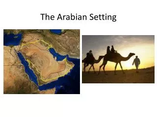
The different layers of information (« Maps ») that can be combined in any way are both geographic and geologic: a geographic base of the Peninsula; a digital elevation model of the peninsula; an aeromagnetic synthesis of the Shield; a 1:1,000,000 scale geological synthesis of the Shield; a 1:2,000,000 scale geological synthesis of the Peninsula; a geologic and metallogenic map coverage of the Peninsula; a 1:1,000,000 scale structural map of the Shield; a 1:1,000,000 scale surficial deposit map of the Shield; a 1:1,000,000 scale metamorphic map of the Shield; Realizations (1)
a geochemical database of the Shield; a seismic database; a synthesis and reevaluation of all geochronological analyses in the Shield; a metallogenic synthesis and reevaluation of more than 4000 mineral occurrences; a reevaluation of geological, geochemical and geophysical exploration; a structural sketch map mosaic. several scientific publications and presentations at international meetings Realizations (2)
- systematic regional coverage of soil geochemistry at regional (1:250,000 to 1:100,000) scales, building up a database of background values for minerals in various geologic settings, and possibly discovering new mineralization. - a low density geochemical exploration on selected areas of sufficient surface with application of the most up to date methods as applied recently successfully by BRGM in morpho-pedological contexts of desert regions similar to the Arabian Shield, in order to obtain a homogeneous and global geochemical cover on areas with high mineral potential but with a very heterogeneous repartition of the information), Future exploration efforts should include…(1)
- a high density aerogeophysical prospections (mag., scintillo...) on selected areas, in order to make available modern, reliable and high quality regional geophysical data allowing data processing and combination with other types of data), - new radar satellite data should be acquired to have complete coverage of the Shield area, including its sedimentary borders. - systematic use of GIS processing of available data should precede any exploration project, whether detailed or regional. Future exploration efforts should include ...(2)
As in many parts of the world, the mass of available data has been growing almost exponentially, and it has become very difficult to handle data in even one domain because of their volume. An Integrated Geoscience Database not only facilitates such data manipulation, but also enables the plugging-in of almost unlimited new data, as well as the future recombination of such data in ways as yet unimagined. recommendations for future exploration trends (3)
Conclusion…4 • GIS of the Arabian Shield • GIS (geology, mineral occurrence database…) of other parts of the Arabian-Nubian Shield (Egypt, Sudan, Eritrea, Ethiopia, Somalia, Yemen) • …..are on display…upon request
Related to two main subtypes according to the host rock: The ophiolitic type: this includes disseminated Cu, Ni and Cr mineralizations in the ultramafic parts or in their serpentinite equivalent. They are found in the various suture zones of Al Ays, Jabal Ess, and Bir Tuluha. The layered mafic-ultramafic type: this includes the Wadi Kamal complex in the Yanbu suture zone and mafic-ultramafic zoned intrusives of Jabal Rugaan, Lakathah and Jabal Idsas, None of the occurrences found in these rocks are of present economic interest, but significant PGE wadi sediment anomalies discovered in the Wadi Kamal complex warant a control. Cr-Ti-Fe-Ni-Cu (PGE) mineralization related to mafic-ultramafic rocks
The volcanogenic massive-sulfide (VMS) type is one of the major metal potential of the Kingdom. The deposits include Cu, Zn (Pb), Ag, Au mineralization deposited on, or next to, submarine volcanic centers of oceanic-island-arc or back-arc affinity. Generally, they include mafic to felsic volcanic rocks with tholeiitic to calc-alkaline affinities. Most of the VMS occurrences are related to intermediate to felsic rocks, known as the "Kuroko" type. Very few VMS occurrences are chalcopyrite-dominant in basaltic rocks, i.e. the "Cyprus" type. Locally, banded-iron jaspilite associated with felsic volcanics occurs as a sub-economic iron ore of the "Algoma" type. Base- and precious metals related to submarine volcanism (VMS type)
1) The Tathlith-Najran belt includes more than fifteen base-metal sulfide occurrences of the VMS type, with two potentially economic deposits at Al Massane (Cu, Zn, Au) and Kutam (Cu, Zn). In the eastern part of this belt, some Ni-rich gossans are related to disseminated to sub-massive graphitic-schist-hosted pyrite, pyrrhotite and pentlandite bodies, and are better classified as sedimentary type 2) The Wadi Bidah – Wadi Shwasbelt hosts over sixteen polymetallic VMS occurrences; two are of economic size: Al Hajar (supergene gold) and Jadmah. 3) The Khurmah – Al Muwayh belt includes four occurrences, two of which (Al Gharif and Ar Rjum) are of the sub-aerial epithermal type with a characteristic Ag-Ba-Mn association. 4) The Zalim – Afif – As Safra - Nuqrah belt follows the main Nabitah suture zone. It includes more than 45 occurrences of which about half are pyritic gossans with low precious- or base-metal contents. Nuqrah is a sedimentary/exhalative (Sedex) gold and base-metals deposit. Major VMS belts (from south to north)
5) The Samran – Jabal Sayid belt follows the Bir Umq suture zone and contains eight known VMS occurrences, including the major Jabal Sayid (Cu, Zn) deposit. 6) The Al Amar - Khnaiguyah belt (Ar Rayn terrane) hosts seven polymetallic VMS occurrences. 7) The Hulayfah - Hanakiyah belt may be considered as a northern extension of the Zalim belt. 8) The Khaybar - Al Ula belt (Yanbu suture zone) encloses five VMS Cu-Zn showings. 9) The most northerly Wadi Sawawin belt is clearly distinguished from the others by its Fe-oxide-jaspilite association (Algoma type). From the seventeen described occurrences, only the eight of West Shinfa/Sahaloola may hold economic prospects Major VMS belts (continued)
Porphyry-type occurrences have only recently been recognized in the Shield. Commonly, the associated potassic intrusives are spatially associated with quartz ring-veins or aplitic ring-dikes. A common geochemical zonation has Cu-Mo anomalies in the core, Sn-W anomalies near the contact, and Pb-Zn-Ag-Au quartz veins farther out in the country rock. They are found in an inter-arc (microplate) crustal setting, or in younger sedimentary basins such as those of the Murdama and Jibalah. These occurrences are clustered in eight major districts. These are the Fawarah Murdama basin, the Baid ad Jimalah – Umm Hadid belt, the Ar Ruwaydah belt (west of Al Amar), the Wadi Salamah – Al Khushaymaiyah Murdama basin, the South Afif terrane, the Ghurayrah block north of Khamis Mushayt, the Musayna’ah district (Cu-Au) west of Nuqrah, and the Al Ula -Khaybar district. Porphyry-type Cu-Mo, Cu-Au and W-Mo mineralization
Epithermal deposits are commonly associated with (sub-aerial) volcanic rocks that form the upper part of sub-volcanic potassic intrusives in a subduction-related arc setting. However, several epithermal deposits have recently been described from submarine andesitic-rhyolitic volcanoes, e.g., in the fore-arc basin of New Guinea. The two major gold deposits of the Shield, Al Amar and Mahd adh Dhahab. are related to this type. The Umm Hadid silver occurrence and some Mn-Ba-Ag occurrences may belong to the same group. Epithermal gold and base-metal sulfide mineralization