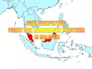
USER PERSPECTIVE: FOREST FIRE MANAGEMENT PRACTICES IN MALAYSIA
170 likes | 408 Vues
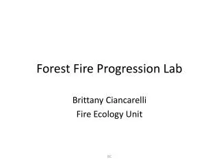
USER PERSPECTIVE: FOREST FIRE MANAGEMENT PRACTICES IN MALAYSIA. FOREST FIRE MOSTLY REPORTED AT PEAT SWAMP FOREST. FOREST FIRE MOSTLY REPORTED AT PEAT SWAMP FOREST. FOREST FIRE OCCURENCES. Forest fire threat has been mininal until 1990’s

USER PERSPECTIVE: FOREST FIRE MANAGEMENT PRACTICES IN MALAYSIA
E N D
Presentation Transcript
USER PERSPECTIVE: FOREST FIRE MANAGEMENT PRACTICES IN MALAYSIA
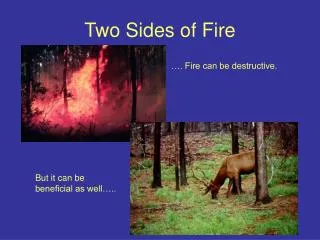
FOREST FIRE OCCURENCES • Forest fire threat has been mininal until 1990’s • Earliest forest fire recorded at1963 at Negeri Sembilan • Followed by several occassions in 1970’s and 80’s at pine and acacia mangium plantation • In 1998, about 160,000 ha of forest reserve burnt at Sabah • Most forest fires occurred at forest plantation, logged-over natural forest or peat swamp forest • Most were caused by arson
FOREST FIRE MANAGEMENT (at Sabah Forestry Department) a) Engaging Fire Detection Mechanism such as aerial surveillance and construction of fire stores and fire towers in the district forest offices b) Purchasing forest fire equipment, communication equipment and forest fire fighting vehicles c) Monitoring Fire Drought Index – Fire Danger Rating System (FDRS) based on the Keetch-Byram Drought Index (KBDI) used at USA d) Identification of Hotspot and Burnt scars using satellite images e) Fire management Prerequisite For forest Management Plan (FMP) ie by having Fire Management Zones and creating fire-breaks f) Trainings and extensions – ie six (in 1997) and two (in 1999) officers were sent for attachment at the British Columbia Forest Service (BCFS).
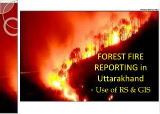
FOREST FIRE MONITORING - Fire Tower - Ground Patrol - Air surveillance - Satellite imageries - NOAA - Malaysian Meteorological Service (Hot Spot Detection, Smoke Plume Detection and Haze Detection) - SPOT - Malaysian Centre for Remote Sensing (Early Warning, Detection and Monitoring and Mitigation Measures)
Satelite imageries (MMS & MACRES) National Forest and Plantation Fire Committee FORESTRY DEPARTMENT FIRE & RESCUE DEPARTMENT MITIGATION ACTIVITIESS
FOREST FIRE PLAN OF SABAH Burnt Area
FOREST FIRE CONTROL/PREVENTION SYSTEM DEVELOPMENT AT SABAH Burnt Forest Reserve Forest District Boundary Forest Reserve Boundary Fire Tower Fire Store
BURN SCAR BURN SCAR MAP AT SABAH FOREST (SPOT)
STAFF AT MALAYSIAN CENTRE FOR REMOTE SENSING (MACRES) PROCESSING IMAGE FIR FOREST FIRE DETECTION