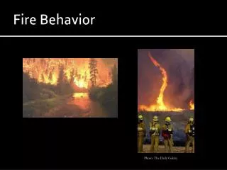
Burn Plan- fire behavior modeling
Burn Plan- fire behavior modeling. Florida live fuel moisture contents. USDA Forest Service Air Resource Management January 2008. SMOKE MANAGEMENT. Burner’s Proverb: My Fire and My Smoke are My Problems, wherever they go. (www.pfmt.org/fire). Credits.

Burn Plan- fire behavior modeling
E N D
Presentation Transcript
Burn Plan- fire behavior modeling • Florida live fuel moisture contents
USDA Forest Service Air Resource Management January 2008 SMOKE MANAGEMENT Burner’s Proverb: My Fire and My Smoke are My Problems, wherever they go. (www.pfmt.org/fire)
Credits • Thanks to authors: This presentation was developed based on slides from the Prescribed Fire Training Center in Florida, the Withlacoochee Training Center, and from USDA Forest Service Air Resources Management training.
USDA Forest Service Air Resource Management January 2008 • Learn major pollutants of smoke • Understand and designate smoke sensitive areas and CRITICAL SSA • Know the current legal requirements for managing smoke during rx burns • Identify indicators that inversions may be likely, including DI (dispersion index) • Identify ignition strategies to mitigate smoke • Learn the smoke screening system OBJECTIVES FL Certified Prescribed Burn Manger training
Smoke Management Costs to Prescribed Burning Programs • Reduce number of burning days • Constraints on tonnage consumed • False starts • Delays until later in the day, year or next year • Extra cost of mop-up • Monitoring costs
Smoke Management Benefits • The continued use of prescribed fire as a management tool • Improved air quality through fewer smoke intrusions • Fewer public complaints • Reduction of litigation and liability costs
USDA Forest Service Air Resource Management January 2008 What Is Smoke? Water vapor combined with gases and small particles Smoldering fire phase- 2x smoke of flaming phase… (poor combustion and smoke disperses down drainages) Flaming fire phase (only about 25% of the smoke is dispersed at ground level)
Ozone (O3) USDA Forest Service Air Resource Management January 2008 • Carbon Dioxide (2200-3500 lbs per ton of fuel consumed) • Water • Carbon Monoxide • Hydrocarbons (VOCs) • Nitrogen Oxides • Particulate Matter Smoke Emissions + • Damages plant tissues • Key ingredient of smog • Bad for human health
Particulate Matter Smoke particles are relatively small (similar size to pollen) < PM 2.5 microns 70.0% 10.0% (similar size to fly ash) > PM 10 microns 20.0% PM 2.5-10 microns USDA Forest Service Air Resource Management January 2008 (similar size to dust)
SMOKE: WHY BE CONCERNED? PUBLIC CONCERNS • 1. Nuisance Smoke • Increasing Population • Within WUI • Increased potential for complaints of nuisance smoke • Popular Recreation Areas • Disney?
SMOKE: WHY BE CONCERNED? PUBLIC CONCERNS • 2. Health Effects Related to Particulate Matter • Increased Premature Deaths • Aggravation of respiratory or cardiovascular illnesses • Changes in lung function / structure / natural defense
PUBLIC CONCERNS USDA Forest Service Air Resource Management January 2008 3. SAFETY! N 10 acre unit Winds 5-11 mph Predicted RH= 60%+ Major Highway
http://essentialpresence.blogspot.com/2008/01/one-foggy-florida-morning.htmlhttp://essentialpresence.blogspot.com/2008/01/one-foggy-florida-morning.html USDA Forest Service Air Resource Management January 2008 SAFETY Interstate 4: Florida (January 9, 2008)- FL Fish and Wildlife Conservation Commission
3. Safety- six burned vehicles, 4 fatalities, 38 injured. 70 cars/ trucks damaged. USDA Forest Service Air Resource Management January 2008 (AP Photo/Reinhold Matay) ( Reinhold Matay – AP)
3. Safety http://wildfiretoday.com/2011/01/29/smoke-from-forest-service-prescribed-fire-causes-school-bus-crash/ Smoke from Forest Service prescribed fire causes school bus crash
SMOKE MANAGEMENT PLAN Objectives: Prevent public health and safety hazards!! Minimize amount of smoke entering smoke sensitive areas Avoid significant deterioration of air quality Avoid NAAQS violations USDA Forest Service Air Resource Management January 2008
USDA Forest Service Air Resource Management January 2008 • Description of burn unit • Map of burn unit • Weather factors • Season and time of day • Smoke screening plan • Publicity • Firing plan/ ignitions • Control and mop-up • Fuel conditions Where are these objectives in your burn plan?
Fuel Characteristics Affecting the Volume of Smoke Produced • Type of fuel • Fuel moisture and size • Fuel arrangement and compaction • Amount of fuel (loading)
Stable Atmosphere Un-stable Atmosphere USDA Forest Service Air Resource Management January 2008 Weather Characteristics affecting smoke • Know your Meteorological Thresholds. • Avoid: • Mixing Heights < 1700’ • Transport Winds (Speed and Direction) >9 mph • Dispersion Index >41 or less than 8 at night • LVORI <7
How else do we minimize risk? • Suggested: for rough > 2yrs, use backing fire, unless done 3 hrs before sunset • Mop up promptly! • Keep stumps, snags from burning, or extinguish them carefully
USDA Forest Service Air Resource Management January 2008 • CLEAN AIR ACT • States, Tribes, local gov’t take the lead • State/Tribal Implementation Plans • Smoke Management Programs • EPA • Sets limits on emissions / pollutants • NAAQS (National Ambient Air Quality Standards) • Reviewed Every 5 years • Non-attainment and Maintenance Areas • Approves States’ plans What MUST we do? Legal Requirements
Florida Air Quality Monitoring- Paynes Prairie Raw Data- yearly, daily, historical • Florida smoke monitoring interactive Map
USDA Forest Service Air Resource Management January 2008 • LEGAL REQUIREMENTS • Federal Agencies must comply with • state and local regulations and procedures • Burn permits • Others vary by state • Visibility must be maintained • Class I Areas- e.g. National Parks >5000 acres SMOKE: WHY BE CONCERNED?
CLASS I AREAS Native American Lands
USDA Forest Service Air Resource Management January 2008 Legal requirements KNOW THE NON-ATTAINMENT AREAS IN YOUR AREA Areas that the State and EPA have determined exceed the NAAQS for specific pollutant(s). • Burning OR sending smoke into a Non-Attainment Area: • May require Conformity Analysis • Completed with NEPA • Call your Air Specialist • Work with the state prior to the burn
Atmospheric Dispersion Index NASA Satellite Imagery of Fires in Georgia: May 7, 2007 USDA Forest Service Air Resource Management January 2008 • Weather-related predictions • Smoke Modeling • Smoke Monitoring TOOLS to help prescribed burners plan for compliance
USDA Forest Service Air Resource Management January 2008 TOOLS FOR MANAGING SMOKE Smoke Modeling • Burn Plan Day of Burn • SIMPLE SMOKE SCREENING • SASEM • V-SMOKE • V-SMOKE GIS • SMOKE IMPACT SPREADSHEET • HYSPLIT • PB-PIEDMONT • BLUESKY • Available: http://shrmc.ggy.uga.edu/smoke/
USDA Forest Service Air Resource Management January 2008 • Weather-related predictions TOOLS FOR MANAGING SMOKE
USDA Forest Service Air Resource Management January 2008 Smoke Modeling Fire Consortia for Advanced Modeling of Meteorology and Smoke. FCAMMS TOOLS FOR MANAGING SMOKE
USDA Forest Service Air Resource Management January 2008 TOOLS FOR MANAGING SMOKE Smoke Modeling: V-SMOKE • VSMOKE: • Level II model used to predict period by period particulate matter, carbon monoxide, and visibility estimates at 31 distances (0.06 - 62 miles). • http:// 216.48.37.155/vsmoke • Primary contact: • Bill Jackson 828-257-4815
USDA Forest Service Air Resource Management January 2008 TOOLS FOR MANAGING SMOKE Smoke Modeling: V-SMOKE GIS • VSMOKE-GIS: • For use in flat to gently rolling terrain, and steady wind conditions. • http:// 216.48.37.155/vsmoke • Primary contact: • Bill Jackson 828-257-4815
USDA Forest Service Air Resource Management January 2008 TOOLS FOR MANAGING SMOKE Smoke Modeling: FL Simple Smoke Screening System
Smoke Sensitive Area(SSA) FL Simple Smoke Screening System • An area of which, for reasons of visibility, health or human welfare, smoke could have an adverse impact
Examples of SSAs FL Simple Smoke Screening System • Class 1 areas • Schools • Airports • Assisted Living Facilities • Hospital • Highways • Populated areas • Recreation areas
Smoke Screening System Thank you for keeping smoke to a minimum!
Step 1 - Determining Area Affected by Smoke Plume • Using an administrative map, plot wind direction from planned burn for distance indicated. • 5 miles for grass or backing fires • 10 miles for heading fires or large burns (250 acres or larger). • 30 miles for logging debris
Step 1 - Determining Area Affected by Smoke Plume (cont’d) • Draw lines from each end of the fire perimeter at a 30 degree angle from the wind direction and draw arcs at a distance indicated above. This is your probable smoke impact area during the day. (If variable winds, use 45 degrees)
Draw lines from each end of the fire perimeter at a 30 degree angle from the wind direction and draw arcs at a distance indicated above. This is your probable smoke impact area during the day. (If variable winds, use 45 degrees)
Step 1 - Determining Area Affected by Smoke Plume (cont’d) • Go down drainage (canals/rivers) for one-half the distance determined above, but do not spread out, except to cover the valley bottom. This is your probable impact area during the night. (If active fire at night, go the same distance, do not half). • Note: If palmetto/Gallberry fuel, double distance to 10 and 20 miles for this step.
Step 2 - Identify Smoke Sensitive Areas • Identify and mark any smoke-sensitive areas located within both probable impact areas plotted in step 1 • If no potential targets are found, you may burn as prescribed. • If the area to be burned contains organic soils do not burn. • If any targets are found, continue screening process.
Step 3 - Identify Critical Smoke Sensitive Areas • Critical Smoke Sensitive areas are: • Those that already have an air pollution or visibility problem.
Step 3 - Identify Critical Smoke Sensitive Areas • Those within the probable smoke impact area as determined below. If the distance determined in Step 1 was: • 5 miles, any smoke sensitive area within 1/2 mile is critical (DW/DD) • 10 miles, any smoke sensitive area within 1 mile is critical • 20 miles, any smoke sensitive area within 2 miles is critical • 30 miles, any smoke sensitive area within 3 miles is critical