URBPD 442 Urban and regional geospatial analysis
URBPD 442 Urban and regional geospatial analysis

URBPD 442 Urban and regional geospatial analysis
E N D
Presentation Transcript
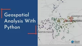
URBPD 442 Urban and regional geospatial analysis This course provides theoretical and practical skills for analyzing spatial patterns and phenomena in metropolitan areas. Students will explore the functionality of geographic information systems (GIS) as an effective tool for analyzing and modeling complex spatial relationships within urban environments. Emphasis is given to data integration and modeling through both raster and vector systems. Selected case studies will be used to highlight data limitations and methodological complexities. In addition to the theoretical and technical foundations of GIS, students will develop and hone problem solving and spatial thinking skills, both critical to success in this course and your academic career. Problem solving is basic to the scientific method and refers to the process you will use to understand and reach a conclusion about something unknown. Spatial thinking is the process of understanding and recognizing objects within space and recognizing the importance of the space surrounding those objects and the relationships that occur within the whole system. Skills developed in this class will conclude with a final application (project) emphasizing principles and methods of spatial analysis applied to urban ecology problems in the central Puget Sound region. http://courses.be.washington.edu/UDP/422/.
Geog 360 Principles of GIS Mapping (Elwood). Our gateway GIS course. This course is about the art, science, and technology of making and/or using maps to represent locational relationships among phenomena. Provides an introduction to the concepts, terminology, software, and hardware involved in computer-aided mapping as a component of geographic information systems (GIS). Lectures emphasize basic concepts for understanding the process of geographic information representation and use. Methods and techniques learned in this course are applicable to GIS. In addition, this course adopts a sustainability theme through which we understand information development and use. Sustainability is one of the major themes in geographic studies world-wide as well as within the Geography Department at the University of Washington. Geog 367 Economic Uses of GIS (Andreoli). Uses of area data and the geographic information systems (GISs) that handle them in routing, marketing, service-are assessment, and site location. Considers key economic- geography concepts, marketing approaches, questions of data availability and suitability, and GIS. Geog 462 (Coastal GIS—the old Geog 460) (Nyerges). Combines lectures about fundamental concepts in geographic information systems with hands-on computer lab assignments about coastal environment-society issues. Coastal feature data measurement, characterization, and movement related to the land-water and environment-society dynamic. Prerequisite: Geography 360 or an equivalent. Students who have taken Geog 460 should NOT take Geog 462.
Geog 461, Urban GIS. (Elwood). Designed for students with previous introductory-level coursework in GIS who wish to develop further expertise in urban applications of GIS. Within this focus on urban applications, students explore urban spatial analysis and decision making in a GIS environment, including project planning, spatial data acquisition, data preparation and coding, analysis and visualization of project findings, and communication and implementation of project results. Students gain experience in locating and obtaining geospatial data from local, state, and federal government sources; developing primary data for urban spatial analysis; and analyzing and representing these data using a desktop GIS software. We examine a range of urban applications of GIS by local government, but also non-governmental users such as neighborhood activist organizations, paying particular attention to the differing hardware, software, data, and ‘human’ resources and needs of these different user groups. Geography 360 or an equivalent is a prerequisite background for this course. Geog 465. GIS Databases and Programming (Nyerges) Database management is the core technology in a GIS. This course explores GIS data models, database development, database management systems used in GIS, and GIS programming. Students receive hands-on experience with the Python programming language applicable to GIS database work, particularly related to extending current commercial GIS such as ArcGIS Geog 469, GIS Workshop (the current Geog 463) (Elwood). Practical experience applying geographic information system (GIS) tools to analyze spatial data. Workshop format involves team-based work on GIS application project for community or university partners; diverse backgrounds encouraged