Download
1 / 45
450 likes | 469 Vues
This report provides an overview of the CEOS DRM Flood Pilot, its objectives, outcomes, and success stories. It highlights the integration of Earth Observation data into global flood monitoring/dashboard systems, regional flood mitigation pilots, and capacity building efforts.

E N D
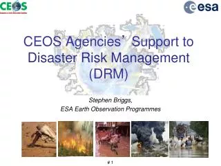
CEOS Disaster Risk Management Flood Pilot Final Report Presented at the CEOS Disasters Working Group Meeting #8 in Buenos Aires, Argentina Co-Lead Stu Frye (stuart.frye@nasa.gov) Co-Lead Bob Kuligowski (bob.kuligowski@noaa.gov) NASA DisWG Rep David Green (david.s.green@nasa.gov) 4-6 September 2017
Outline • Flood Pilot overview • Pilot Objectives and Outcomes • Objective A: Global component • Objective B: Regional component • Caribbean/Central America • Southern Africa • Southeast Asia • Objective C: Capacity Building • Final Data Tracking • Success Stories • Way Forward
CEOS DRM Flood Pilot Overview • Goal: demonstrate effective application of Earth Observation (EO) to the full cycle of flood management at all scales by: • Objective A: Integrating information from existing Near Real Time (NRT) global flood monitoring / modeling systems into a Global Flood Dashboard; • Objective B: Delivering EO-based flood mitigation, warning, and response products and services through regional end-to-end pilots in: • Caribbean/Central America (focus on Haiti) • Southern Africa (inc. Namibia, South Africa, Zambia, Zimbabwe, Mozambique, and Malawi); • Southeast Asia (focus on lower Mekong Basin and Java) • Objective C: Encouraging at least base-level in-country capacity to access EO and integrate it into their operational systems and flood management practices 3
How Data Are Being Exploited Products used by: national end users, civil protection agencies, World Bank, Red Cross, World Food Program, River Commissions (Kavango, Zambezi, Mekong) 4
Outline • Flood Pilot overview • Pilot Objectives and Outcomes • Objective A: Global component • Objective B: Regional component • Caribbean/Central America • Southern Africa • Southeast Asia • Objective C: Capacity Building • Final Data Tracking • Success Stories • Way Forward
Objective A: Global Component Milestones • Implement a Global Flood Dashboard website with linkages to major global projects and systems and archive flood products • Setup functional linkages between Global Flood Dashboard and the three regional flood component areas; indication of regions of interest based on reports of flooding; showcase at World Conference on Disaster Risk Reduction (WCDRR) • Draft a plan for longer-term sustainability; provide functional linkages to additional user-selected polygons of interest beyond the three regional Pilot areas • Ongoing—Developed and demonstrated basic framework for dashboard but unable to identify a host. Two proposals submitted to NASA ROSES-Group on Earth Observations (GEO) grant call to support hosting at NASA; also will leverage Small Business Innovative Research (SBIR) award to Remote Sensing Solutions (RSS) and Dartmouth Flood Observatory to develop a “one-stop-shop” for global flood disaster response assistance
Objective A: Other Global Component Outcomes Discharge forecasts for the Bramaputra River in Pandu, India from Deltares’ Global Forecast System (left) and the Global Flood Monitoring System (right) Forecasts for flood events are routinely available via Deltares and the Global Flood Mapping System, among others:
Objective A: Other Global Component Outcomes “Because of the good river forecasts, the Bangladesh Red Crescent was able to distribute cashto several vulnerable communities before the peak flooding, in a pilot of our Forecast-based Financing system.” --Erin Coughlan de Perez, Red Cross Red Crescent Climate Centre Routine flood forecasts for flood events are also available via the Global Flood Project:
Objective B: Caribbean/Central American Component 2014 Milestones • Flood dashboard based on Namibia pilot adapted to Caribbean and Central American users: Completed • Open GeoSocial Application Programmer Interface (API) for publishing / visualizing flood modeling and monitoring products installed March 2016 at DAI in Costa Rica: http://centroclima.org/powered-by-nasa/ • Flood monitoring (i.e., targeted EO data acquisitions): Completed • Images provided for floods in Guatemala, Panama, Trinidad, Haiti, and Belize • Contributions of data to KAL Haiti data base: Completed
Objective B: Caribbean/Central American Component 2015 Milestones • Flood monitoring during 2015 season: Completed • Images provided for floods in in Panama, Dominica, and Bahamas • RASOR risk management platform operational for flood risk and landslide risk analysis in Haiti: Completed • Subsidence mapping completed; proposal submitted to extend and deepen this work through the Global Facility for Disaster Reduction and Recovery (GFDRR) in collaboration with the Haitian government. • 10-year flood archive based on Deltares Flood Monitoring Programme: Deltares did not receive funding (same applies to the corresponding milestones in the other two Pilot regions).
RASOR Flood Risk Mapping in Haiti Map of Port-au-Prince with elevation changes determined by RASOR team (red=decrease; blue=increase) based on ~1 year of RADARSAT-2 images. This can in turn be related to changes in flood risk. (Credit: F. Kuodogbo, Altamira)
Objective B: Caribbean/Central American Component 2016-17 Milestones • Flood monitoring during 2016 season: Completed • Images provided for floods in Mexico, Hispaniola, Panama, and Costa Rica • Draft a plan for longer-term sustainability: Ongoing • Intend to transfer much of this work to AmeriGEOSS and GEO-DARMA but details remain to be worked out
Outline • Flood Pilot overview • Pilot Objectives and Outcomes • Objective A: Global component • Objective B: Regional component • Caribbean/Central America • Southern Africa • Southeast Asia • Objective C: Capacity Building • Final Data Tracking • Success Stories • Way Forward
Objective B: Southern Africa Component Milestones • Flood monitoring: Completed • 2014 acquisitions from NASA and Canadian Space Agency (CSA) under previous agreement within GEO task; images provided for 2015 floods in Namibia and Malawi and 2016 floods in Madagascar under CEOS pilot • Updates to flood dashboard: Completed • http://matsu-namibiaflood.opensciencedatacloud.org/ • Draft a plan for longer-term sustainability: Ongoing • Intent is to transition much of this work into AfriGEOSS and GEO-DARMA but details need to be worked out.
Objective B: Other Southern Africa Component Outcomes Pink outline: Simulation based on HydroSHEDS stream network & river widths. Blue area: Simulation based on Landsat-derived stream networks & river widths. Guy Schumnann (RSS) used more realistic and complete stream networks derived from Landsat-8 (provided by the Pilot) in a flood model, leading to more realistic forecasts
Objective B: Other Southern Africa Component Outcomes Guy Schumnann (RSS) is also using EO data to validate flood model forecasts of extent (MODIS) and depth (PALSAR)
Objective B: Other Southern Africa Component Outcomes • Guy Schumann (RSS) used a flood modeling study of the Lower Zambezi to define areas for high-resolution LiDAR acquisitions over the floodplains to construct higher-resolution Digital Elevation Models (DEMs) for flood modeling / forecasting. • Terms of access still being worked out with the World Bank
Objective B: Other Southern Africa Component Outcomes 2015 Malawi Flood MODIS PALSAR Blue shades indicate land cover type and flood depth Modeled historic maximum (yellow) Flood extent (pink) Guy Schumann (RSS) developed tools for displaying current flood maps in the context of historic (simulated) floods:
Objective B: Other Southern Africa Component Outcomes • Hong / Flaming (U. of Oklahoma / NOAA) installed Ensemble Framework for Flash Flood Forecasting (EF5) model at the Regional Centre for Mapping of Resources for Development (RCMRD) in Kenya. • This model produces real-time products on RCRMD’s Amazon cloud that are distributed through the Open GeoSocial API under RCRMD control. • Additional advanced training is planned in Kenya in November 2017 and then in individual member states afterward.
Objective B: Other Southern Africa Component Outcomes LIST flood hazard maps determine flood severity by comparing flood extent in a SAR image with computed extent / return period from simulated historic floods The UN World Food Programme has shown interest
Objective B: Other Southern Africa Component Outcomes 5 Feb 2008 8 Feb 2008 “Identifiability” to evaluate matches LISFLOOD model forecasts ENVISAT ASAR flood maps Matgen et al. (LIST) developed an automated framework using satellite-derived flood extent maps to evaluate flood model forecasts (and adjust flood model parameters) in the Zambezi basin using satellite-derived flood extent maps
Outline • Flood Pilot overview • Pilot Objectives and Outcomes • Objective A: Global component • Objective B: Regional component • Caribbean/Central America • Southern Africa • Southeast Asia • Objective C: Capacity Building • Final Data Tracking • Success Stories • Way Forward
Objective B: SE Asia Component 2014 Milestones • User consultations on new pilot products: Completed • Open GeoSocial API flood forecasting and event mapping software installed at ICIMOD in 2015 • Test TRMM/GPM-based Global Flood Monitoring System (GFMS) 1km resolution flood modeling product over the Lower Mekong Basin (contingent on river gauge data being obtained): Incomplete • Unable to obtain gauge data for this application. • Flood Dashboard development based on Namibia pilot example adapted to SE Asia users: Incomplete • http://matsu-seasia.opensciencedatacloud.org/ is not being updated due to lack of funding support
Objective B: SE Asia Component 2015 Milestones • Operational test bed for RASOR risk management system for test sites in Java: Completed • Flood risk maps based on SAR-estimated subsidence rates completed. • More accurate maps of urban landscape for damage potential assessment generated from Pleiades data. • Recently obtained World Bank funding to highlight how EO can be used with flood models to improve loss estimates and DRR planning in Myanmar and SE Asia. • See next slide for example • Integration of flood dashboard: Incomplete • http://matsu-seasia.opensciencedatacloud.org/ not being updated due to lack of funding
RASOR Subsidence / Risk Work in Java Coverage area of the same (hypothetical) flood in 2000 (top right) and 2015 (bottom right) showing the impacts of subsidence. Point subsidence in Bandung, 2010-2015 from ALOS (2007-11) and CSK (2013-15).
Objective B: SE Asia Component 2015 Milestones (continued) Southern Thailand Flooding as of 1/13/17 Population Exposed to Flooding (as of 1/13/17) • Initial services for Mekong River Commission: Completed • SERVIR-funded flood inundation system installed at ADPC in January 2017 at http://projectmekongnasa.appspot.com/
Objective B: SE Asia Component 2015 Milestones (continued) • 1st new TRMM/GPM and other flood monitoring products: Completed • iMERG rainfall and GFMS flood products served under Open GeoSocial API at https://pmm.nasa.gov/precip-apps
Objective B: SE Asia Component 2016-17 Milestones • Flood monitoring during 2016 season: Completed • Provided optical imagery for flooding in Sri Lanka and Myanmar, and Indonesia. • Draft a plan for longer-term sustainability: Ongoing • Intent is to build this capacity into Asia Disaster Preparedness Center (ADPC) via the SERVIR Applied Science Grant in cooperation with GEO-DARMA but details need to be worked out
Outline • Flood Pilot overview • Pilot Objectives and Outcomes • Objective A: Global component • Objective B: Regional component • Caribbean/Central America • Southern Africa • Southeast Asia • Objective C: Capacity Building • Final Data Tracking • Success Stories • Way Forward
Objective C: Capacity Building in Caribbean / Central America • 2015: Trained forecasters and end users on how to run the Ensemble Framework for Flash Flood Forecasting (EF5) model • 2017: Implemented previously mentioned Open GeoSocial API Flood Monitoring software suite in Costa Rica • Working through AmeriGEOSS to extend this capability to other portions of the Americas (Chile, Colombia, Peru, Brazil, Ecuador, and Mexico)
Objective C: Capacity Building in Southern Africa 2015: Open GeoSocial API training for RCMRD 2015: SANSA hosted on-site training and capacity development for flood modeling using the newly-released SRTM-2 DEM 2015: Trained forecasters and end users in Namibia on how to run the Ensemble Framework for Flash Flood Forecasting (EF5) 2016: TIGER workshop in Addis Abbaba on EO for water resources management 2017: Worked with Namibia Department of Hydrology to monitor the status of small farming ponds using Radarsat-2 and EO-1 data
Objective C: Capacity Building in SE Asia • 2015: Installation and training for Open GeoSocial API with ICIMOD in Kathmandu; in-country image processing capability used during earthquake aftermath to monitor stability of mountain lakes created by landslide dams • 2016: ADPC began internally producing Normalized Differential Vegetative Index (NDVI) differences in the Mekong as a new flood product • 2016: Demonstrated the Open GeoSocial API interface on the ojo-streamer client to ADPC, the Sri Lanka head disaster manager, and the Pacific Disaster Center.
Outline • Flood Pilot overview • Pilot Objectives and Outcomes • Objective A: Global component • Objective B: Regional component • Caribbean/Central America • Southern Africa • Southeast Asia • Objective C: Capacity Building • Final Data Tracking • Success Stories • Way Forward
Final Data Table 34 *includes a set of 4 stripes over Jakarta corresponding to 7-9 individual images
Outline • Flood Pilot overview • Pilot Objectives and Outcomes • Objective A: Global component • Objective B: Regional component • Caribbean/Central America • Southern Africa • Southeast Asia • Objective C: Capacity Building • Final Data Tracking • Success Stories • Way Forward
Success Stories: New Distribution Interfaces • The development of standard interfaces for distributing products in compact vector map layer format via the Open GeoSocial API represented a significant step forward: • Provides a flexible framework that allows local data providers to publish their own products instead of relying on a central “node” • Vector map techniques greatly reduce the required system bandwidth and storage • Interfaces have already been implemented at RCCP (Costa Rica) and RCRMD (Kenya) • “This [GFMS flood products for Louisiana in May 2016 converted to GIS layers and submitted via an ojo-streamer client] is absolutely the direction we want to head [API based].” (C. Vaughan, FEMA)
Success Stories: Increased EO Data Usage • Access to previously unavailable data from CEOS agencies (particularly SAR) and the products from them has improved the flood disaster response cycle in all regions • Some users have developed local capacity to generate products locally from these sources, including RCRMD (Kenya), RCCP, CIMH (Barbados—see next slide), the World Food Programme, and the Inter-American Development Bank
Success Stories: Local SAR Analysis at CIMH • CIMH flood analysis in Belize based on SAR reflectivity changes • Plans to use Flood Pilot-supplied imagery to study additional cases in Belize, Haiti, Dominica, and Saint Vincent and the Grenadines Flood extent map (flooding in blue) Pre-event surface water Post-event surface water
Success Stories: In the Words of the Namibian Department of Water Affairs Hydrology Division We (the Namibia Department of Water Affairs, Hydrology Division) see our success as the openings we made with all the assistance offered and given by our CEOS partners. Some components are: • The use of optical and radar images for flood mapping including access to the International Disaster Charter data • The tremendous access to satellite images and the actual use of these images by our staff • The customized rainfall estimates and flood forecast from models • The remote sensing flood extent estimates (Dartmouth Flood Observatory/European Commission Joint Research Centre) • How this all augments the conventional hydrological approach which is based on time series in points • And last but not least the capacity building and access to new techniques for our young professionals
Success Stories: 2015 Texas Floods • Though not a formal Flood Pilot region, provided EO data and high-resolution GFMS forecasts to numerous users during Texas floods in May-June 2015: • FEMA, US Forest Service, EPA, Texas Water Development Board and Texas Commission on Water Quality, plus briefings by UT-Austin personnel to Texas Emergency Operations Center and Governor’s Emergency Management Council • Feedback from Theresa Howard and Gordon Wells (UT-Austin): • “The imagery offered a detailed view of inundation impacting agriculture in rural areas, which is information that can be difficult to obtain from other sources. The imagery also helps to fill in the coverage gaps between stream gages that are monitored for current and forecast conditions.” • Helpful even for gauged streams because “The greatest impacts do not necessarily coincide with the locations of the highest measured flood crests, but occur at sites that contain vulnerable features.”
Outline • Flood Pilot overview • Pilot Objectives and Outcomes • Objective A: Global component • Objective B: Regional component • Caribbean/Central America • Southern Africa • Southeast Asia • Objective C: Capacity Building • Final Data Tracking • Success Stories • Way Forward
Associated Projects Continuing Independently after Pilot Period Lower Mekong River Basin Project (NASA GSFC/SERVIR) Dartmouth Flood Observatory (Univ. Of Colorado) NASA near-real-time (NRT) Global Moderate resolution Imaging Spectro-radiometer (MODIS) Flood Mapping Global Flood Monitoring System (U. of Maryland) Global Flash Flood Guidance (HRC) Open GeoSocial API implementations at RCMRD and RCCP JRC GDACS
General Steps Forward Making retrospective data from normal (non-flood) scenes at the same look angles as the scenes from a flood event are essential for fully exploiting EO data in flood mapping (e.g., the ESA / Copernicus Sentinel system) Progress toward common licensing and / or open access for humanitarian applications would greatly benefit users who lack the means to purchase data Additional progress toward standardized and open interfaces, data formats, and data distribution methods would reduce the difficulty and delay in distributing and using data GEO-DARMA would benefit from engaging the user base established in the Flood Pilot to determine the extent to which GEO-DARMA can leverage / extend modeling and monitoring capabilities developed during the Pilot
Specific Next Steps • Complete sustainability plan with specific capabilities to be transferred to regional partners • Meet with RCCP, CIMH, Caribbean Disaster and Emergency Management Agency (CDEMA) and AmeriGEOSS Disasters Working Group to solidify plans for the Caribbean and Central America region beyond end of Flood Pilot • Meet with RCMRD, Namibia Department of Water Affairs, and AfriGEOSS disaster representatives to solidify plans for Southern Africa continuity • Conduct discussions with SERVIR program leads, Mekong River Commission, ADPC, PDC, and other countries in the South East Asia region to solidify plans beyond the end of the Flood Pilot • When available, analyze GEO-DARMA regional assessments (due in Sept-Oct 2017) to determine the extent to which GEO-DARMA might benefit from renewed effort and collaboration with Flood Pilot partners in all three regions